A journal of the thoughts, pictures, and adventures of photographer and writer Lee H. Rentz. Inspired by nature, with a passion for ideas both visual and literary.
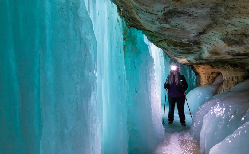
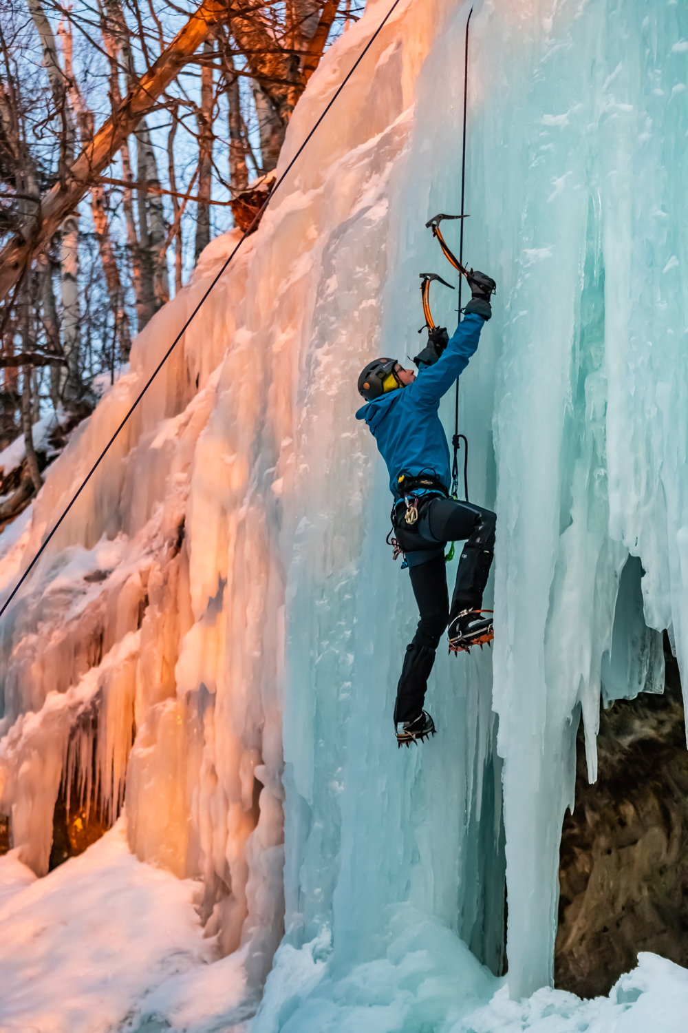
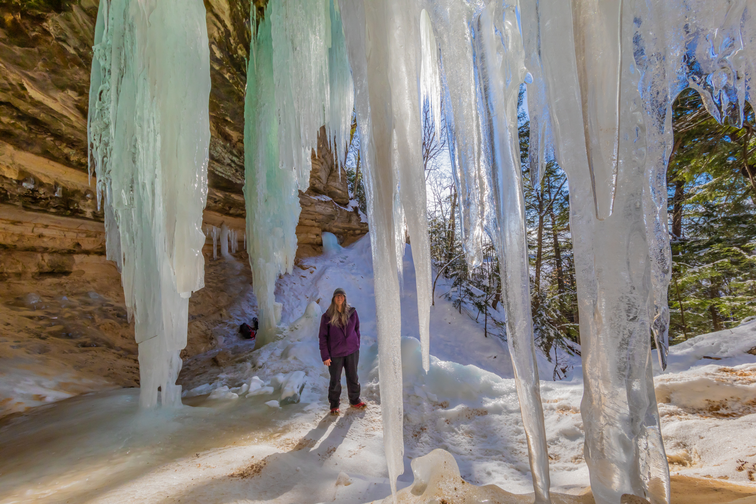
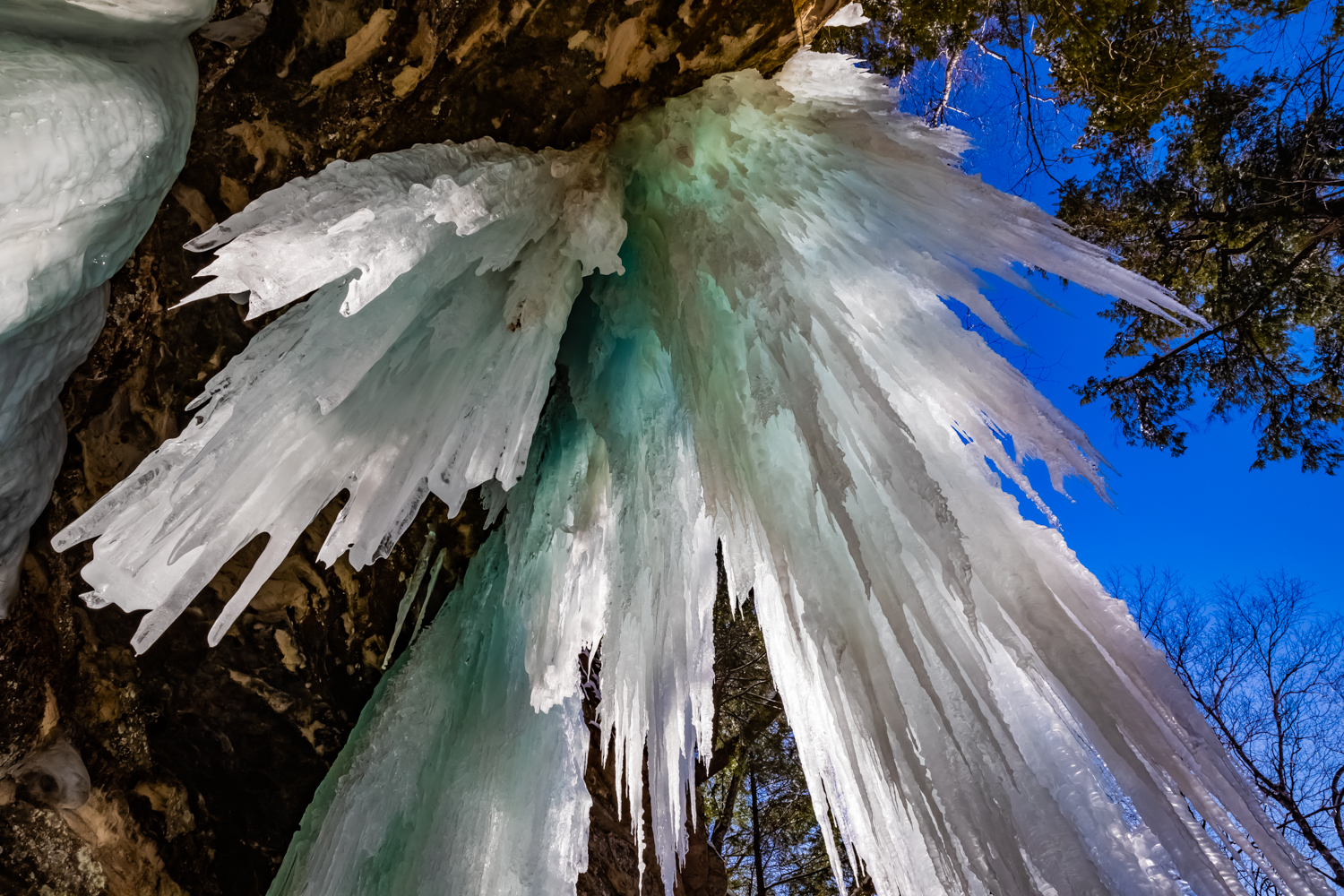
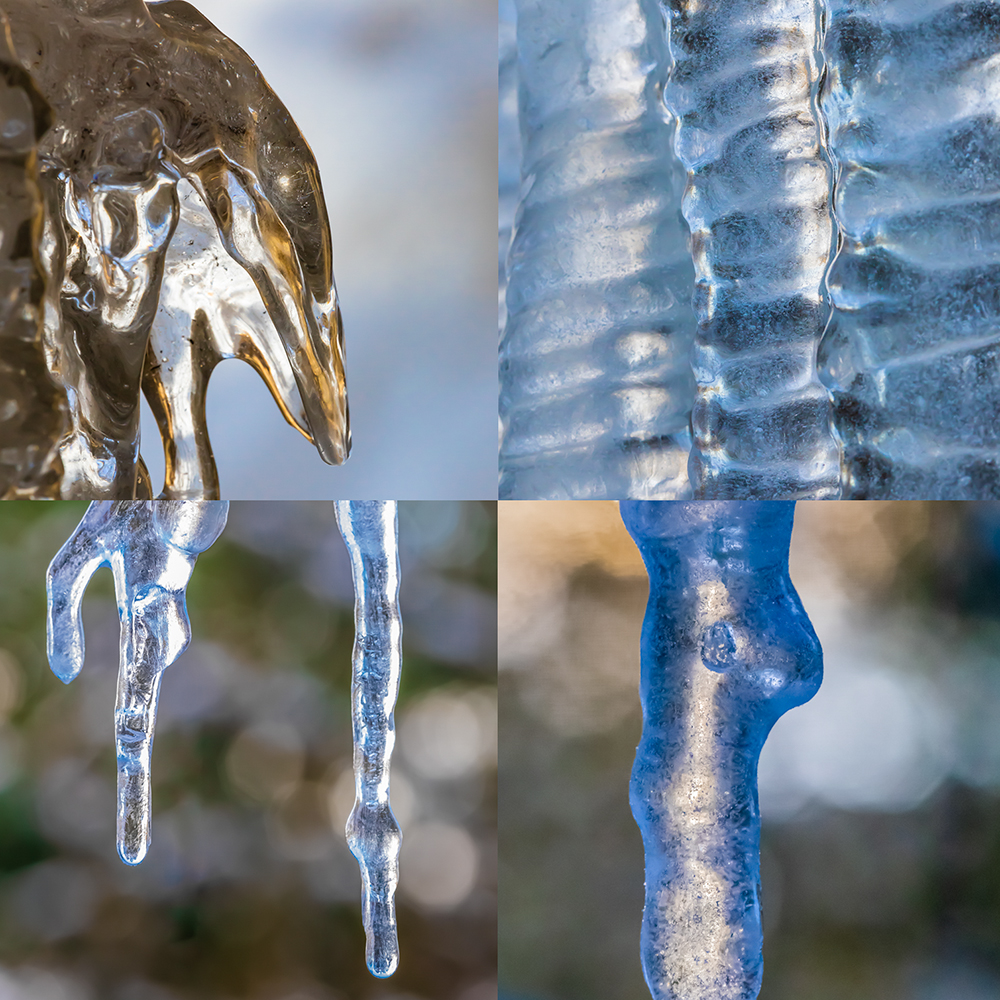
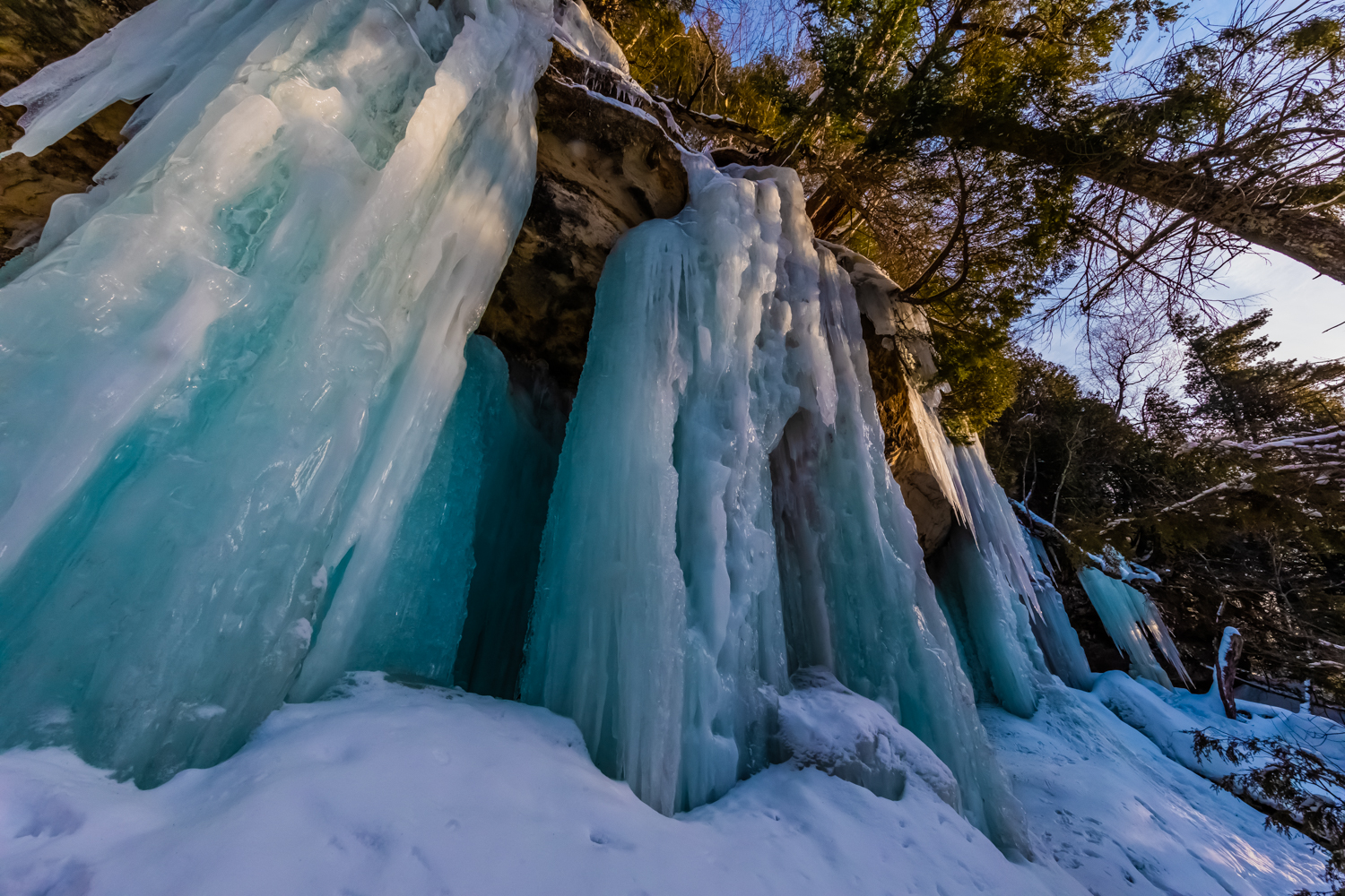
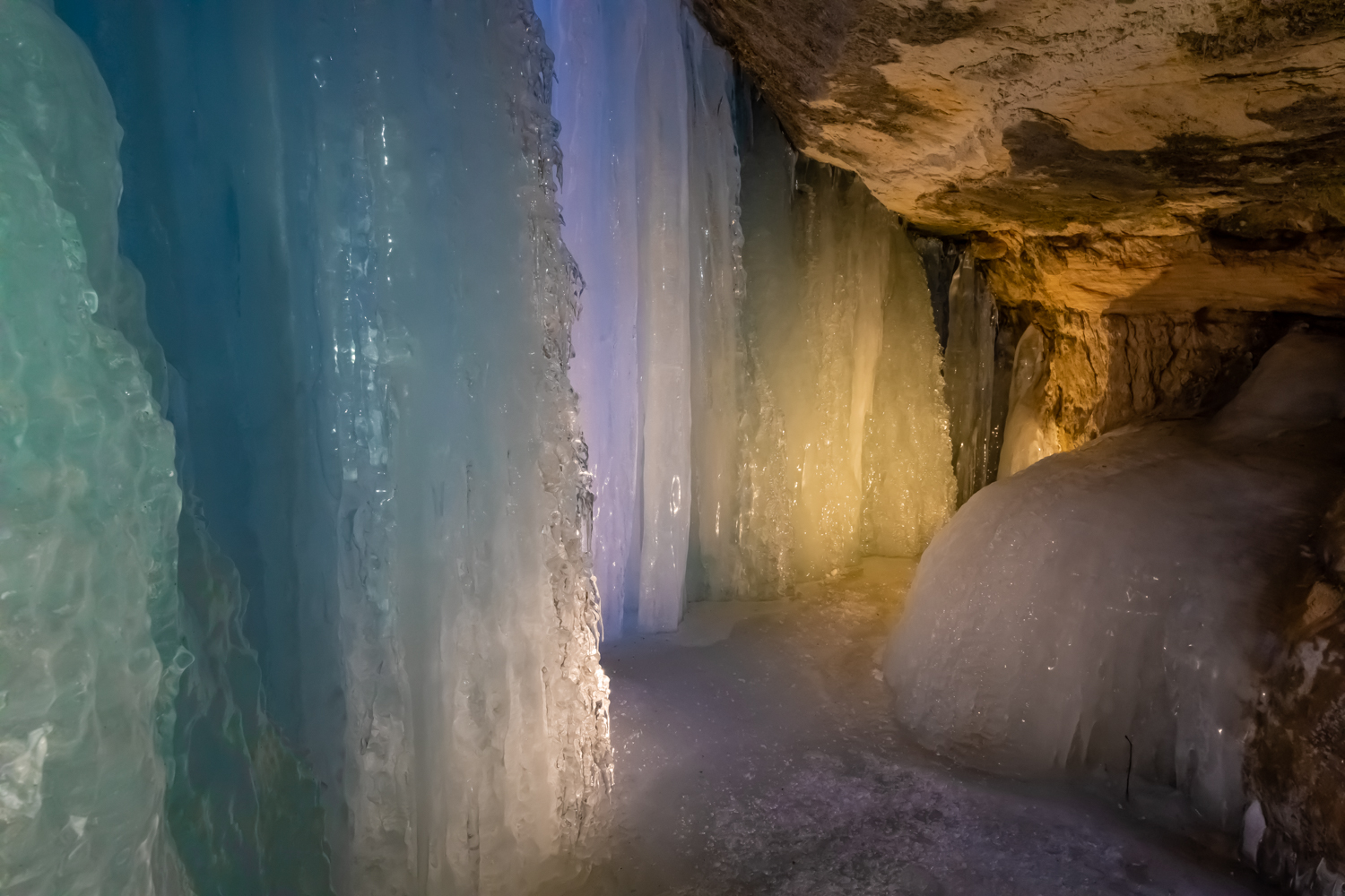
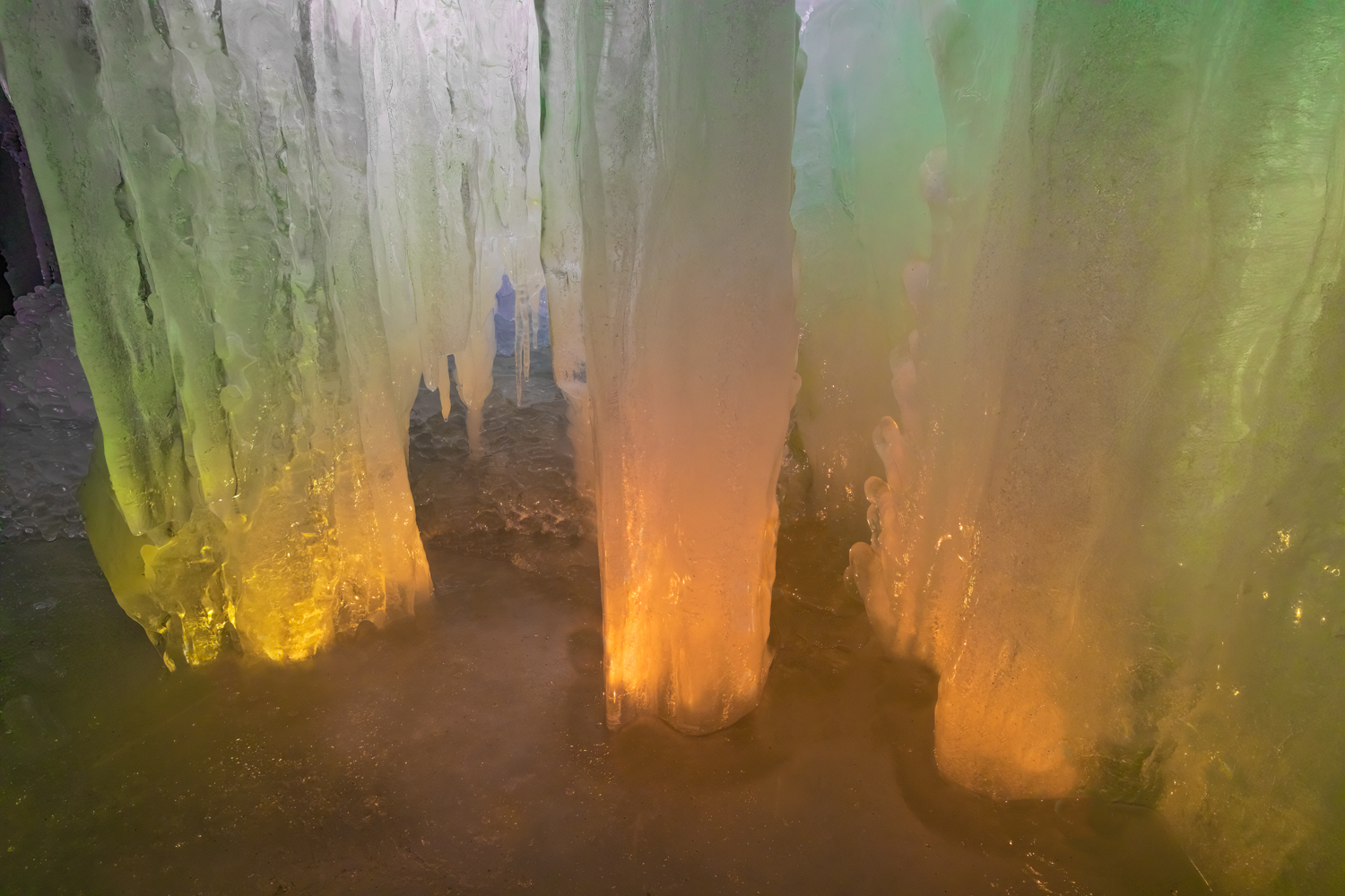
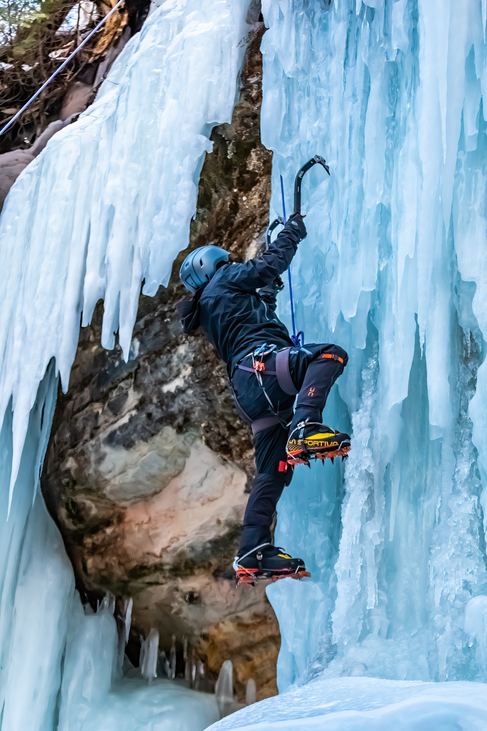
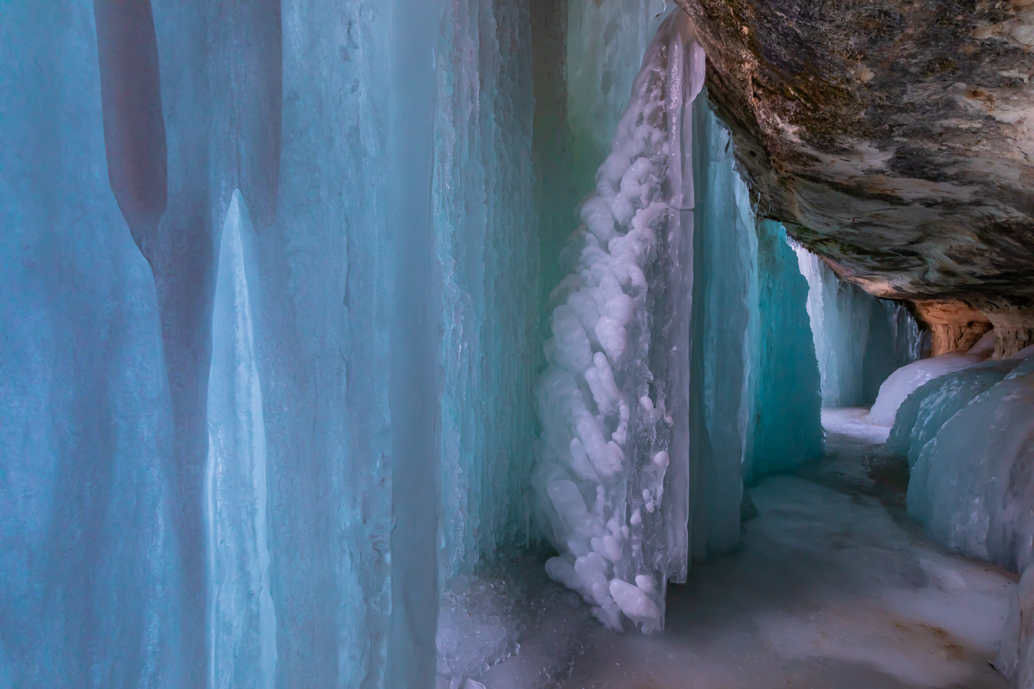
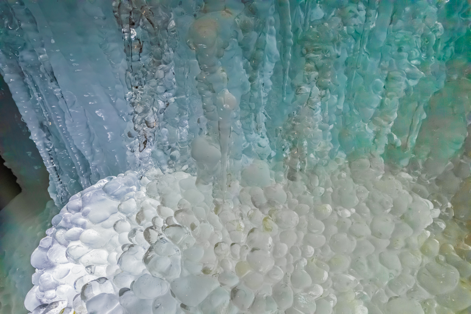
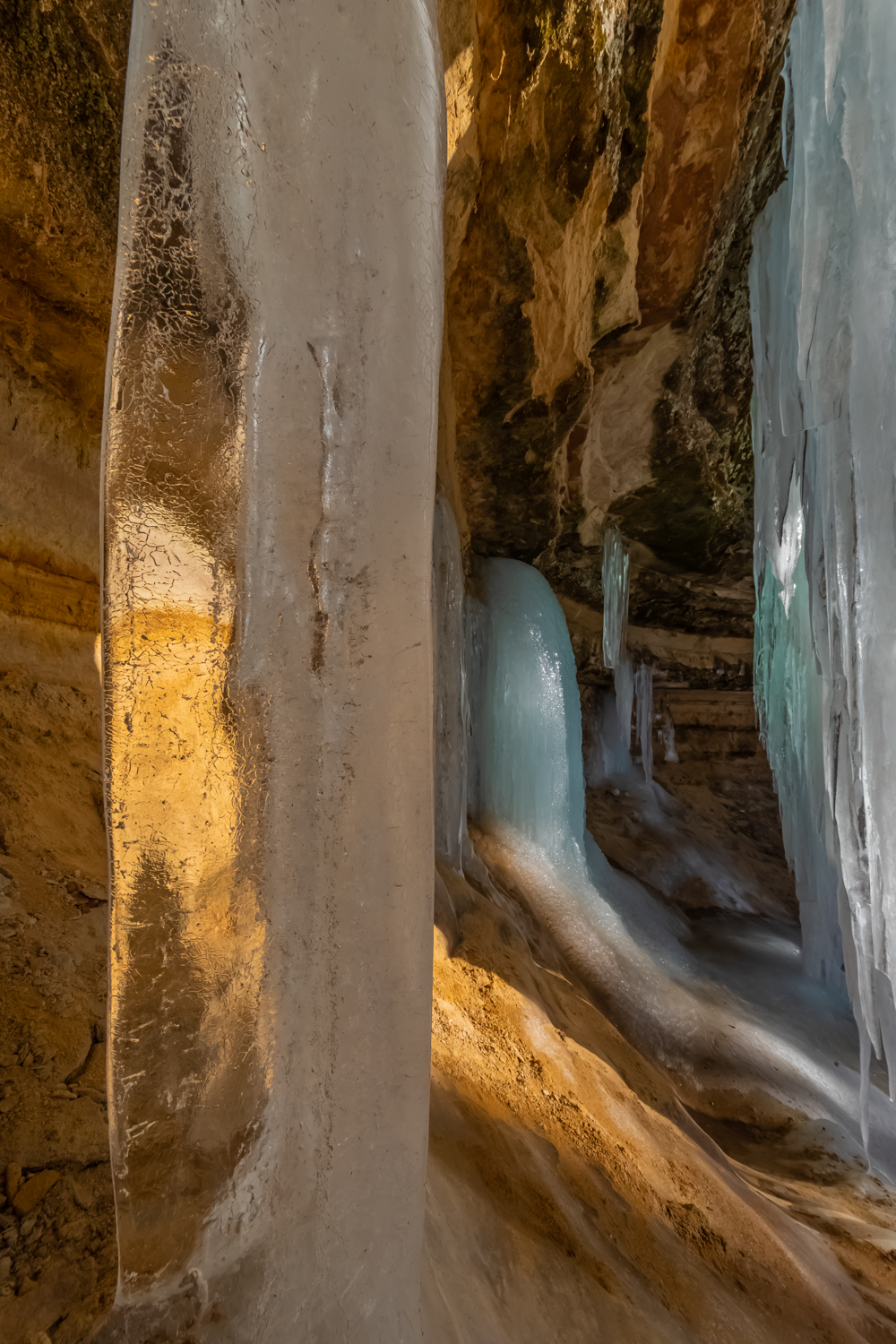
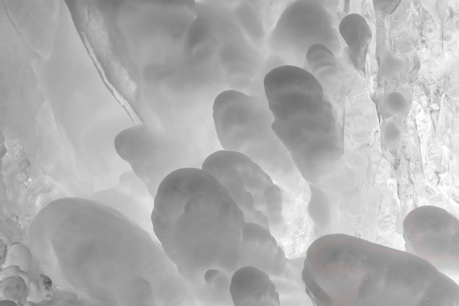
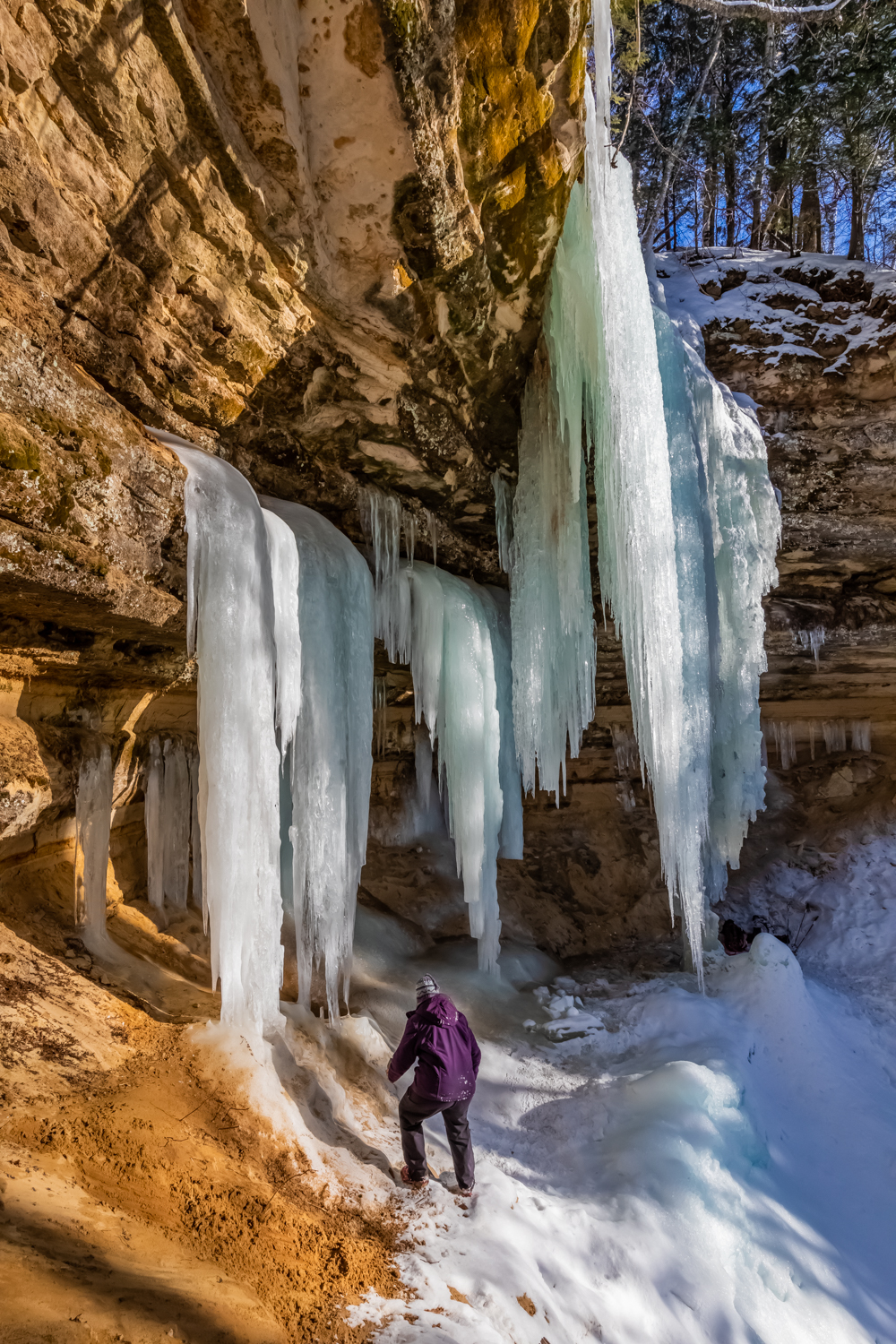
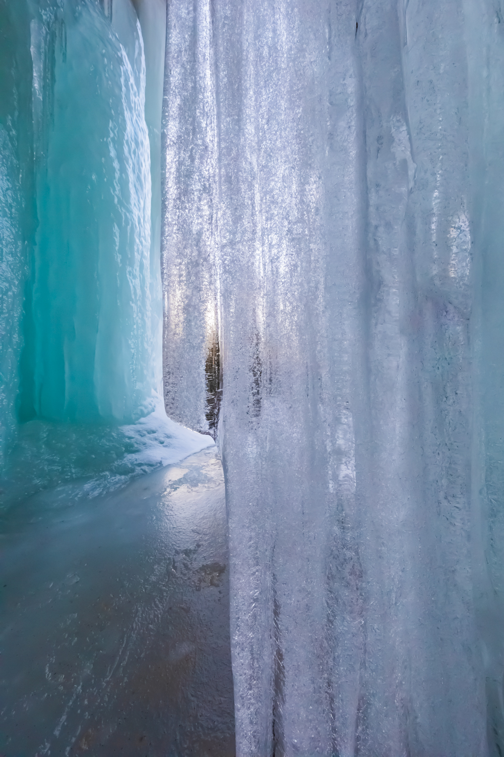
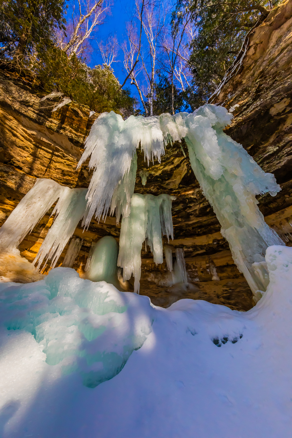
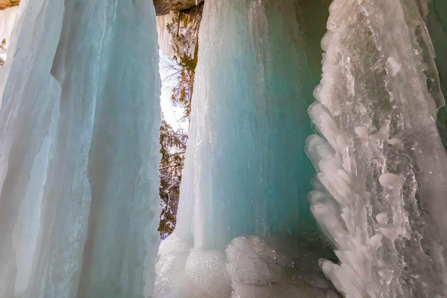
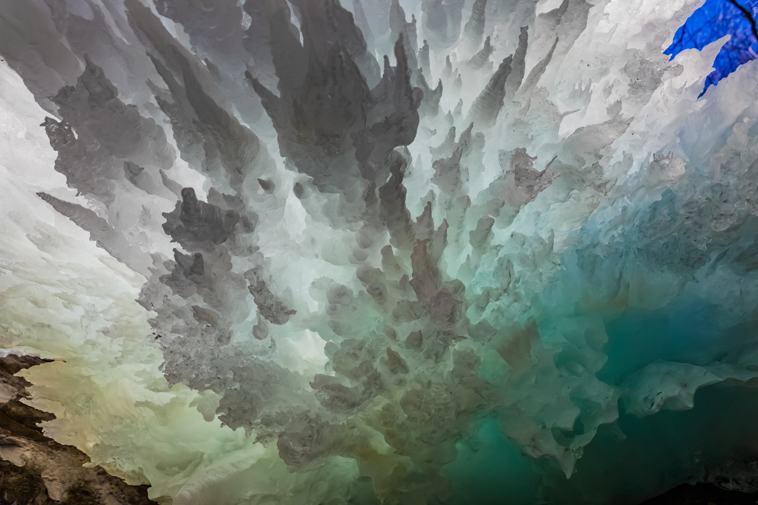
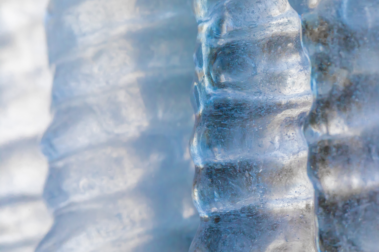
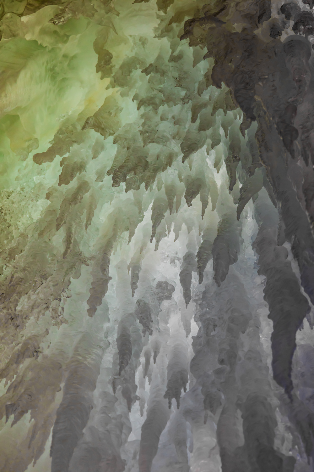
Each winter temporary ice formations form along the orange sandstone cliffs of Pictured Rocks National Lakeshore in Michigan’s Upper Peninsula. Wherever a tiny stream cascades over a cliff, or where water oozes through porous stone, ice forms upon hitting the frigid temperatures of a Lake Superior winter. These formations are reliable enough to have descriptive names given by the ice climbers who return each winter to test their skills on the frozen columns.
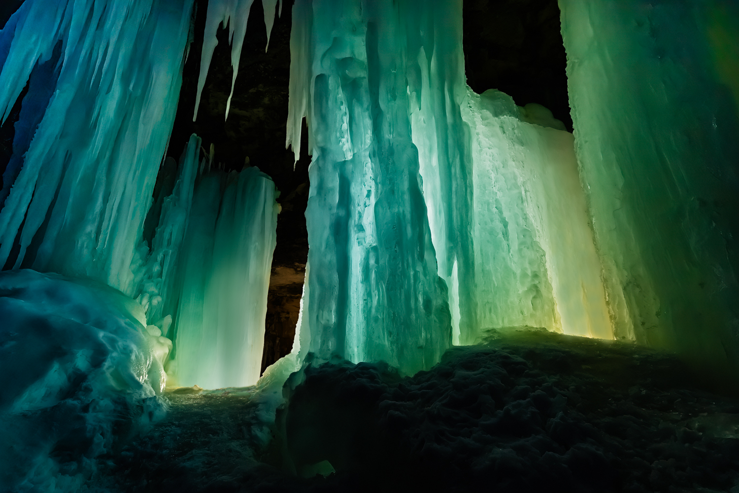
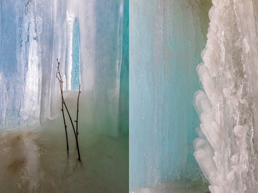
I have photographed the formations over several winters, but the winter of 2023 was my favorite because Karen (my wife) and I experimented with backlighting the ice at twilight and at night to give a sense of the color and translucency of the beautiful formations. I find the natural artistry of the ice as stunning as the sandstone formations of the Utah desert, but these are ephemeral and have to recreate themselves each winter. What an experience!
Ice climbing on Curtainsat sunseKaren Rentz at Amphitheater ice formation, with ice daggers overheadAmphitheater ice formationDetails of ice formations in Pictured Rocks National LakeshoreCurtains ice formation lighted by us at nightCurtains ice formation at the end of a winter dayTwo views of naturally sculpted ice behind the CurtainsBehind the Curtains ice formation, lit by the photographer’s lights and by the twilight outsideIce Daggers of the Amphitheater formationCurtains ice formation lighted at nightIce climbing on Curtains; note the ice tools, rope, helmet, and cramponsNorthern White Cedar twigs encased in ice in the Curtains ice formationBehind the Curtains ice formation with blue twilight coloring the translucent iceDetails of Curtains ice formation lighted at night; the round bubble-like shapes are created by water drops melting from the ice column aboveLate afternoon light on the Amphitheater ice formationSculptural details of the Curtains ice formation lighted at nightKaren Rentz at Amphitheater ice formation: the ice columns emerge from seeps in the sandstoneKaren Rentz exploring behind the Curtains ice formationBehind the Curtains ice formation, the translucent ice is reminiscent of a bridal veilFront view of Amphitheater ice formation named for the shape of the alcove in the cliffsDetails of Curtains ice formation; note how the ice takes different shapesDetails of Curtains ice formation lighted at nightAmphitheater ice formation used by ice climbers in Pictured Rocks National LakeshoreIcicle details of the Curtains ice formationDagger icicle details of the Amphitheater ice formation
Pictured Rocks National Lakeshore is located along Lake Superior in Michigan’s Upper Peninsula. Its namesake cliffs are miles long and make for great adventures all year, whether kayaking, backpacking, day hiking, snowmobiling, snowshoeing, cross-country skiing, or taking a guided cruise past the cliffs at sunset.
When we go in winter, we wear Kahtoola MICROspikes when navigating sheer ice at the ice formations, and we watched many people trying to stay upright when they walked in regular snow boots. Wear them! We also take snowshoes in case there has been a fresh snowfall and the trails are buried in deep fluff, though the short trails from Sand Point Road are often packed down by climbers. We also take cross-country skis to use on the nearby groomed trails. When venturing out in winter, we always wear insulated boots, and dress in layers of merino wool long underwear, waterproof snow/rain pants, and down, fleece, and a Gore-Tex shell. Mittens are essential, and chemical handwarmers can help when it’s really cold out. Take high energy snacks. To us, navigating winter is far more rewarding than enduring the bugs of early summer in the Upper Peninsula; just be prepared.
Important information about Pictured Rocks National Lakeshore:
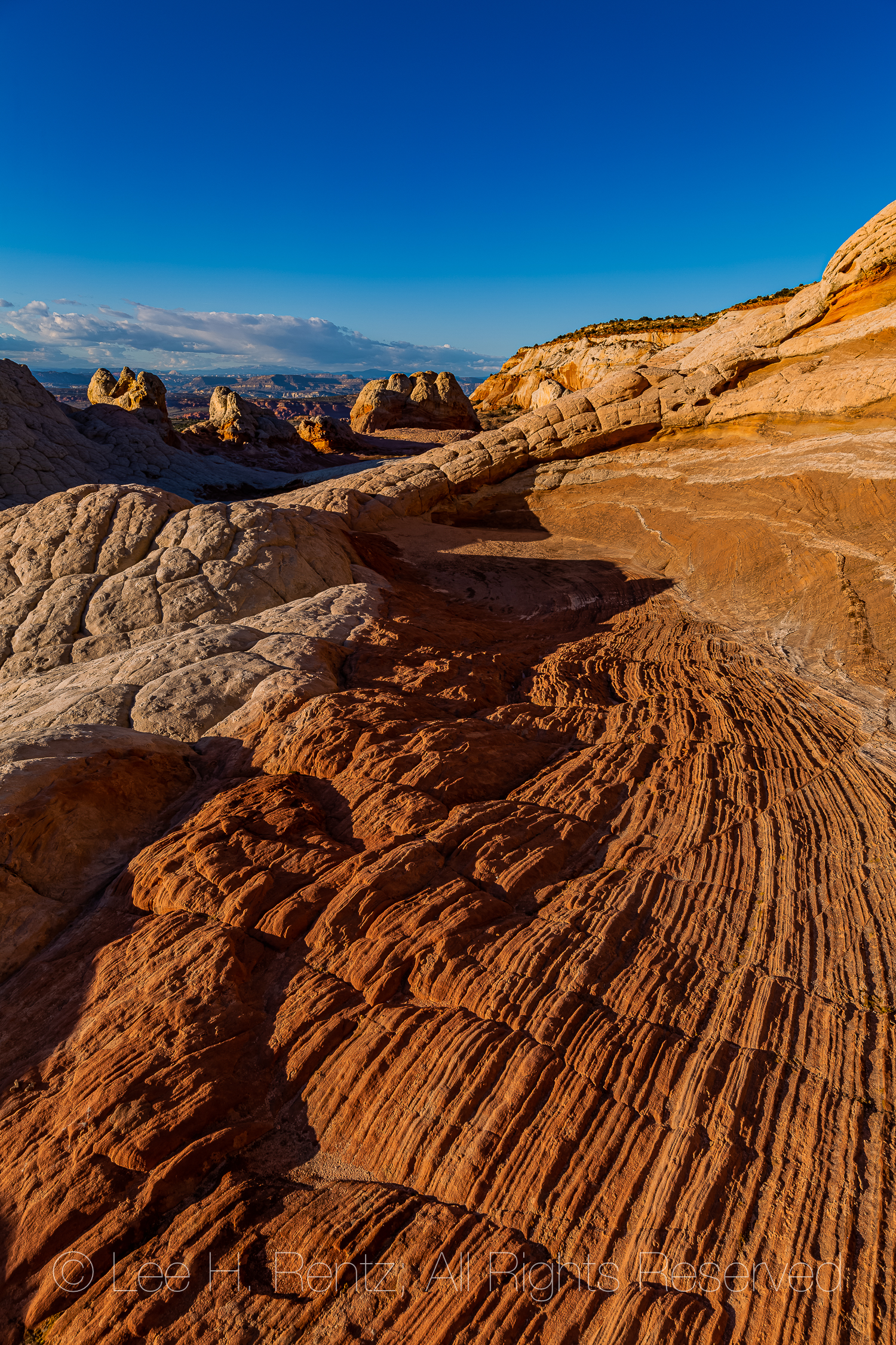
Twisting and swirling, the red rock follows the random paths of a wild dream, then skirts a dome of white Navajo Sandstone cracked into nearly perfect polygonal plates, enchanting under a perfect sapphire sky. All of it originated 190 million years ago with a Jurassic sand dune that became saturated with groundwater, then experienced a sudden disruption–perhaps by an earthquake–that suddenly contorted the whole wet jumble while it had been hardening into sandstone. Incredible beauty resulted from this chaos.
Our time is short for exploring before the short period of golden light near sunset, so we walk around quickly to get a feeling for the whole area, which is about a square mile in size. An outfitter got us here and we have about 20 hours from mid-afternoon today to mid-morning the next day to explore and photograph before we have to leave. We are on our own, except that the outfitter provides dinner, a tent, and breakfast the next morning. The reason we came with a touring company is that we don’t have a rugged 4-WD vehicle to get us through the March mud quagmires and deep sand traps along the access roads. A tow out would cost $2,000 and is not covered by AAA. So here we are.
I once worked for the Bureau of Land Management on the Arizona Strip, a part of Arizona between the Grand Canyon and the Utah state line. This is an arid landscape that includes pockets of incredible beauty, such as Paria Canyon, The Wave, and White Pocket. When I was there with BLM in 1977, I was working as a writer and pen-and-ink illustrator for a book of wildflowers (still in print 43 years later!), but White Pocket was virtually unknown at the time, except for some ranchers and probably a handful of government employees. I certainly didn’t know about it and even if I did, my big Chrysler at the time couldn’t have dreamed of getting there. The name White Pocket originated from the desert term “pocket” which referred to a rock depression that can hold water–an important feature for cattle ranching and desert travelers. At that time the world hadn’t yet discovered much of the stunning beauty of red rock country. While at BLM, I heard the geologist for our district remark to my boss that he thought it was better in the desert when it was all considered a wasteland, and environmental regulations didn’t need to be followed. Fortunately, times have changed.
We spend the hours before dark exploring and photographing in great light, then walk back to camp for a meal of barbecued salmon or chicken or steak (another value in contracting with an outfitter!), then we venture back out into the contorted lands for hours of night photography. We return to camp sometime after midnight, then get up at 4 a.m. for dawn photography, so not much sleep. We stay until afternoon, delayed for a couple of hours by a vehicle problem, and we don’t mind the delay in the least, because it gives us more time to explore this place torn from time.
The photographs here give the visual story of White Pocket, which is the most stunning desert location we have visited.
Navajo Sandstone formations of White PocketA dome of Navajo Sandstone shaped like cauliflower, cracked into polygonsLayered sandstone formations in White PocketSculptured and striated Navajo Sandstone formations of White PocketA polygon of Navajo Sandstone with etchings in the shapes of lichens, the etchings created by acids from the fungal hyphae of the lichens that dissolve rock to obtain nutrientsA closeup view of the lichen etchings, created when living Tile Lichens, Lecidiea tessellata, dissolve rock using acidsSculptured and striated Navajo Sandstone at White PocketKaren Rentz exploring a once-inhabited cave at White PocketAncient corncobs, potsherds, and animal bones left in the cave by early inhabitants at White Pocket, probably over 800 years ago. Remember that it is against the law to remove anything from federal lands!Bighorn Sheep and Elk or Mule Deer Petroglyphs made by ancient peoples at the cave in White PocketHiker’s shadow crossing sculptured and striated Navajo SandstoneThe golden hour light just before sunset is particularly stunning on these formationsKaren Rentz illuminating a cauliflower rock formation in White Pocket with her headlampStarry sky above the Navajo Sandstone formations of White PocketWe illuminate the rock formations with a headlampAs the night wore on, the Milky Way above White Pocket is the brightest I’ve ever seenThe next morning, photographers are out before dawn to explore the formationsFirst light is magicalSunlight descending upon the Navajo Sandstone formationsEarly light on a Pinyon Pine heroically growing in a crack in a sandstone domeReflections of Navajo Sandstone on a pond at White PocketSwirling and sculpted sandstone formations; this photograph gives a good sense of the whole areaThe natural designs of these formations, originating in the Jurassic world, is astoundingThere is little evidence of human use here, except for an old cattleman’s barbed wire fence and the damming of the pond to make it largerThe oranges and reds of the sandstone are colored by iron oxideA stunning chaos of sandstoneAll good things must pass, and we must say goodbye as a cirrus cloud appears over a sandstone dome
Rather than give you directions and maps and more cautions, I will refer you to three good websites that cover all that information. Be advised that there have been discussions at the Bureau of Land Management about requiring a permit so the area does not become overused, so make sure you check with them about current rules and regulations (and road conditions) before you attempt traveling to White Pocket.