A journal of the thoughts, pictures, and adventures of photographer and writer Lee H. Rentz. Inspired by nature, with a passion for ideas both visual and literary.
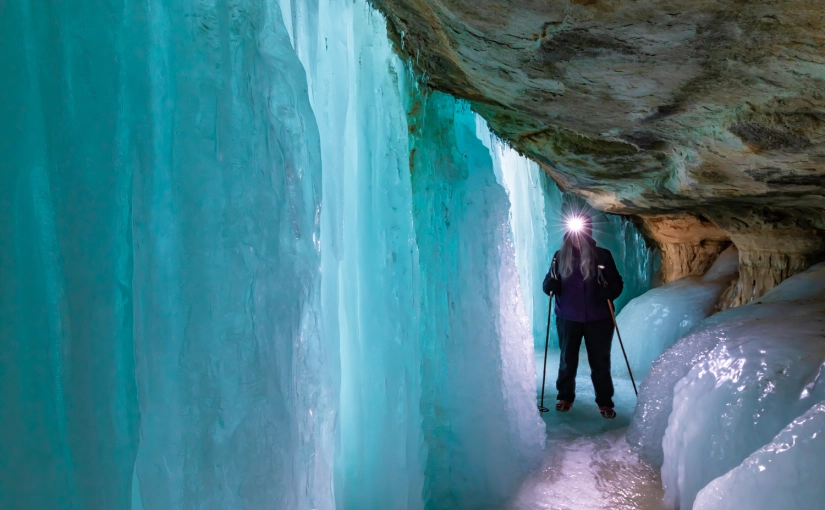
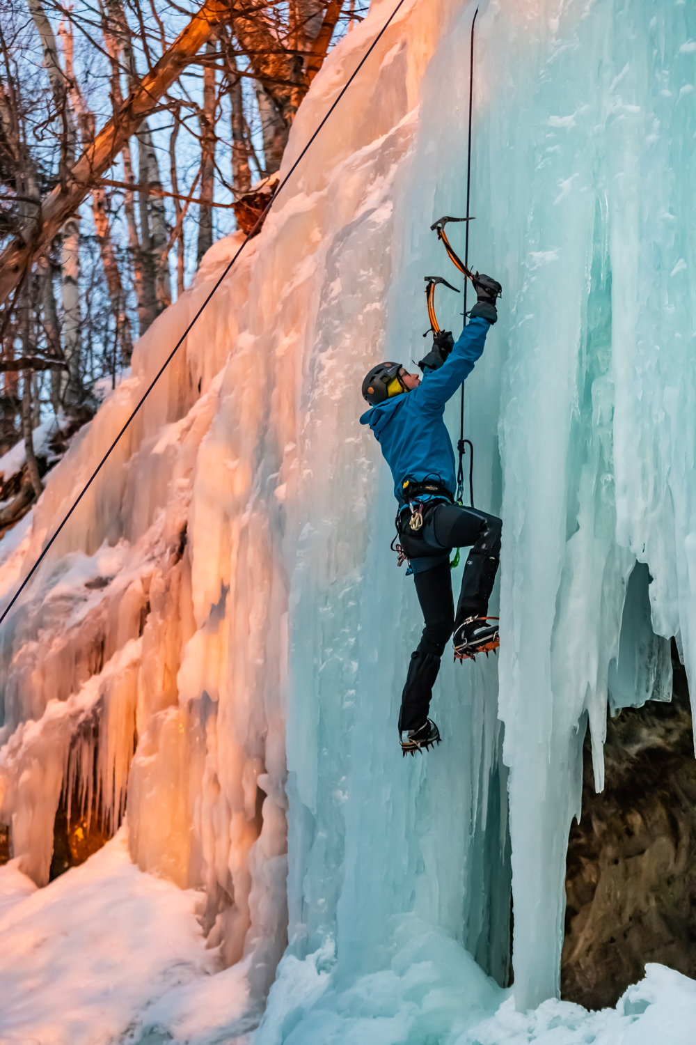
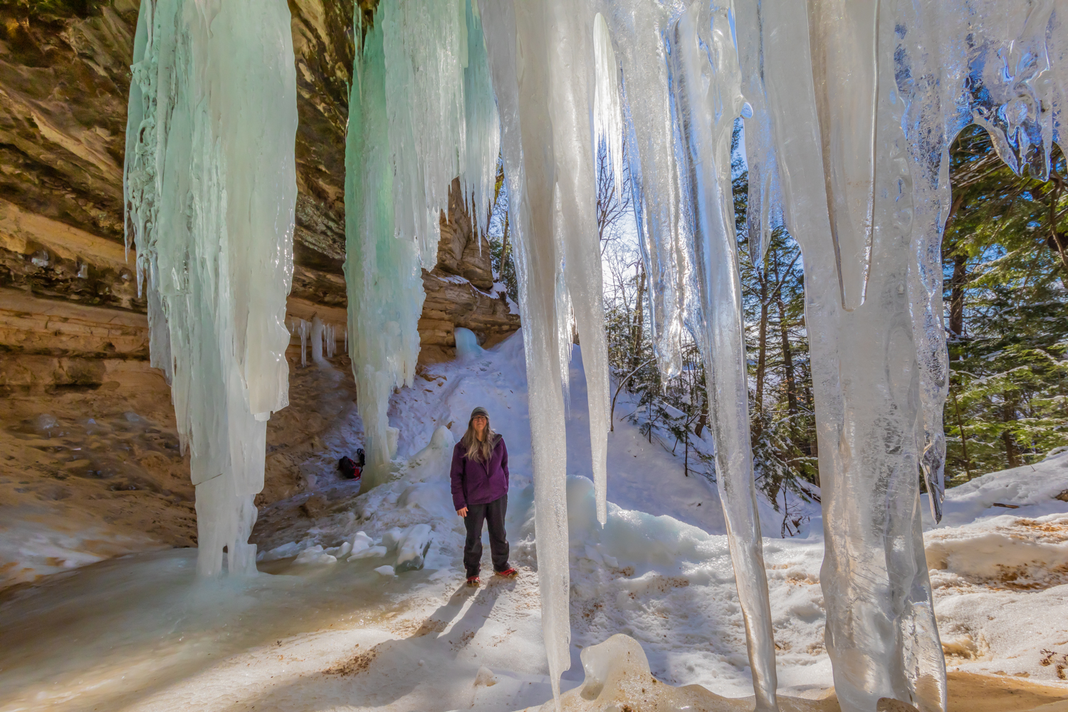
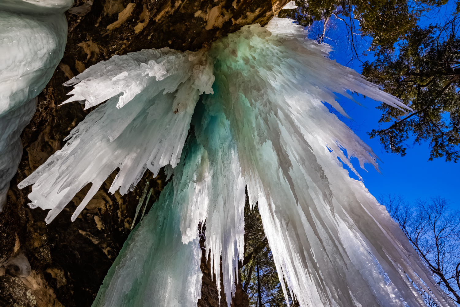
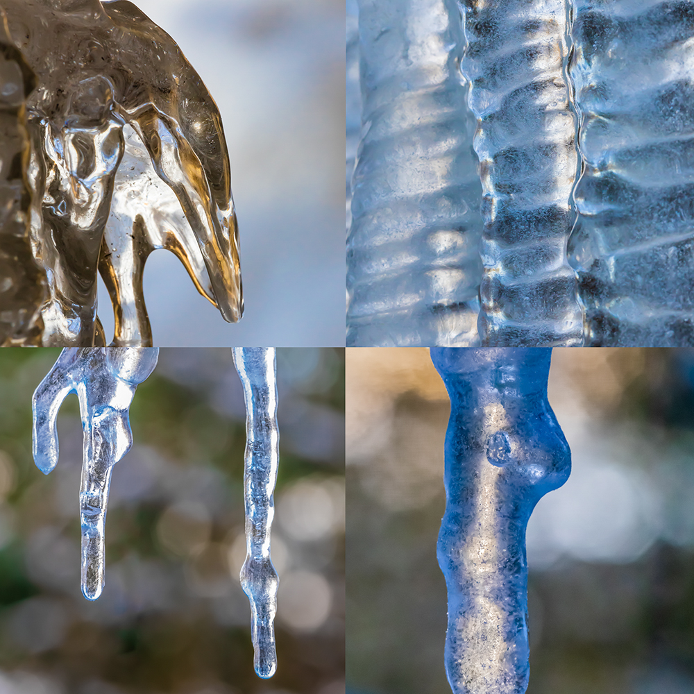
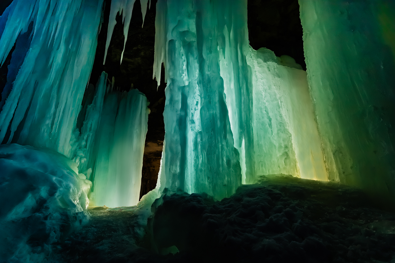
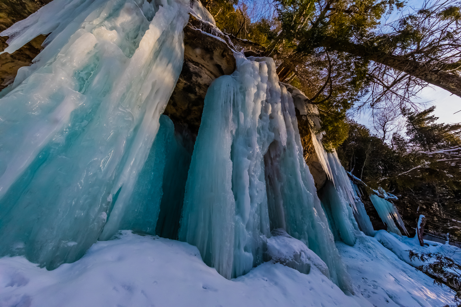
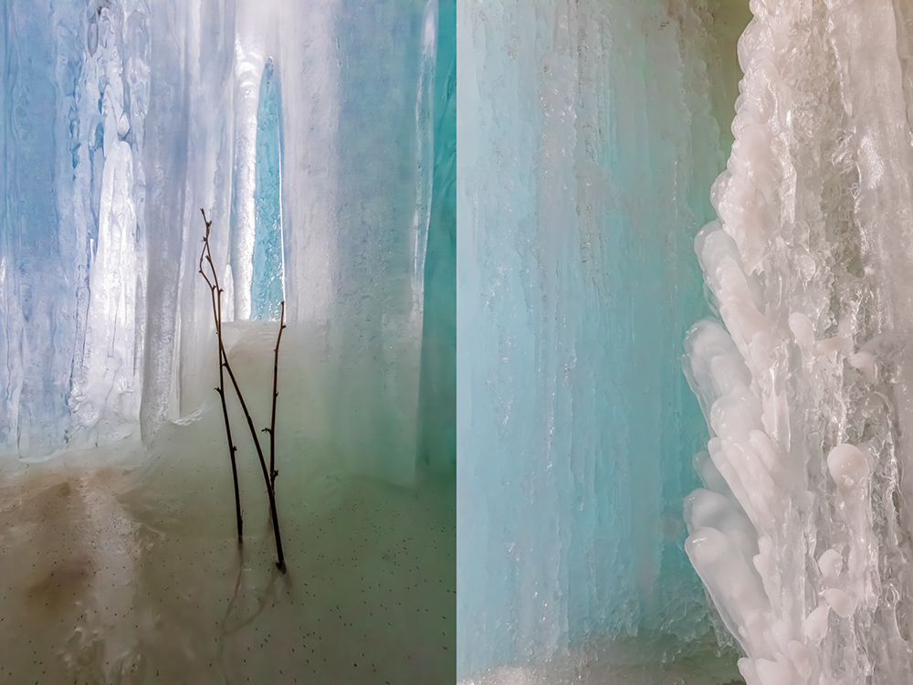
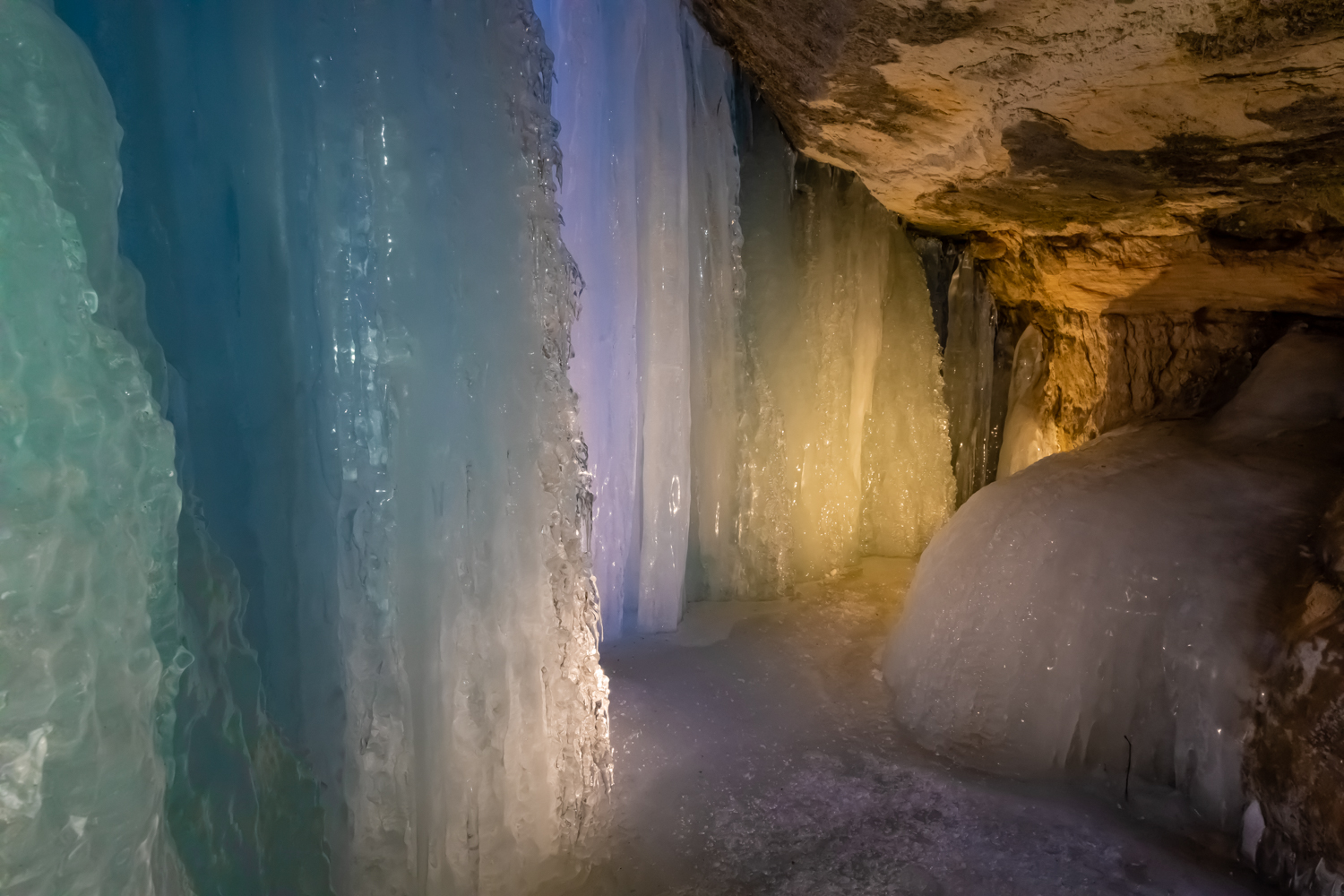
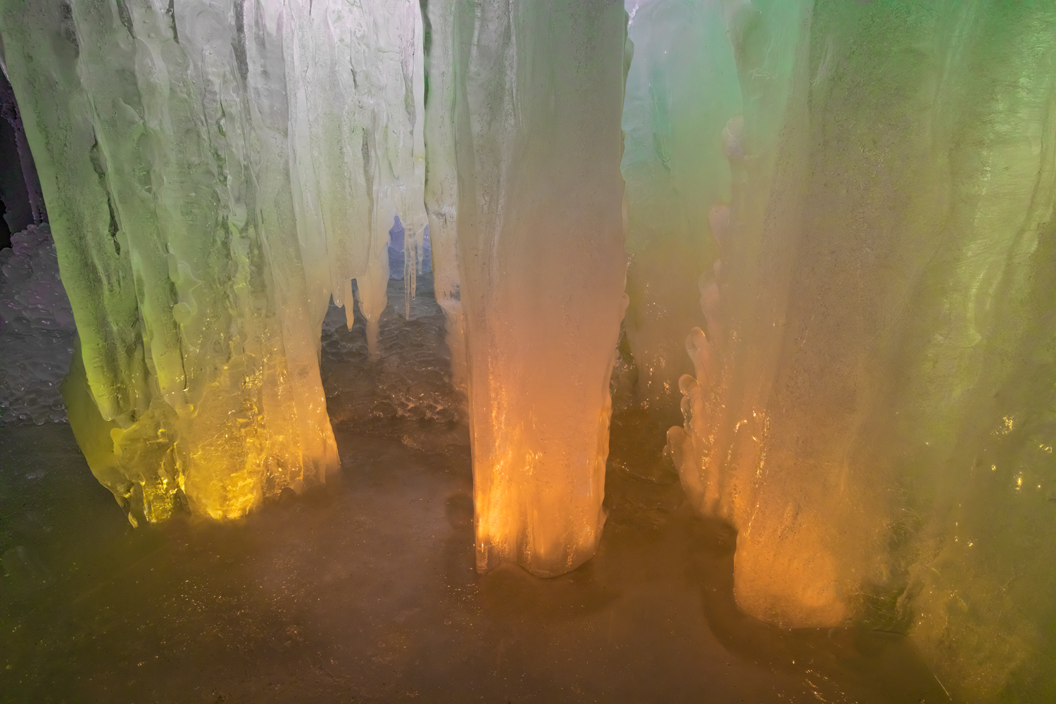
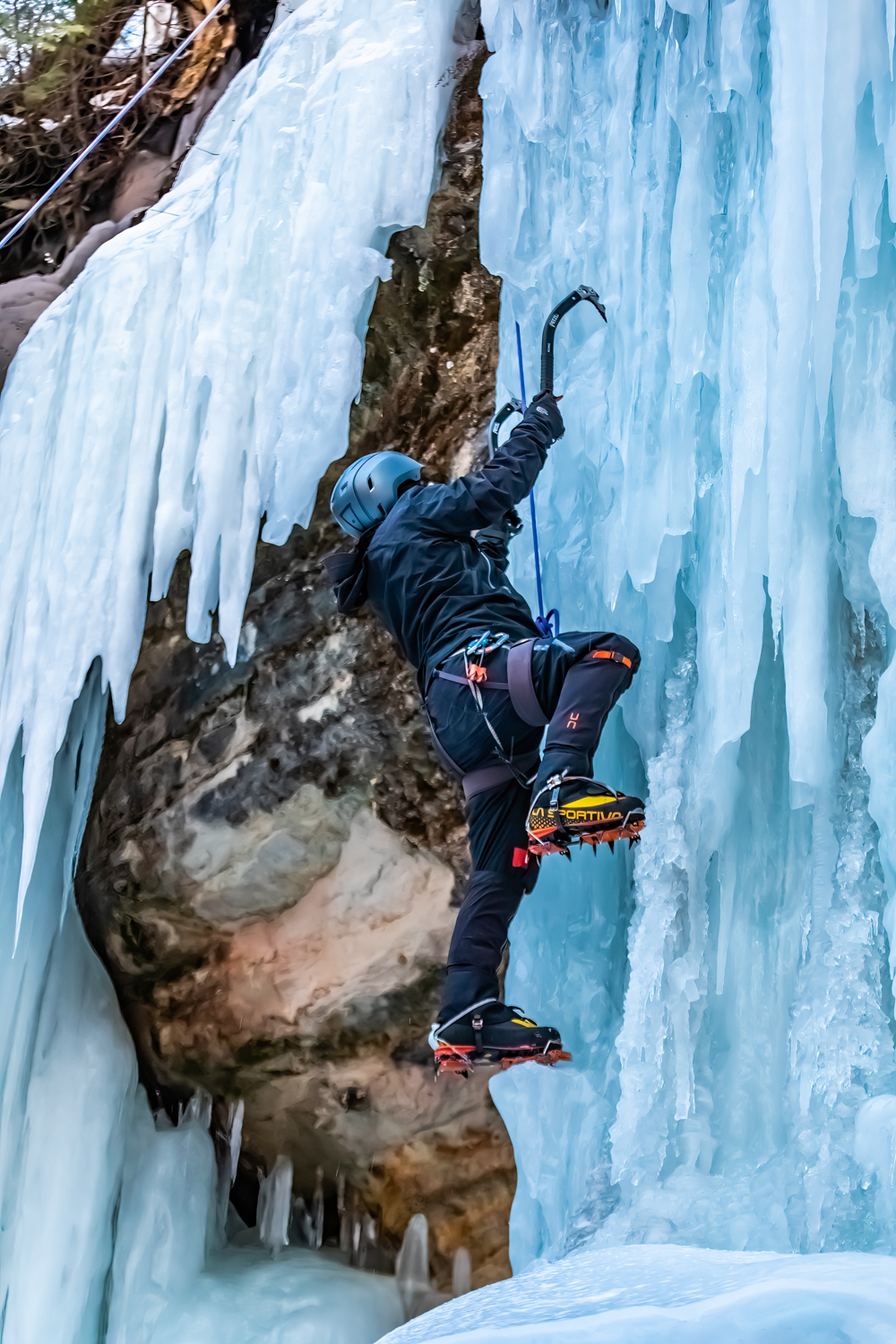
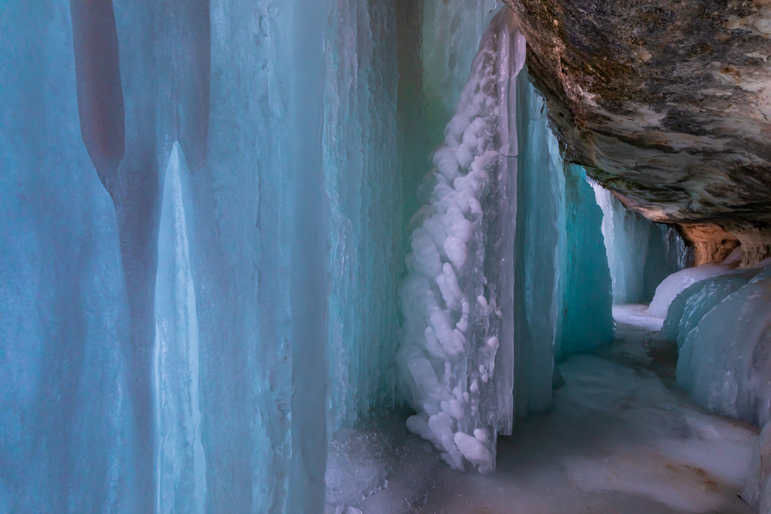
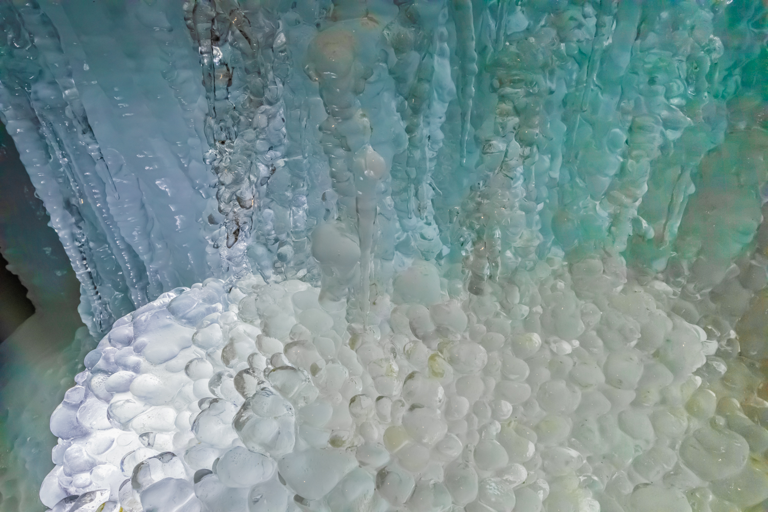
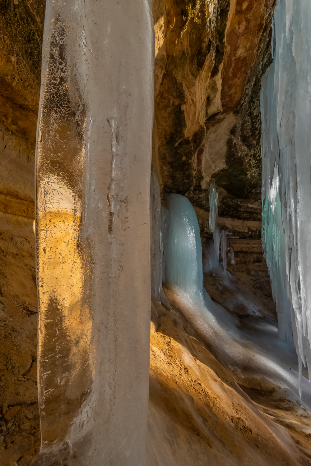
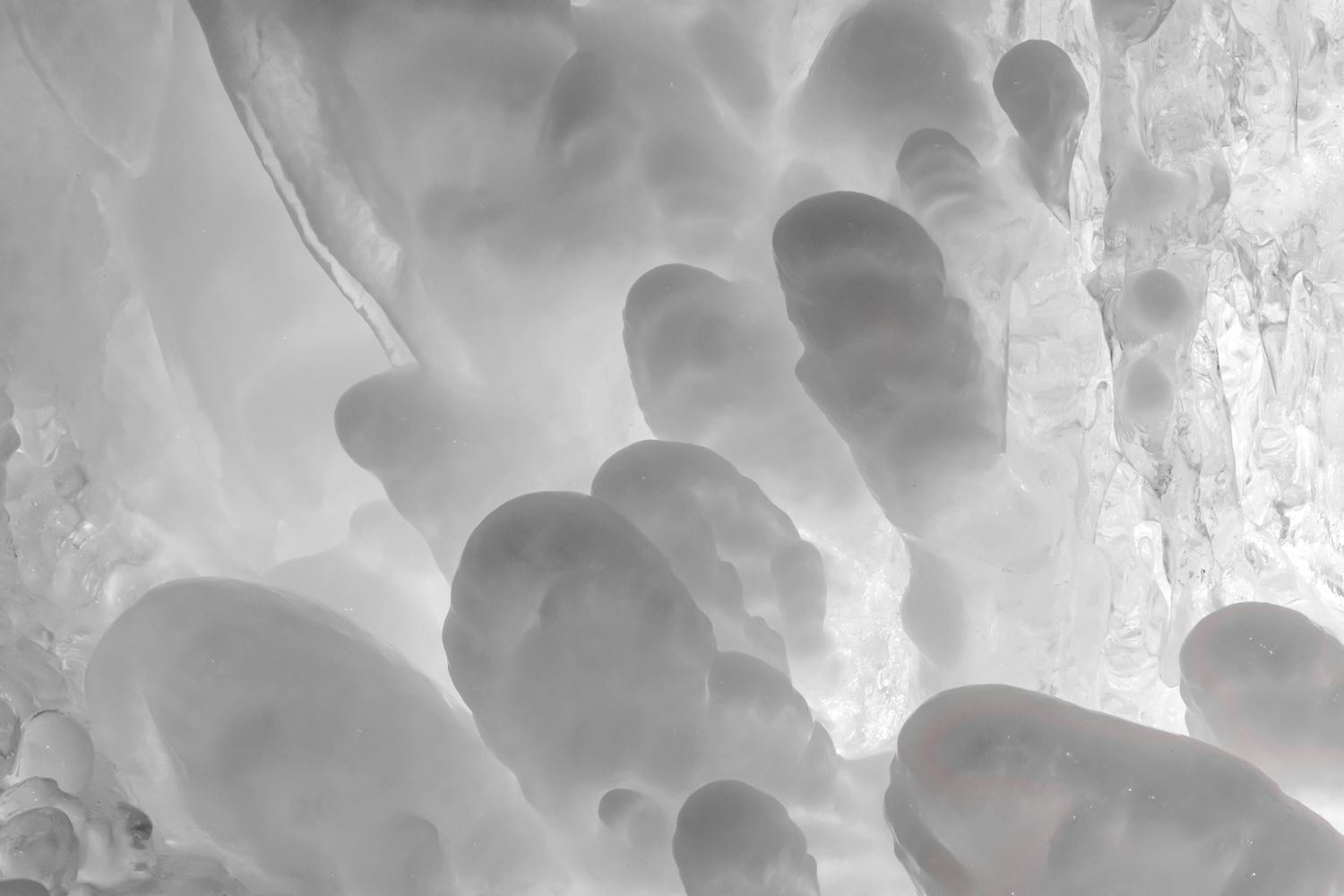
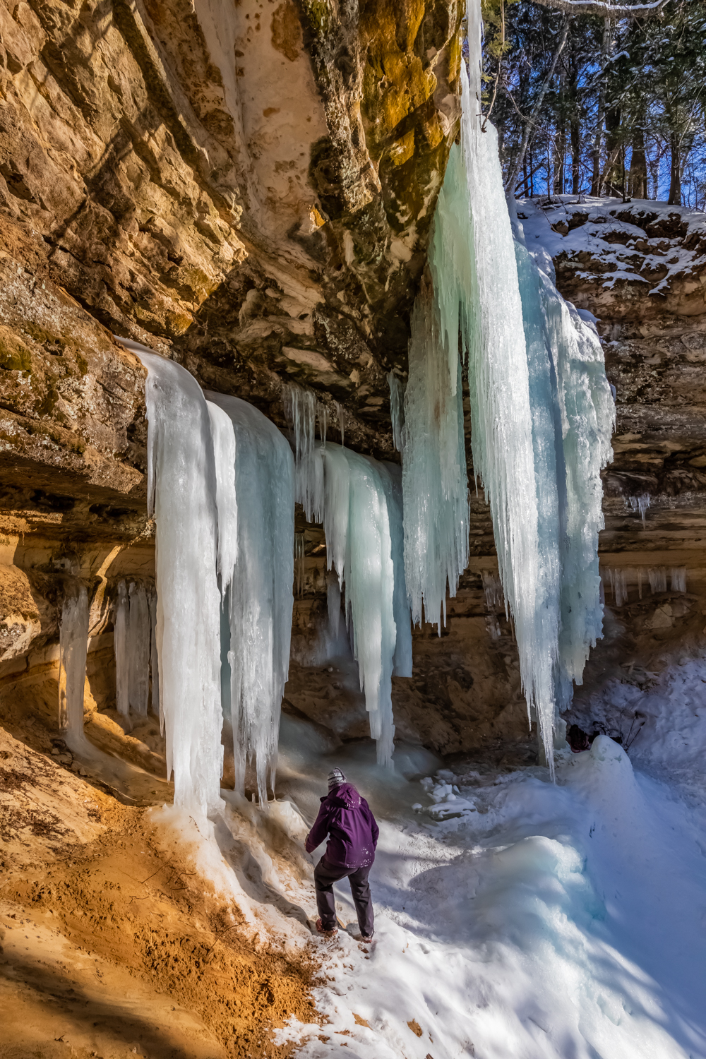
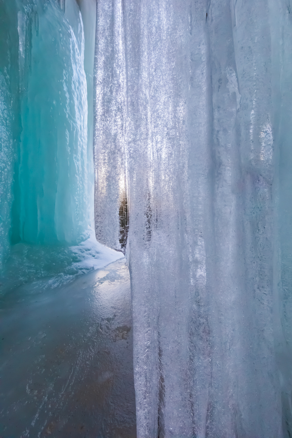
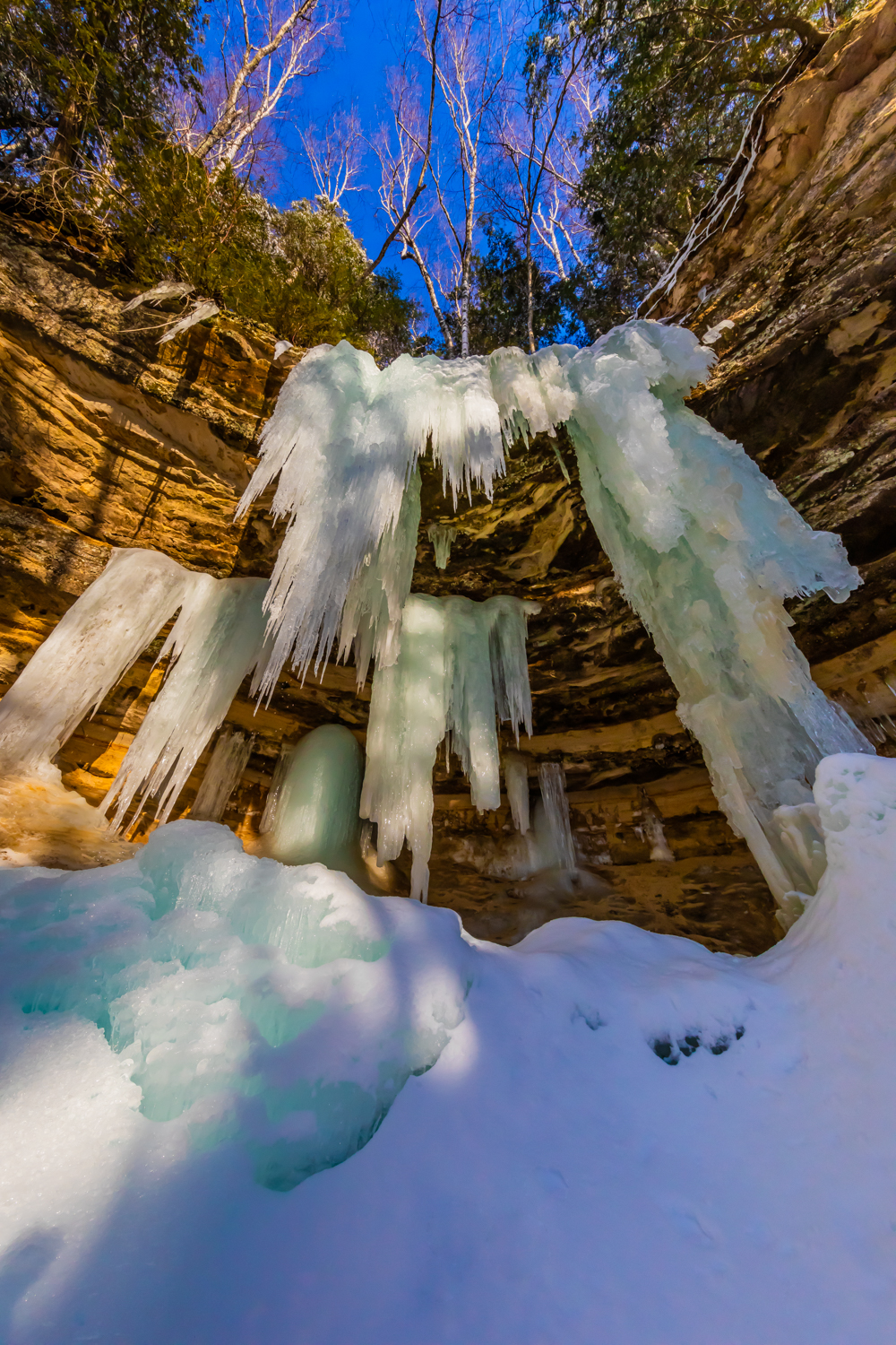
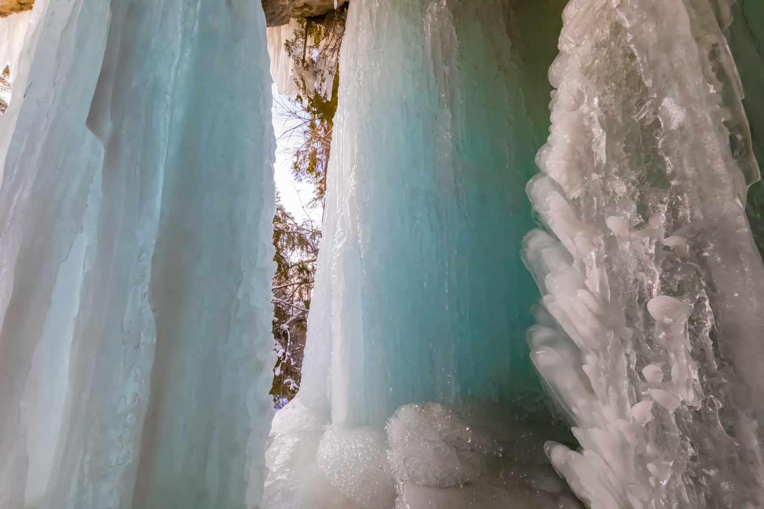
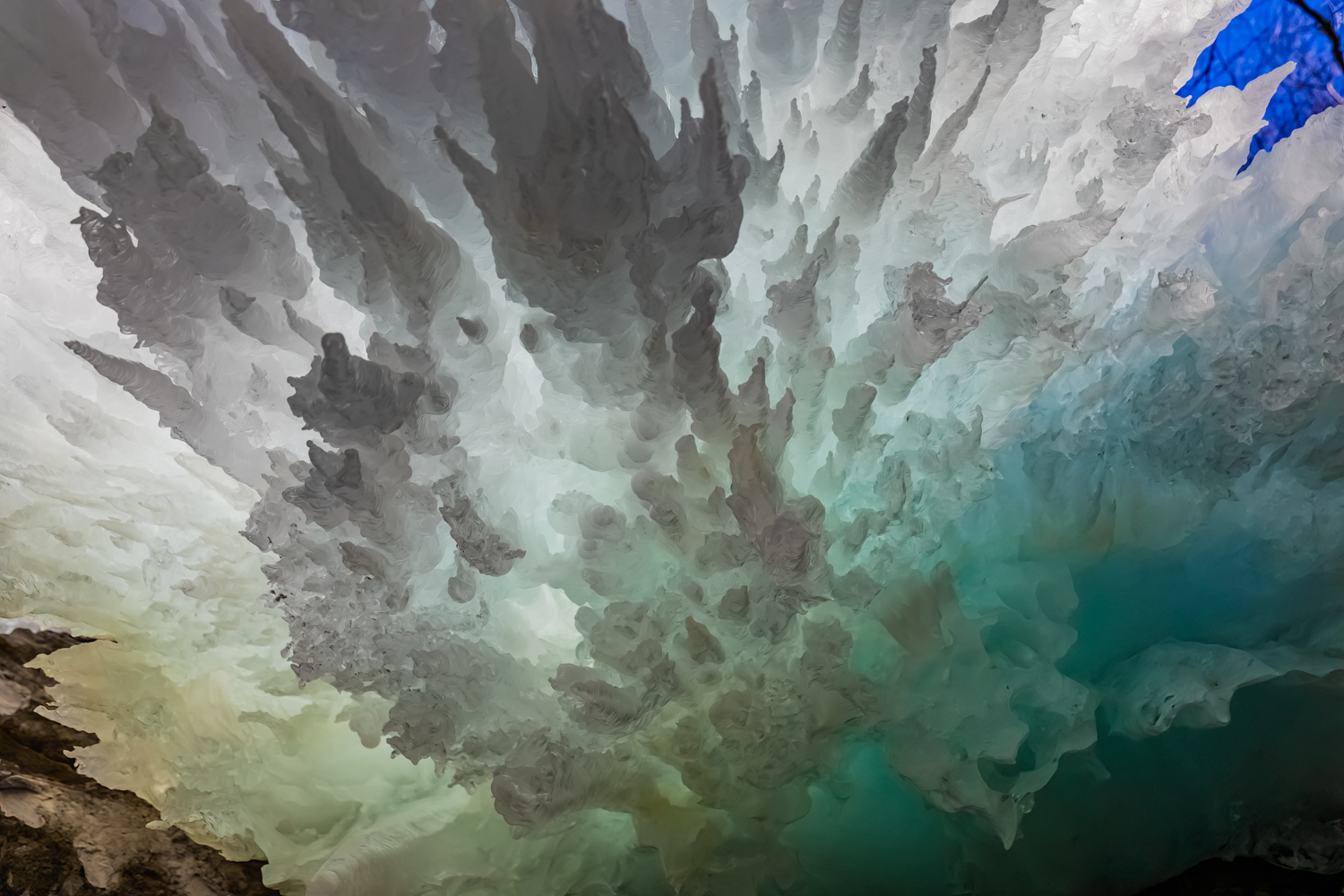
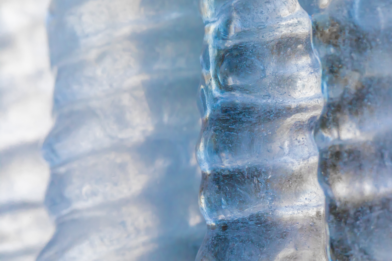
Each winter temporary ice formations form along the orange sandstone cliffs of Pictured Rocks National Lakeshore in Michigan’s Upper Peninsula. Wherever a tiny stream cascades over a cliff, or where water oozes through porous stone, ice forms upon hitting the frigid temperatures of a Lake Superior winter. These formations are reliable enough to have descriptive names given by the ice climbers who return each winter to test their skills on the frozen columns.
I have photographed the formations over several winters, but the winter of 2023 was my favorite because Karen (my wife) and I experimented with backlighting the ice at twilight and at night to give a sense of the color and translucency of the beautiful formations. I find the natural artistry of the ice as stunning as the sandstone formations of the Utah desert, but these are ephemeral and have to recreate themselves each winter. What an experience!
Ice climbing on Curtainsat sunseKaren Rentz at Amphitheater ice formation, with ice daggers overheadAmphitheater ice formationDetails of ice formations in Pictured Rocks National LakeshoreCurtains ice formation lighted by us at nightCurtains ice formation at the end of a winter dayTwo views of naturally sculpted ice behind the CurtainsBehind the Curtains ice formation, lit by the photographer’s lights and by the twilight outsideIce Daggers of the Amphitheater formationCurtains ice formation lighted at nightIce climbing on Curtains; note the ice tools, rope, helmet, and cramponsNorthern White Cedar twigs encased in ice in the Curtains ice formationBehind the Curtains ice formation with blue twilight coloring the translucent iceDetails of Curtains ice formation lighted at night; the round bubble-like shapes are created by water drops melting from the ice column aboveLate afternoon light on the Amphitheater ice formationSculptural details of the Curtains ice formation lighted at nightKaren Rentz at Amphitheater ice formation: the ice columns emerge from seeps in the sandstoneKaren Rentz exploring behind the Curtains ice formationBehind the Curtains ice formation, the translucent ice is reminiscent of a bridal veilFront view of Amphitheater ice formation named for the shape of the alcove in the cliffsDetails of Curtains ice formation; note how the ice takes different shapesDetails of Curtains ice formation lighted at nightAmphitheater ice formation used by ice climbers in Pictured Rocks National LakeshoreIcicle details of the Curtains ice formationDagger icicle details of the Amphitheater ice formation
Pictured Rocks National Lakeshore is located along Lake Superior in Michigan’s Upper Peninsula. Its namesake cliffs are miles long and make for great adventures all year, whether kayaking, backpacking, day hiking, snowmobiling, snowshoeing, cross-country skiing, or taking a guided cruise past the cliffs at sunset.
When we go in winter, we wear Kahtoola MICROspikes when navigating sheer ice at the ice formations, and we watched many people trying to stay upright when they walked in regular snow boots. Wear them! We also take snowshoes in case there has been a fresh snowfall and the trails are buried in deep fluff, though the short trails from Sand Point Road are often packed down by climbers. We also take cross-country skis to use on the nearby groomed trails. When venturing out in winter, we always wear insulated boots, and dress in layers of merino wool long underwear, waterproof snow/rain pants, and down, fleece, and a Gore-Tex shell. Mittens are essential, and chemical handwarmers can help when it’s really cold out. Take high energy snacks. To us, navigating winter is far more rewarding than enduring the bugs of early summer in the Upper Peninsula; just be prepared.
Important information about Pictured Rocks National Lakeshore:
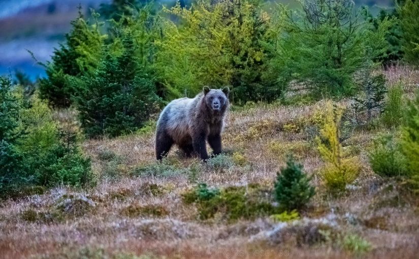
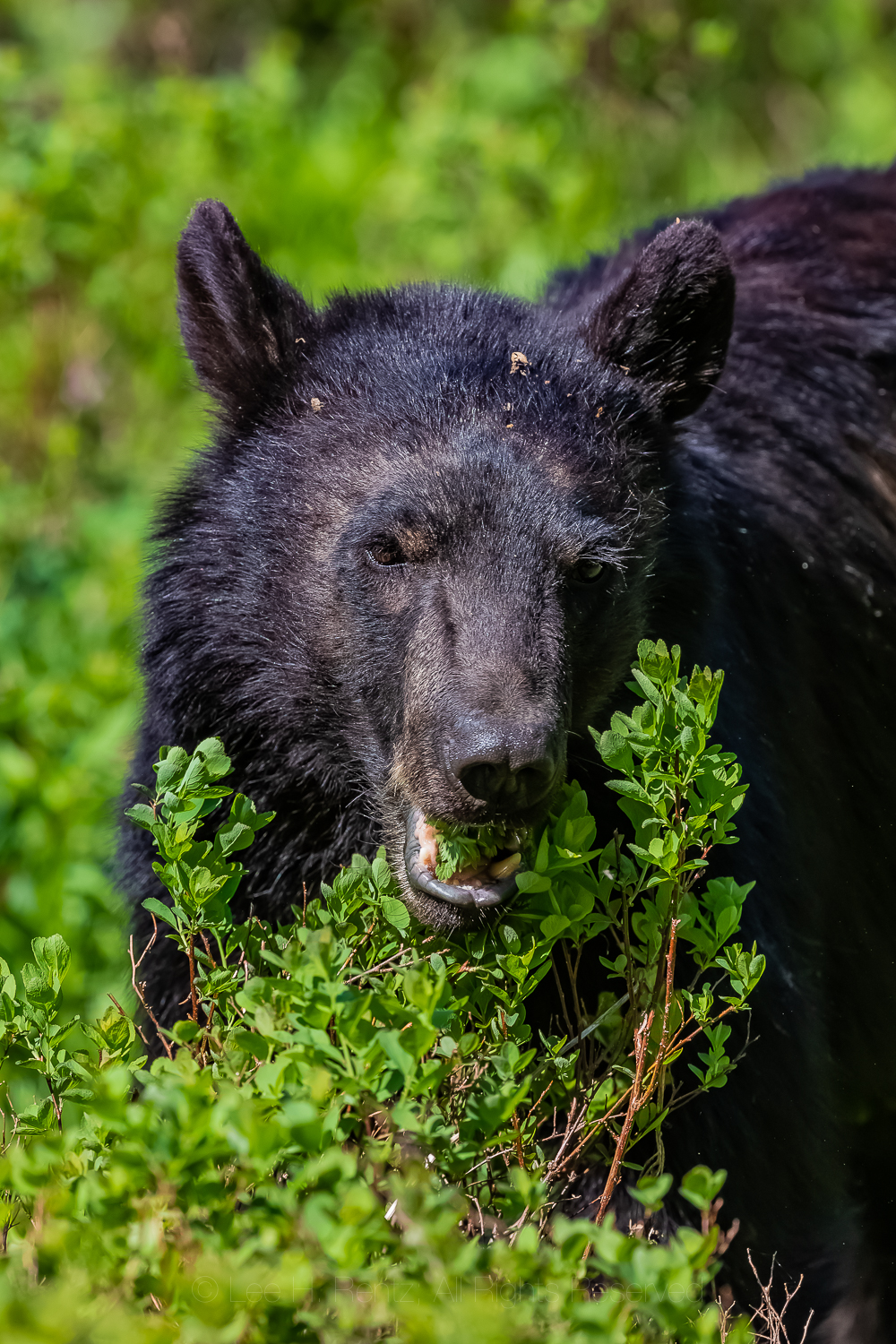
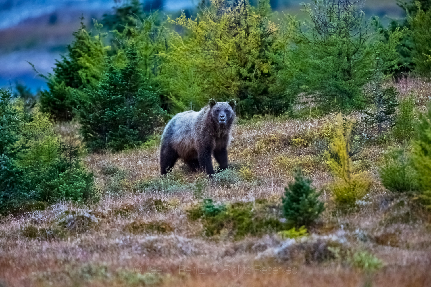
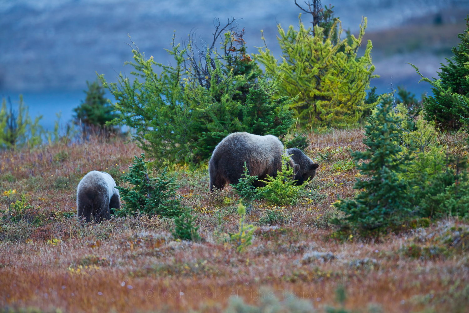
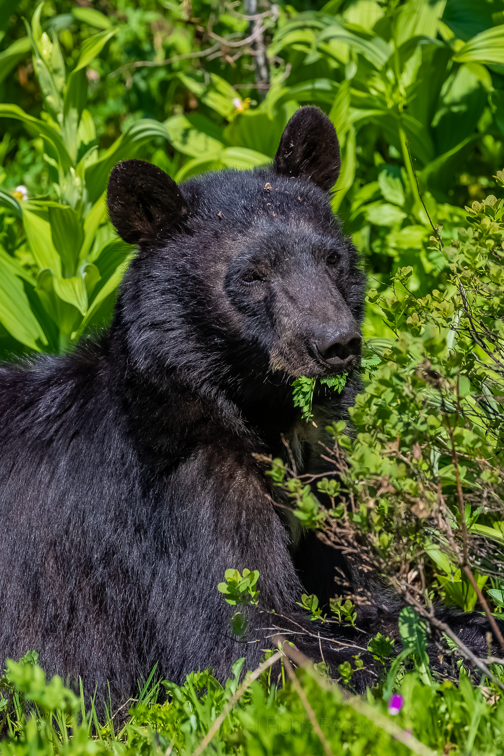
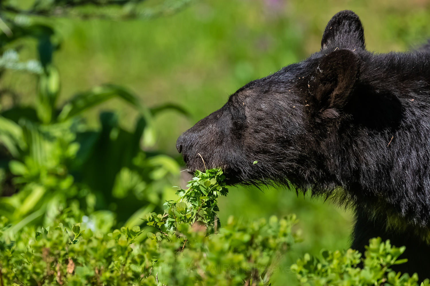
Karen and I have encountered Black and Grizzly Bears occasionally, and these sometimes make for memorable stories. Here are five adventures that we can’t possibly forget, along with assorted bear photographs I’ve taken in recent years.
American Black Bear feeding on Gray’s Lovage in July, Mount Rainier National Park in Washington State
WATCHING BEARS AT THE DUMP
Copper Harbor on Michigan’s Keweenaw Peninsula, circa 1959
My family used to take camping vacations to state parks back in the 1950s and 1960s. Of those, Fort Wilkins State Park at the tip of Michigan’s Keweenaw Peninsula, which sticks up like a long curved finger into Lake Superior, was a favorite. This was an early army outpost established in 1844 to keep order during a copper boom in the region, and there were cannons and a fort that excited the small boy in me.
But the coolest thing we did as a family there was to drive the ’57 Chevrolet station wagon to the dump and wait until dark, lined up with all the other classic Detroit cars. At deep dusk the bears arrived one by one, until there were five. They poked their snouts into the fresh garbage and turned over cardboard boxes with their powerful legs and claws, each working independently of the others. I remember one was a big cinnamon-colored bear, while the others had black hair. I’m sure the dump smell and flies were awful, but it was thrilling to see bears up close for the first time in my life.
Dumps used to be a special way for families to experience bears outside each small town in the Upper Peninsula. Those days are long gone, but those of us who experienced bears at the night dumps will never forget the adventure. Here is a sampling of memories of that time by many people: https://www.pasty.com/discuss/messages/313/617.html
American Black Bear traversing in an alpine meadow on Sahale Arm, North Cascades National ParkAmerican Black Bear foraging in a Ponderosa Pine forest near the ghost town of Garnet, Montana, USA
SLEEPING WITH A BEAR
1982 in the High Peaks of the Adirondacks
We were camped in a dense stand of Red Spruce high in the mountains. We knew that there were bears in the mountains, so we hung our food, but we didn’t have the mental acuity or experience to hang the food correctly in a tight grove of toothpick trees.
An hour later, in the tent, we heard a dreaded sound outside. I opened the zipper, and of course it was a big American Black Bear of the bad boy kind. I startled it by poking my head out the opening, and the bear responded by immediately climbing a tall spruce within five feet of our tent. So, it was a standoff, with me looking nervously up at the bear and it looking nervously down at me, occasionally clacking its teeth to warn me how fierce he was.
The standoff lasted all night. I had finally fallen asleep and didn’t wake up until we heard the sound of claws descending on bark. We quickly got dressed and I assumed the bear had skedaddled away, but instead it went directed to our hanging food bag. I think the bear had gotten into the food before coming close to the tent the night before, and the torn bag waving in the breeze and a pile of plastic bags below told the story. We finally chased the bear away, but we were short on food the rest of the weekend trip. My morning ration of instant coffee had bear saliva on its torn plastic container, and we never did find the peanut butter.
In the years since then we have learned to engineer a relatively bear-proof hanging bag under most circumstances, but it is often a challenge that most hikers don’t master, based upon most of the hanging food bags we see. Bear spray is also a good idea, though I don’t normally carry it in Black Bear country.
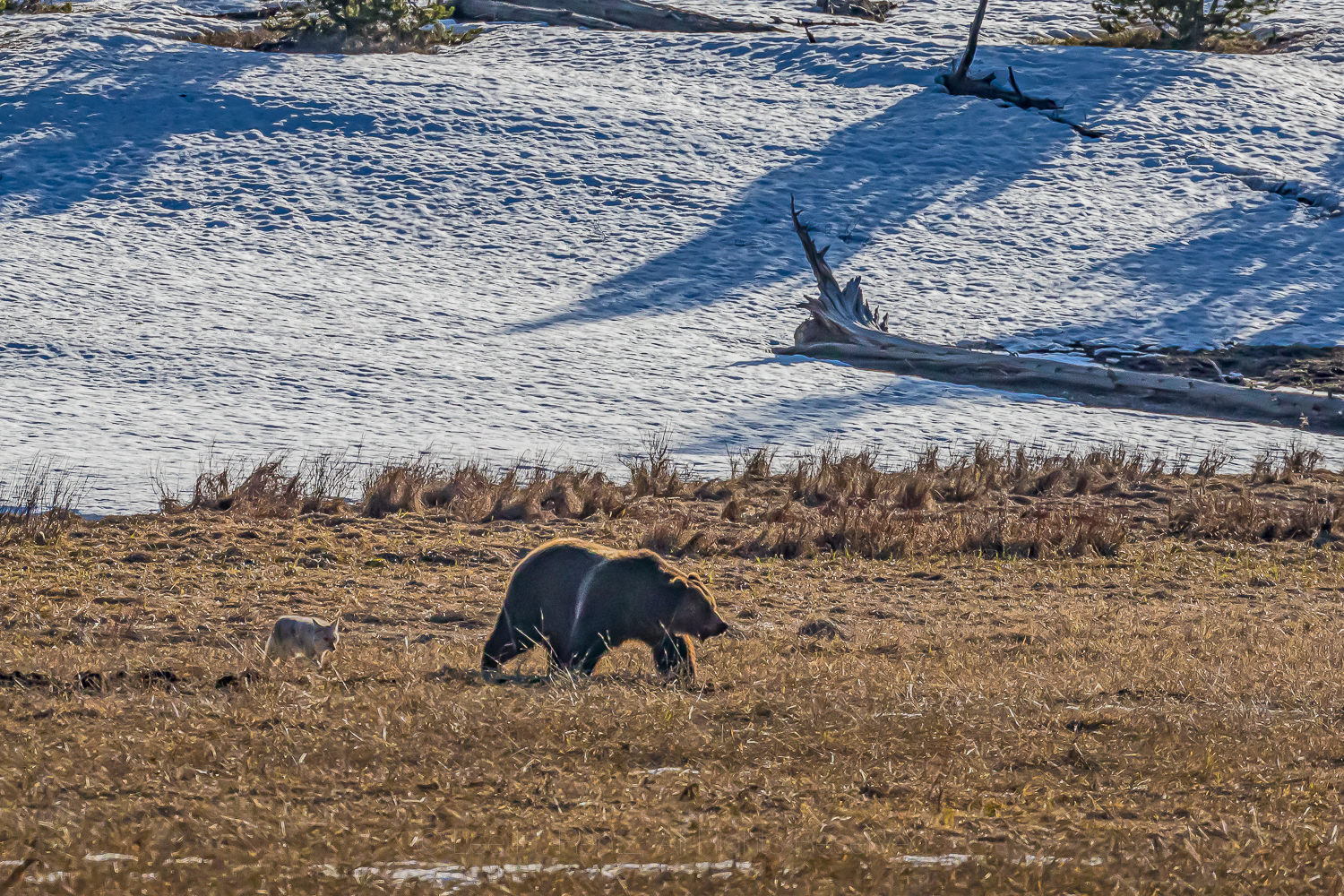
Grizzly Bear searching for food, accompanied by a scavenging Coyote, in Yellowstone National Park
FENDING OFF A BLACK BEAR WITH STONES
1989 in the Mount Baker Wilderness, Washington State
We left our rental car in the parking lot at the trail leading to Hannegan Pass to begin a backpacking adventure in North Cascades National Park. At the trailhead we had an unusual siting of a Black Bear wandering around, and in the trail register comments someone wrote “pesky bear!” We set out on our ten day backpack into lowering clouds.
We set up camp among blueberry bushes and conifers, cooked dinner and hung our food in two heavy bags from a tree branch, then retired to our tiny tent. The next morning, we got up and immediately found a Black Bear under our food hang, trying to get at it. I yelled at it and threw some stones to try and chase it away, and it left, But I had a feeling that it wasn’t done with harassing us, so I went to where I anticipated it might approach the bag next, and lo and behold, there it was! So I threw more stones, hoping to discourage it. After a couple more parries, the bear finally left us alone.
Later in the day however, as we were hiking, a bear descended a mountainside at an angle that would intersect with us, causing us to be really apprehensive about its intent. It came within 20 yards of us, and I suspect it was the same pesky bear, but we hiked beyond without incident. The rest of the trip was bear-free, but those first two days were more than a bit unnerving.
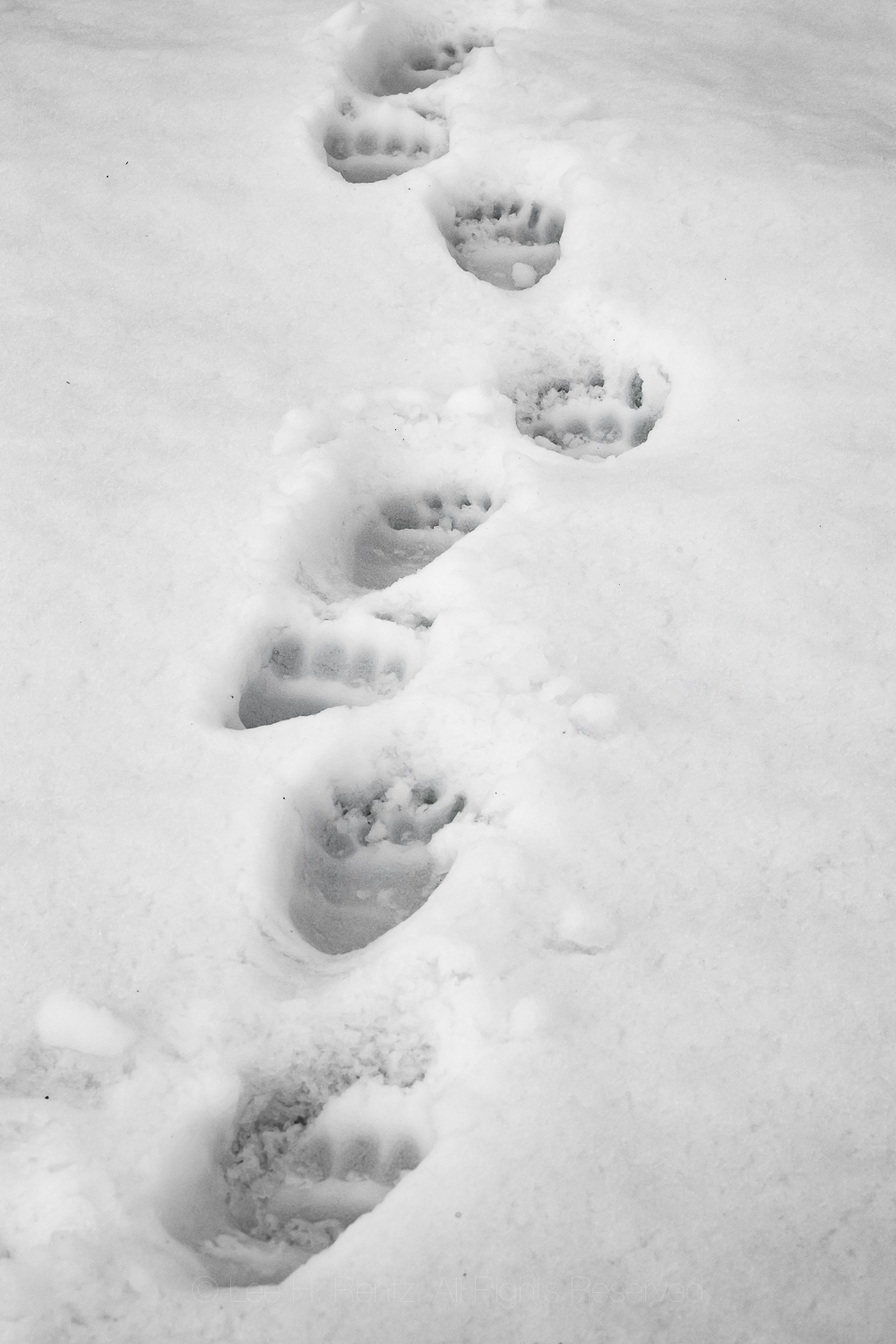
Tracks of Grizzly Bear 399, who was accompanied by her two cubs of that year in snow in Grand Teton National Park, Wyoming. She had been seen here five minutes before we came on the scene.
BEING BLUFF-CHARGED BY A BLACK BEAR
1991 in Enchanted Valley, Olympic National Park
We hiked the 13+ mile trail to Enchanted Valley on a spring day, early in the season when Red Alder leaves were emerging. It is a long hike but the setting in the valley was worth it, with waterfalls cascading off the gray cliffs. We set up camp and talked to a national park ranger about a murder mystery we were reading called The Dark Place, by Aaron Elkins, which was set in that very part of Olympic National Park. We hung our food from a tree, then soothed our hike-weary bodies in our warm sleeping bags.
The next morning we awoke to see a bear foraging in the hummocky gravel of the Quinault River’s flood plain. I went out with my camera on a tripod and got too close to the bear; I knew that when it bluff-charged me and I hurriedly backed up, even with my long telephoto lens.
Then the ranger came out of the old hotel building, converted to a ranger station, and also saw the bear. He thought it was an opportunity for a photo, just like I had. He was wearing a wife beater undershirt instead of his uniform at that early hour, and he also had a camera. Only his was a point-and-shoot camera without a telephoto, so he had to get much closer to the bear than I did. It then bluff-charged him! It was really funny to watch a ranger–who knew better–get so close to a bear!
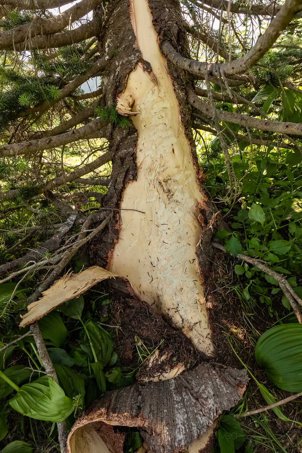
Evidence of an American Black Bear feeding on the cambium of a Subalpine Fir using claws and teeth, in Mount Rainier National Park, Washington State
SURPRISING GRIZZLIES ON THE TRAIL
2010 Mount Assiniboine Provincial Park, British Columbia
We were high in the Canadian Rockies, staying in log huts with hobbit-height doors during a snowy September. This park is known for its Grizzly Bears, and we had to be careful about walking to the outhouse from the cabin. One morning we awoke to Grizzly tracks near the cabin, heading up a nearby trail we were going to walk later in the day. When we did the hike in a group, we came upon big rocks that the bear had turned over and dug around using the enormous strength in its front legs and claws (these huge muscles terminate in the hump on the back that is characteristic of this species). It had been searching for hibernating ground squirrels or marmots and could quickly dig them out of their winter chambers.
One morning our group rose well before the crack of dawn to walk a trail past Lake Magog and the Mount Assiniboine Lodge and into the trail system beyond. We had headlamps on because it was a dark, cloudy morning. The man ahead of me suddenly stopped and said “There is a big mammal in the trail just ahead.” We waited, and a Grizzly cub, hefty after a summer of ground squirrels and berries, crossed the trail. Then there was another, soon followed by mama. We had our bear spray unholstered and at the ready, and Karen began whistling three loud blasts with her whistle to alert another part of our group that had been late in getting started.
Fortunately nothing bad happened, even though we were in extremely close proximity to the mother and cubs. They left the trail area and moved off about two hundred yards, where the mama began furiously digging for ground squirrels, with the two cubs imitating her. She even stood up on her hind legs repeatedly to sniff the air; we think there was probably a big male–dangerous to her cubs–in the area, based upon a guy we met who was camping with his dog in the nearby campground. His bear encounters were scary enough that he rented a cabin for the next night.
Nothing like Grizzly encounters to set the heart racing!
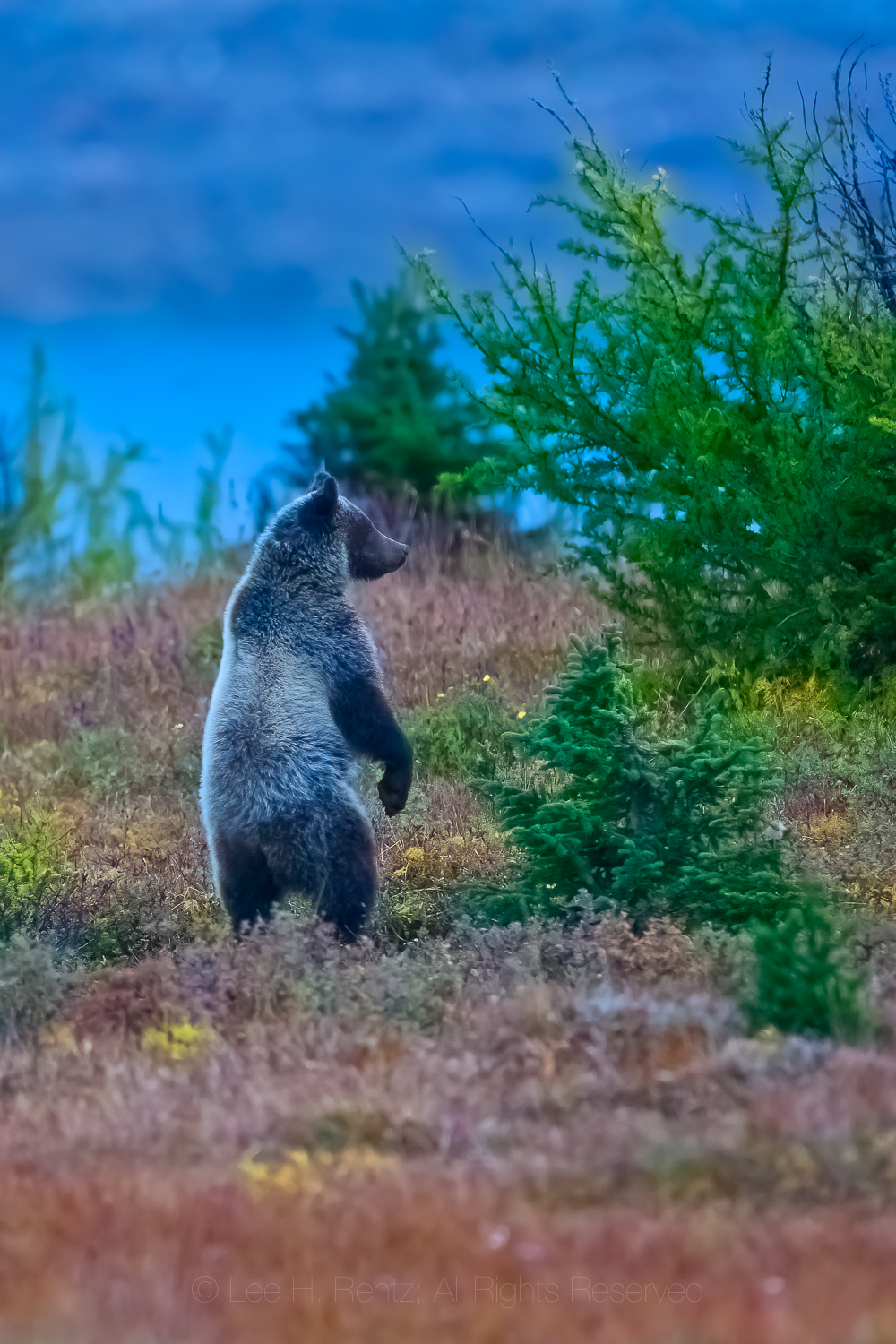
Grizzly Bear mother standing on hind legs after scenting or hearing a possible threat to her cubs at Magog Lake, Mount Assiniboine Provincial Park, British Columbia, CanadaKaren Rentz showing the depth of a fresh hole dug by a Grizzly Bear into the burrow of a Columbia Ground Squirrel, on the border of Mount Assiniboine Provincial Park and Banff National Park, CanadaGrizzly Bear staring with menace at the photographer near Magog Lake, Mount Assiniboine Provincial ParkGrizzly Bear sow and cubs digging for Columbian Ground Squirrels near Magog Lake in Mount Assiniboine Provincial ParkAmerican Black Bear feeding on Gray’s Lovagein Mount Rainier National Park in Washington StateAmerican Black Bear feeding on Gray’s Lovage in Mount Rainier National Park in Washington State
You can see more of the work of photographer Lee Rentz at his website: leerentz.com
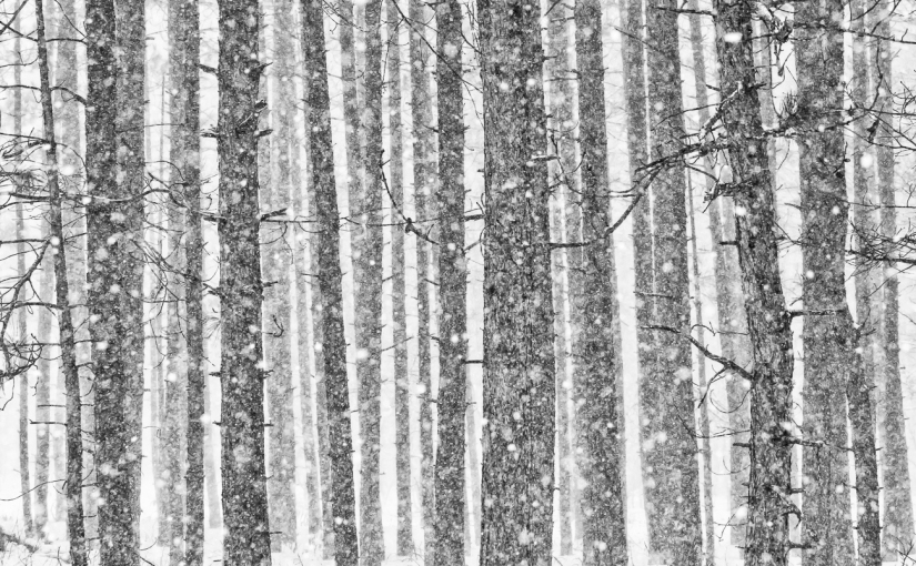
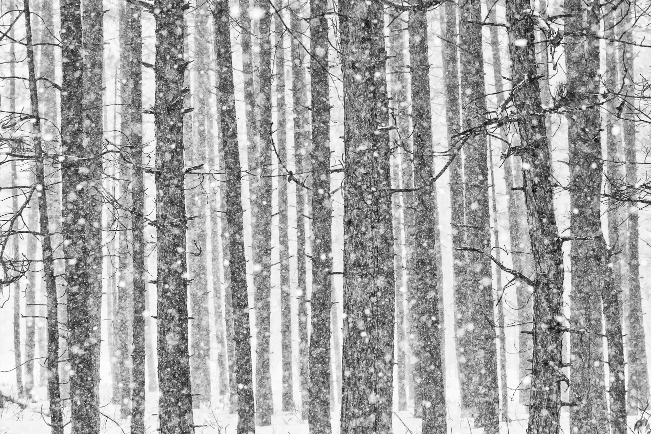
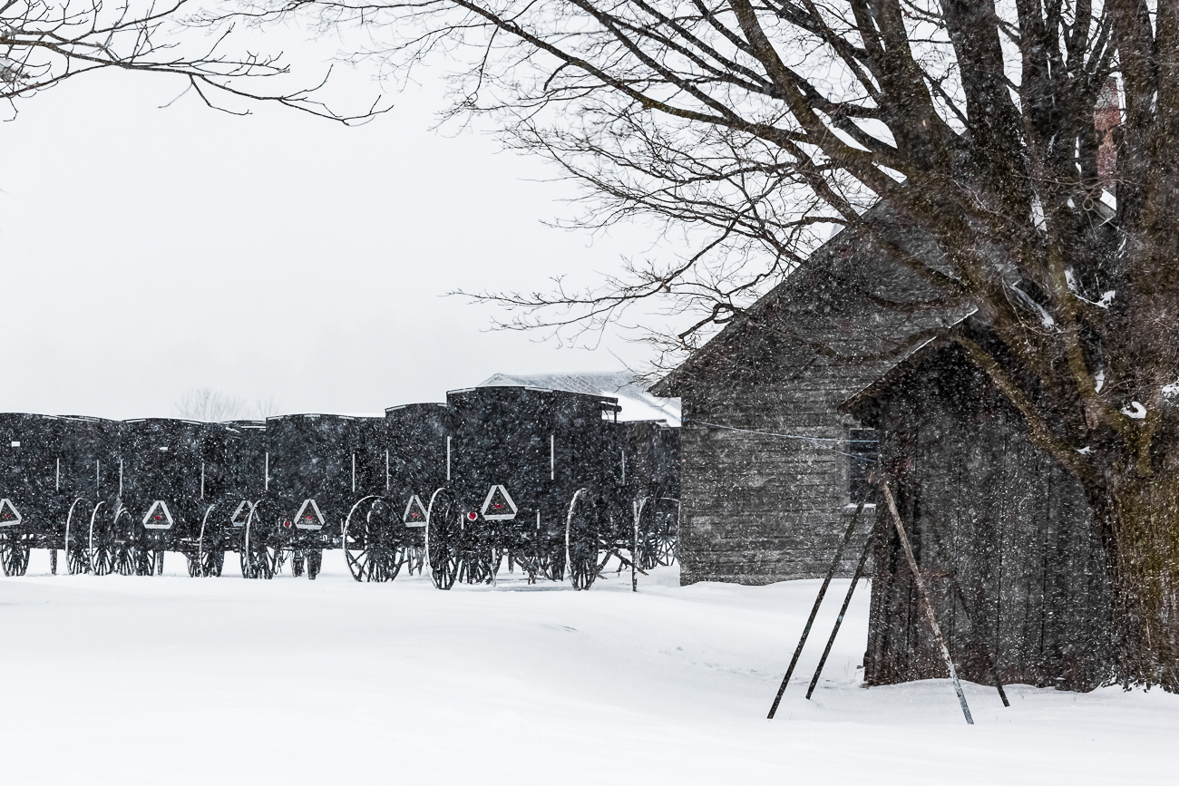
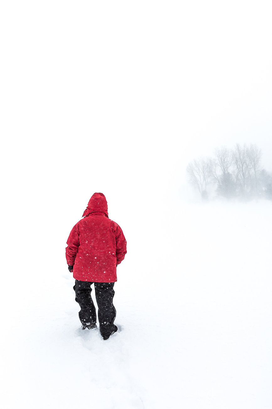
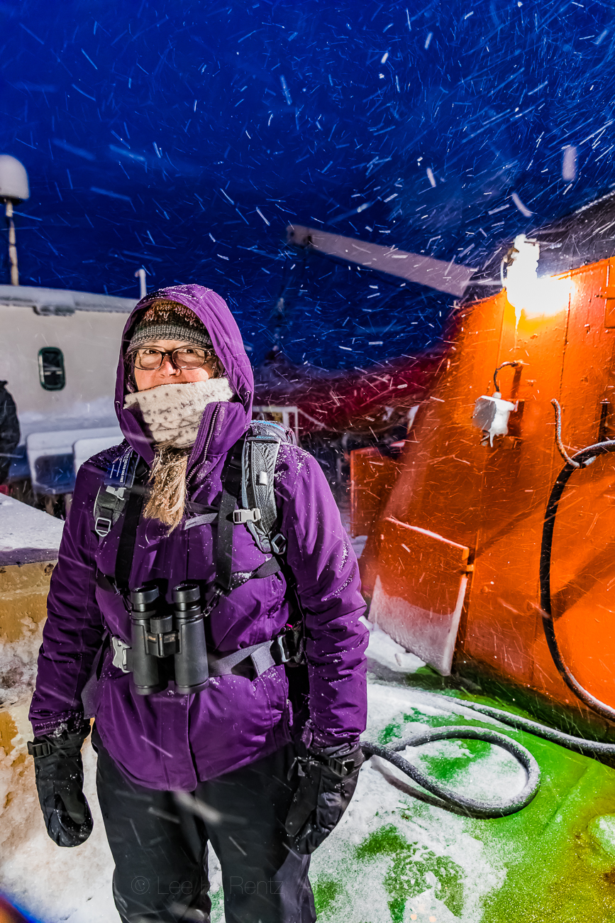
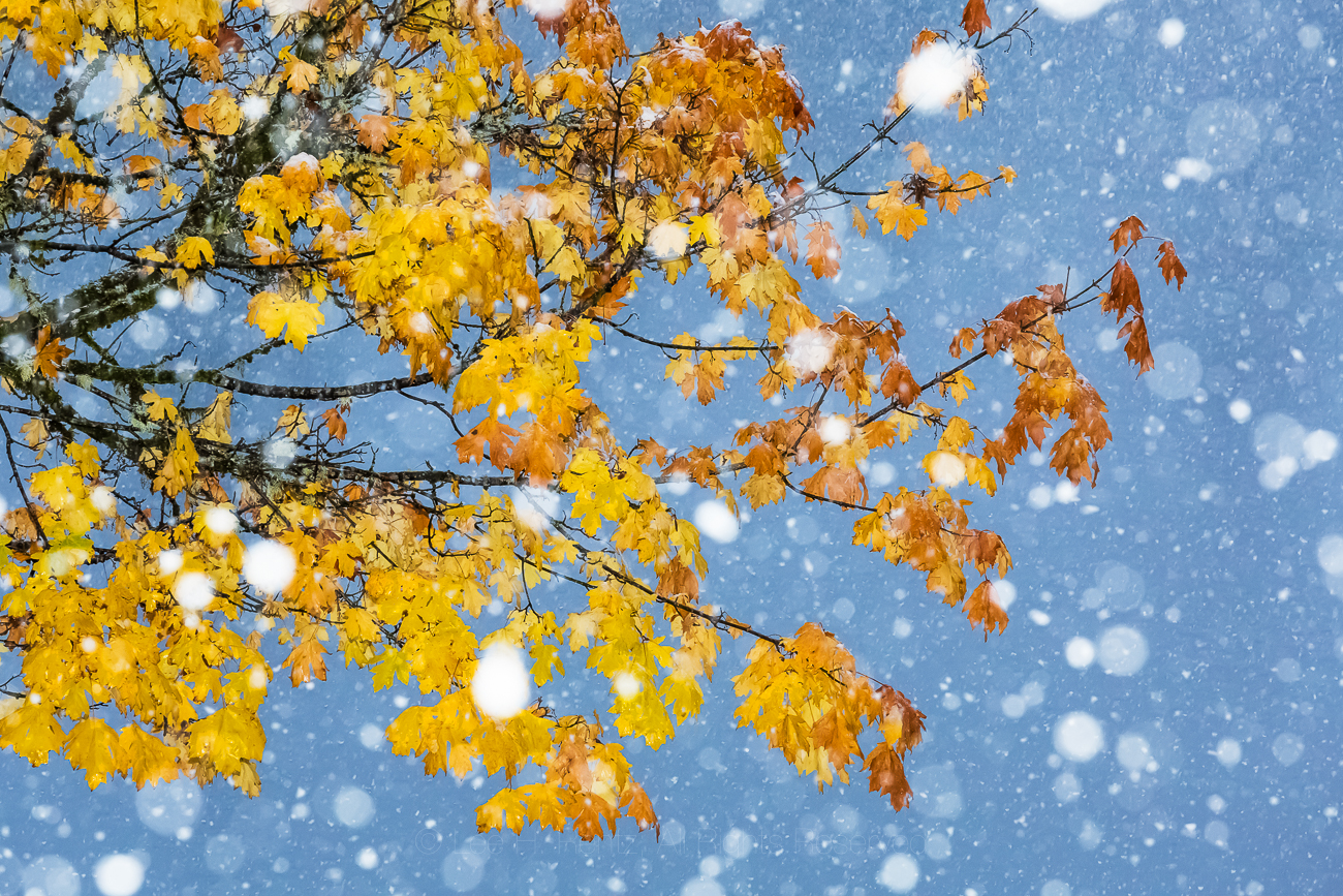
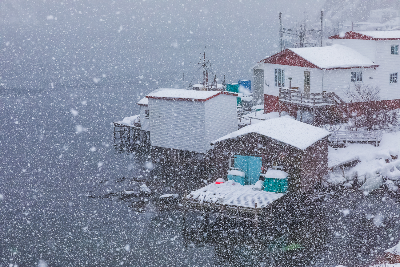
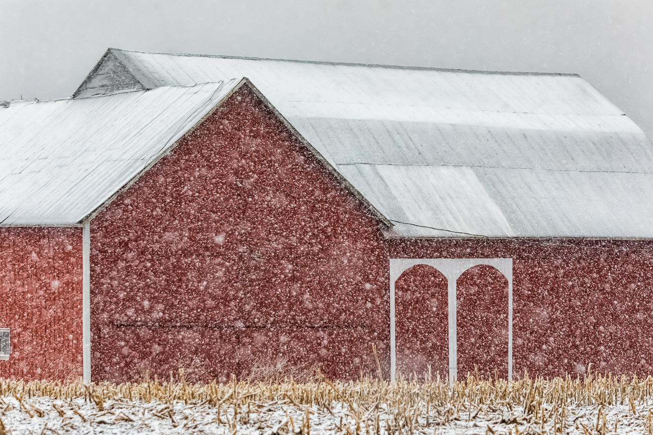
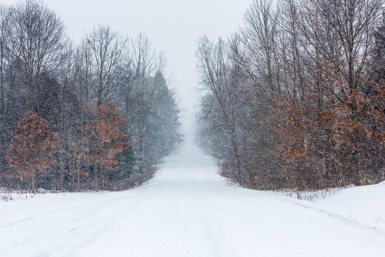
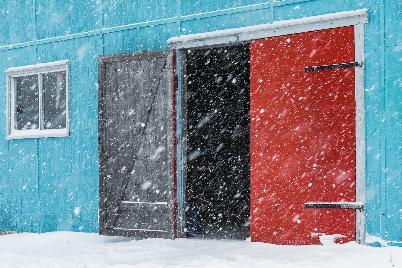
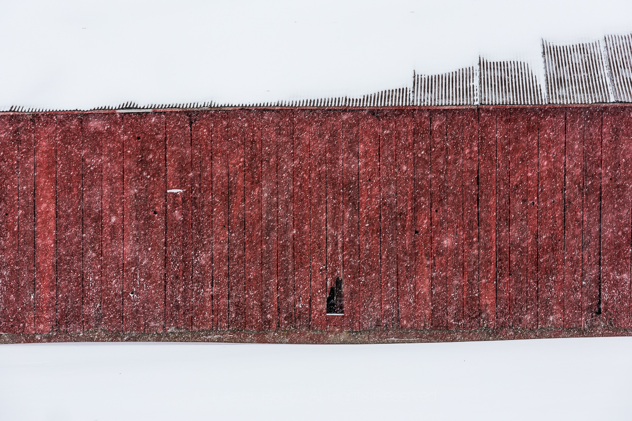
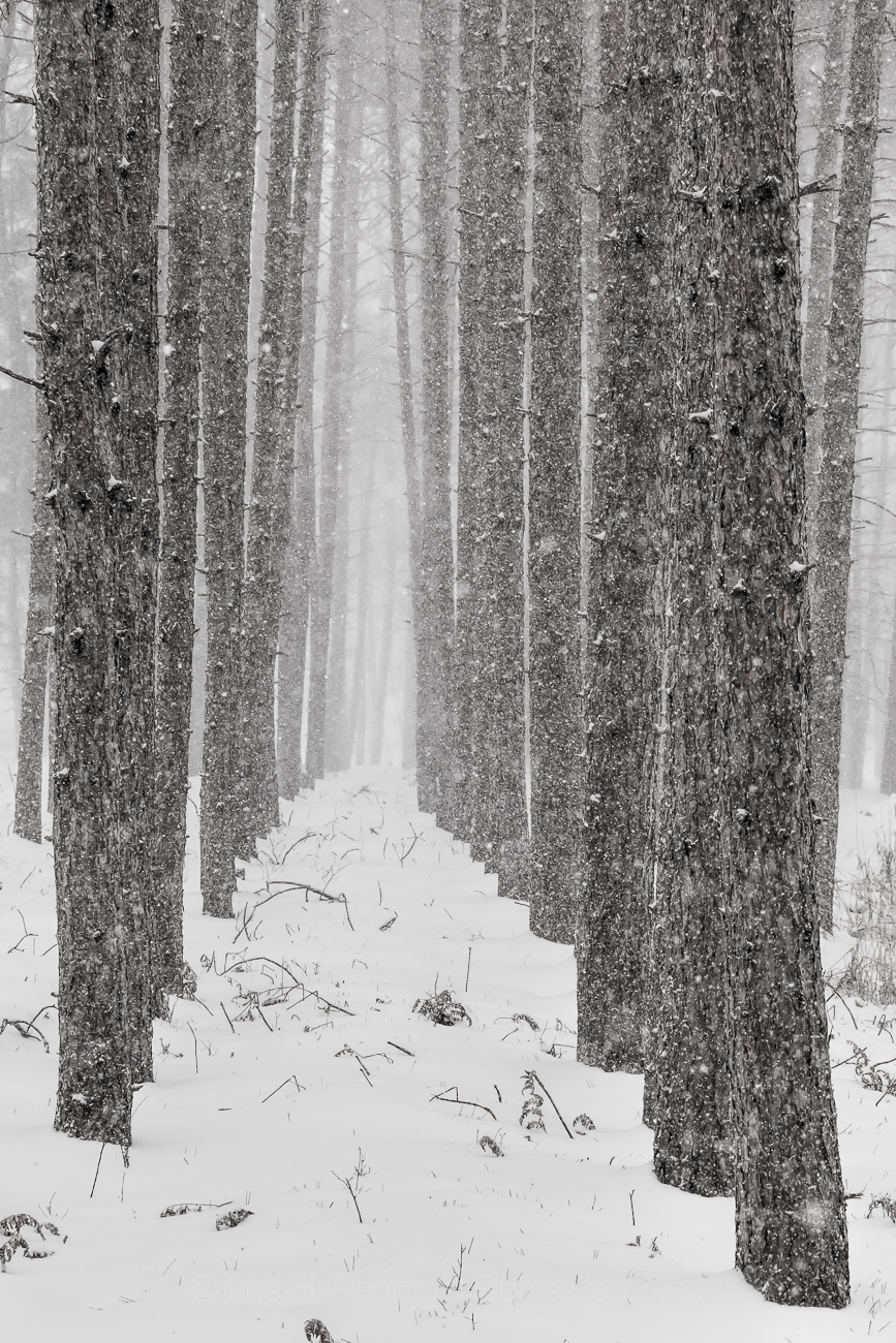
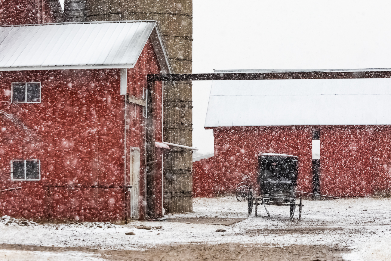
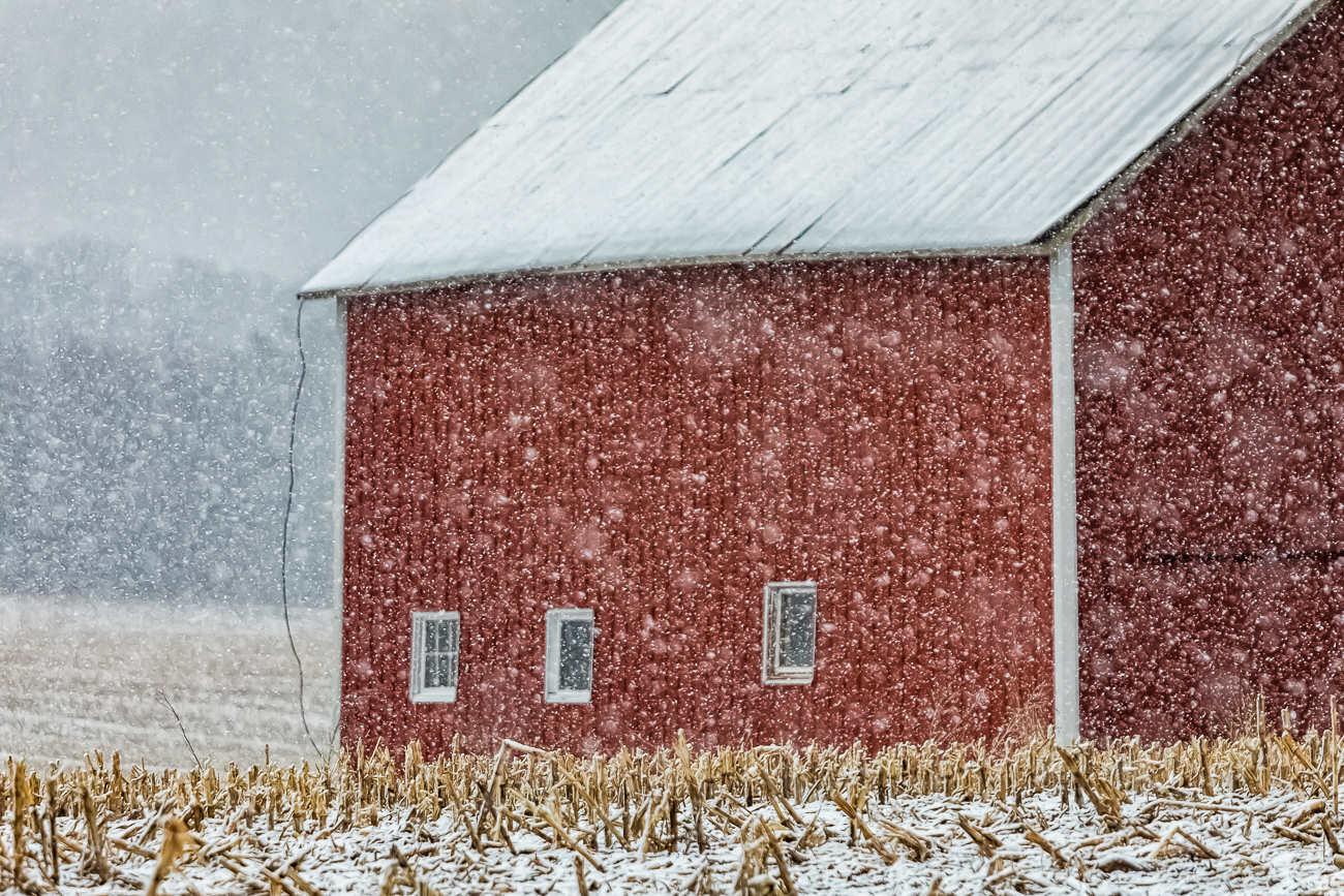
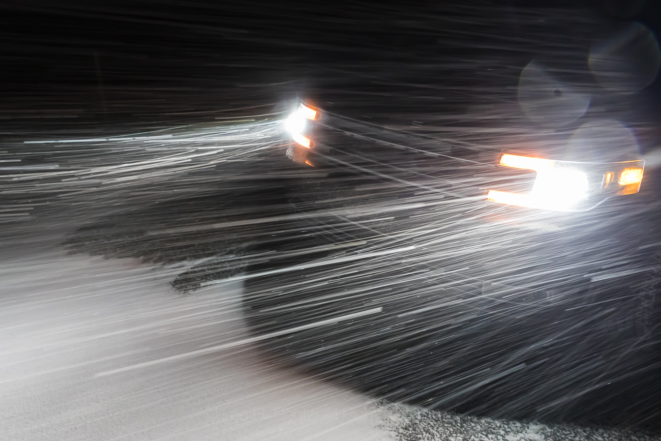
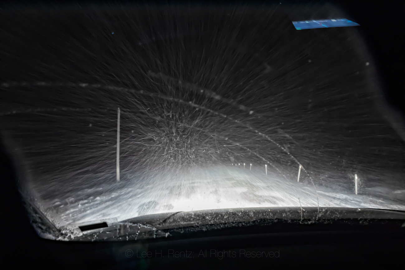
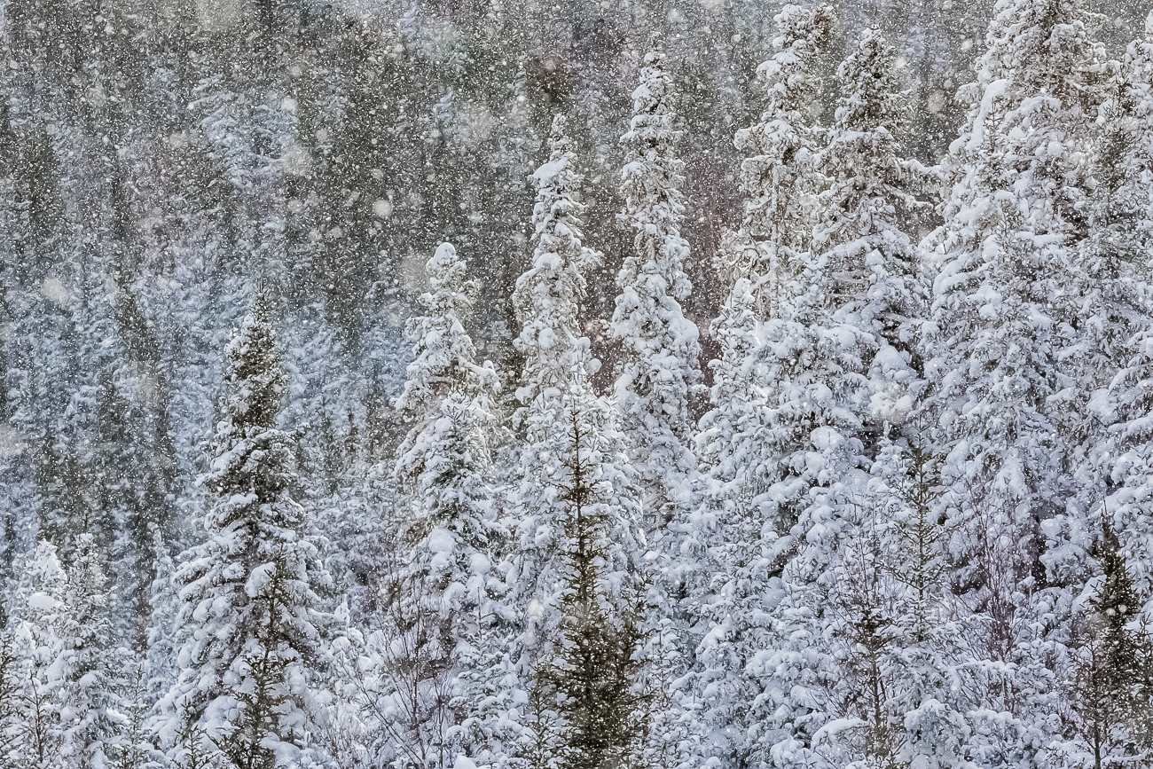
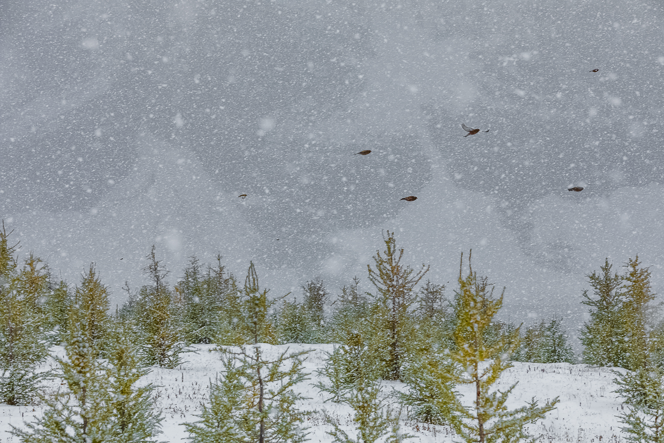
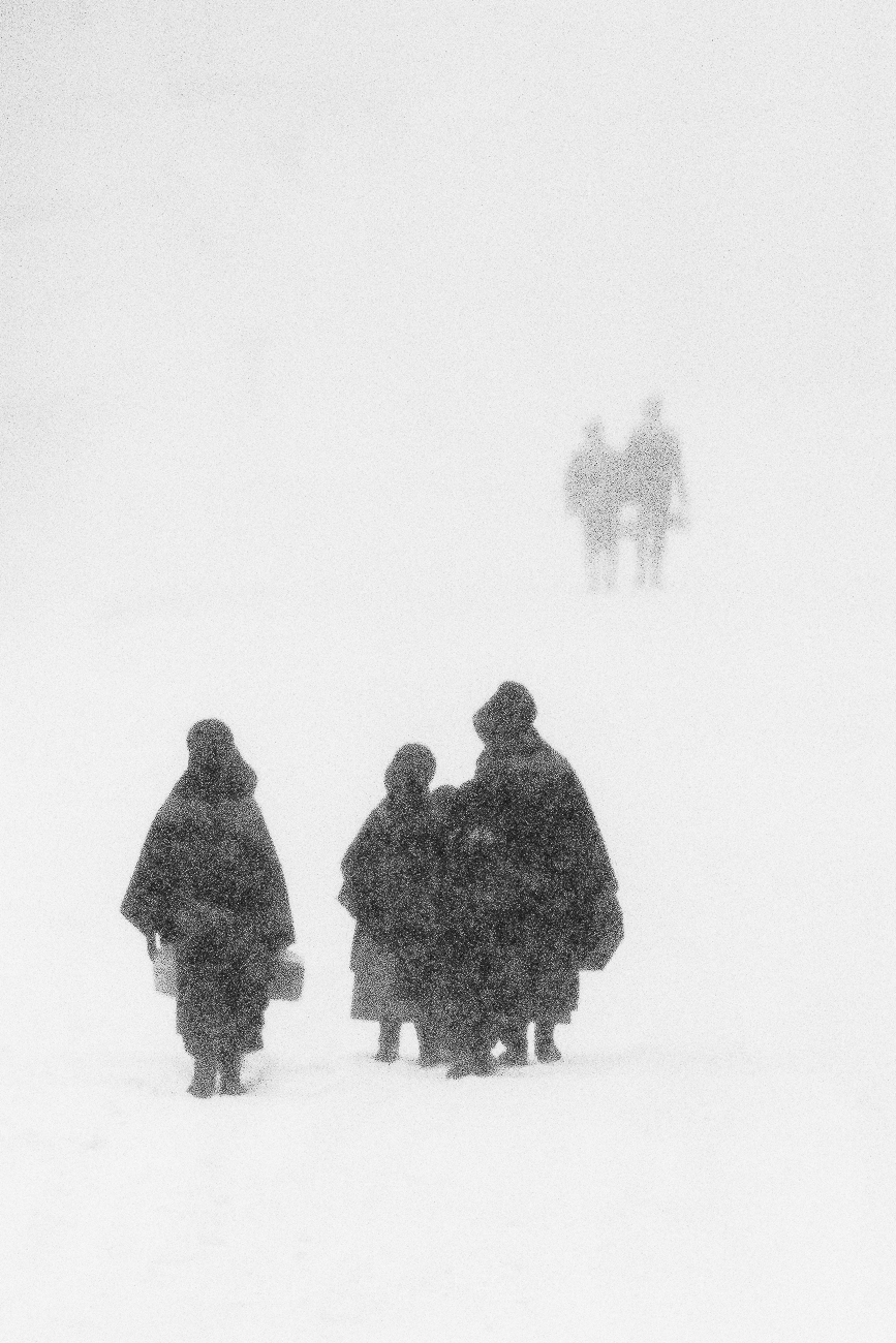
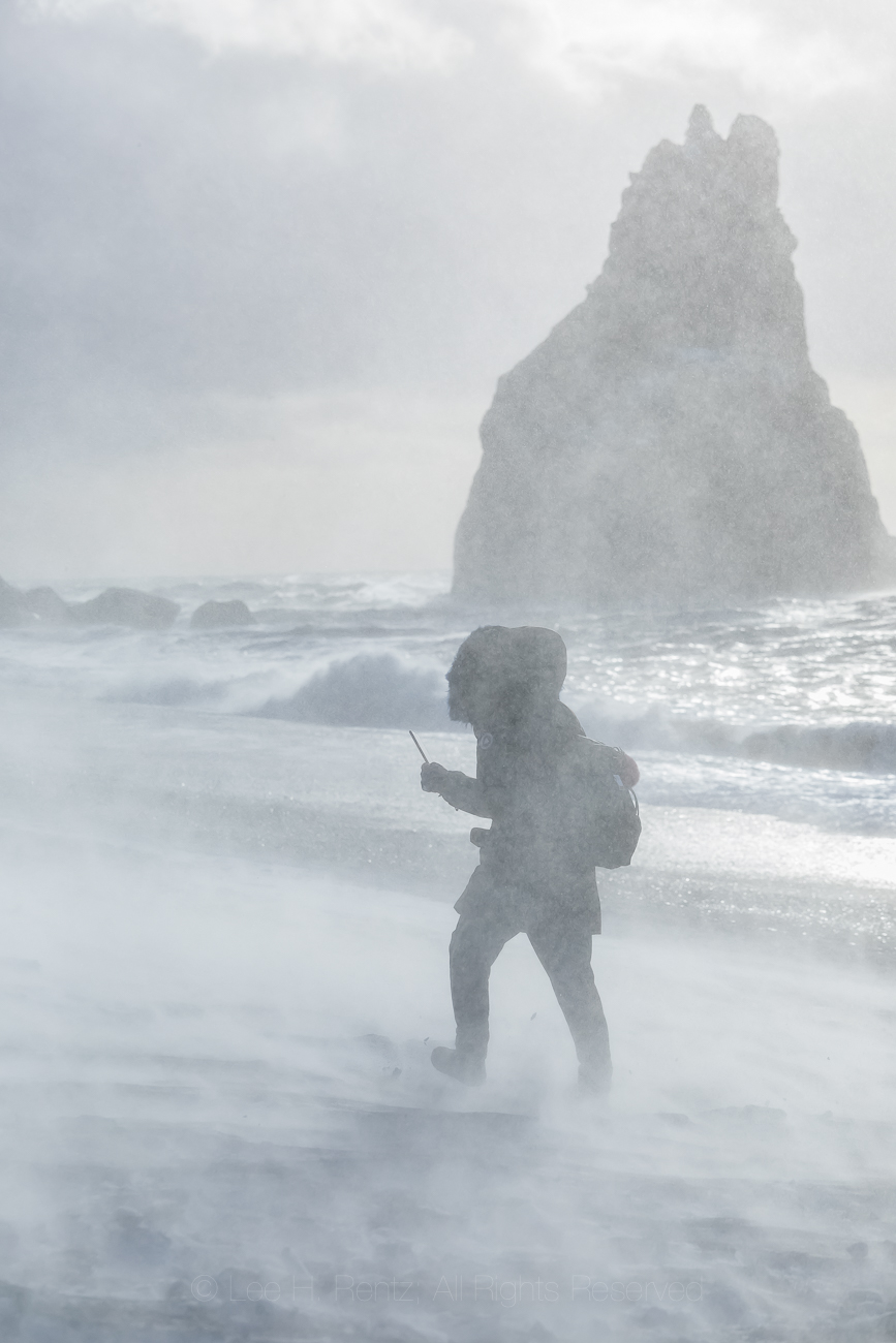
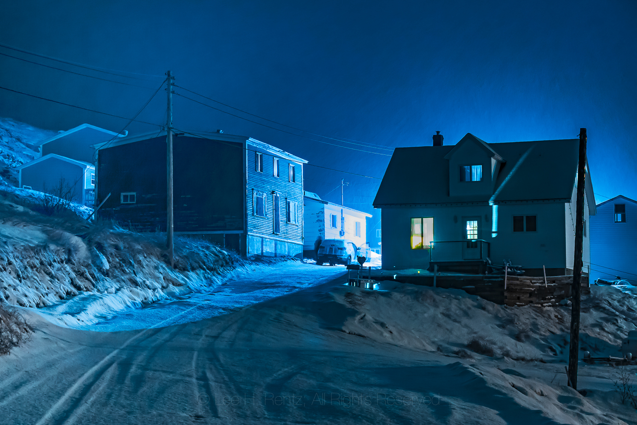
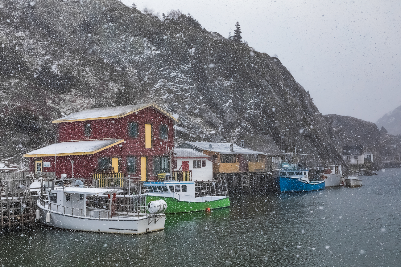
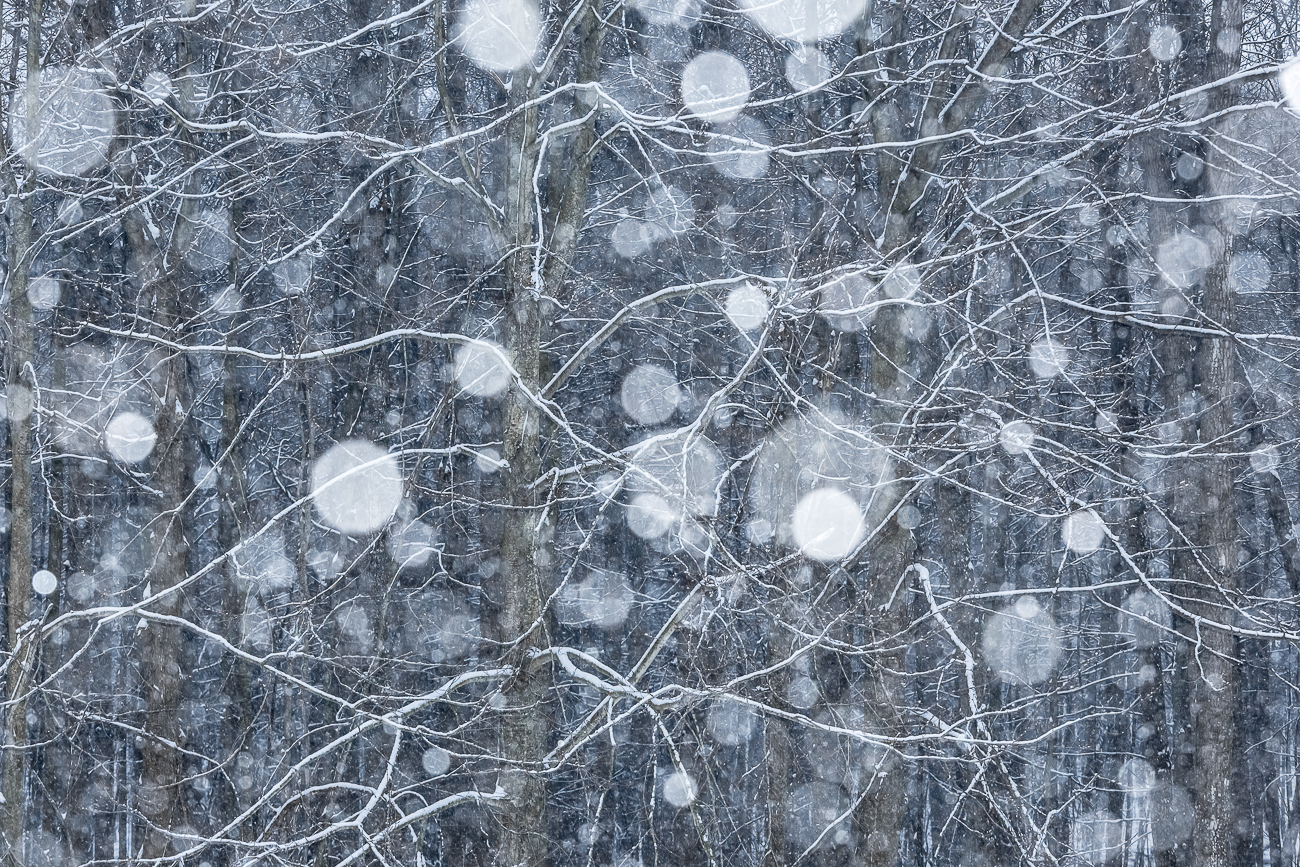
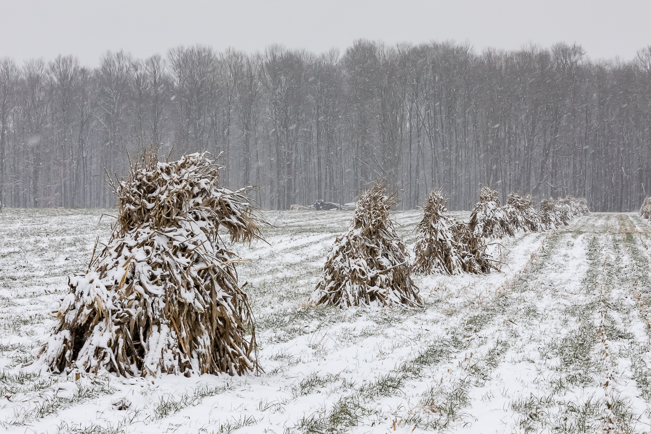
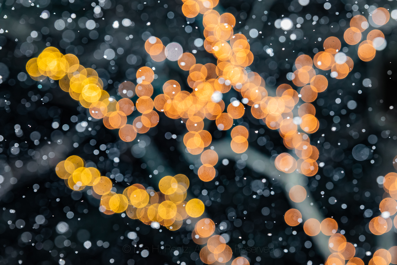
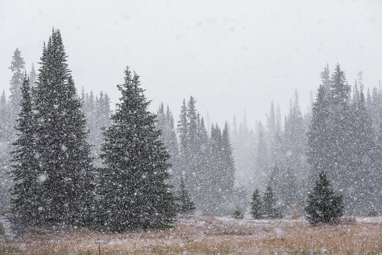
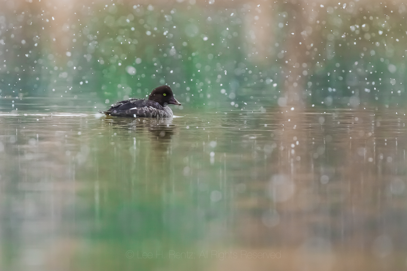
My wife and I made a decision long ago that we enjoy the dramatic cycle of seasons in the north, so we avoided the rush of our generation to move to Florida or Arizona. I’m paler as a result, but am especially enjoying winters in central Michigan because of the snowfall. In fact, when the fat flakes are softly falling, I will often venture out on foot or in the Subaru to see what I can find to photograph.
The pictures here, taken over the last six years in Michigan, the Canadian Rockies, Newfoundland, Iceland, and a few other places represent my passion for falling snow. I love how the thickly falling flakes dissolve the landscape into what seems like molecules, where I get a glimpse of the fundamental nature of the universe. Nothing is as solid or as stable as it seems, and everything we know and love is made up of infinitesimal and fundamental particles buzzing around each other in the void. My glimpse into the great mystery.
You can click on any of the photographs here to see it larger and to view all of them using the arrow on the right. Each is available for $100 in a 12 x 18″ print that you can mat and frame however you like. Free shipping in the USA and each limited edition cotton print comes with a Certificate of Authenticity and a description of the photograph. Contact me at lee@leerentz.com for information; you can also go to http://leerentz.com for more options, including metal prints.
The story of our 1984 journey to Gates of the Arctic National Park in the Brooks Range of far north Alaska in words and in photographs. Below the story there are many more photographs that you can click on to enlarge and also see photo captions.
“You guys might want to get out of the tent … there’s a Grizzly out here.” Denis Davis startled us out of our perpetual twilight dreams with that simple statement, and we’ve rarely gotten dressed so fast. The Griz was several hundred yards away on the Arctic tundra and was steadily traveling up the treeless valley. If it smelled us–which it probably did given that we had been backpacking for a week–it didn’t stop to check us out or even look our way. For that we were grateful, given that we had no protection in the era before real bear spray.
This two-week backpacking trip in Alaska’s Brooks Range originated in Denis’ Christmas card for 1983, in which he suggested several possible adventure trips for the coming year to a number of his friends. We were the only ones who responded, and we liked the idea of backpacking in Gates of the Arctic National Park, which was at that time a newly minted national park.
Karen Rentz backpacking in 1984 in Gates of the Arctic National Park, Brooks Range, Alaska, USA
We began planning for the trip in conjunction with Denis and his wife at the time, Elaine. We needed to carefully consider every aspect of our equipment for weight and usefulness. I needed camera gear, including a 500mm lens for wildlife, a macro lens for wildflowers, and a wide-angle lens for landscapes, plus 25 rolls of Kodachrome film. Tents at the time were limited, and we needed a tent strong enough to withstand possible snow, so we brought the legendary North Face VE-25, a favorite of Mount Everest expeditions, but which weighed 12 pounds! Karen brought a hiking staff that was actually a beaver-chewed stick from the Adirondacks; she had to check it on the cross-country flight because the gate attendant said it looked like a weapon. Our clothing was in the pre-fleece era and included items Karen sewed from Frostline kits. We had jeans, army surplus wool pants, wool shirts and sweaters, long underwear, rain-resistant pants, and Frostline parkas. We also each had an insulated Frostline vest; these would also serve as pillows. Plus stocking caps and Frostline mittens and heavy wool socks for hiking. Water-resistant hiking boots were essential to combat the wet tundra and snow.
Lee Rentz backpacking in 1984 in Gates of the Arctic National Park, Brooks Range, Alaska, USA
Considering food, we had to keep it light. Karen used our dehydrator to dry all sorts of precooked meals, not all successfully. Dried shredded cheddar cheese was crunchy and tasty, but melted away needed fats. For lunches we ate Pemmican Bars, which were an early protein bar from the 1980s. For breakfast and dinner we cooked on a Svea stove that ran on white gas. Our simple meals included a commercial beef stroganoff, rice and beans and dried cheese and chocolate. Breakfast always included hot drinks: our standing joke on this mosquitoey trip was that when a mosquito would land in the hot chocolate, we would fish it out, but any leftover mosquito legs would just go down the hatch. We lost weight on this trip because our calorie intake couldn’t possibly keep up with our exertions.
At the start of the trip, Lee’s backpack weighed 78 lbs, with Karen’s about 59. Karen had a full bright orange daypack lashed on top of her backpack; she sewed it from a Frostline kit.
After all our preparations, the time for travel came in late July, 1984. We flew from Syracuse, New York to Anchorage, Alaska. There we boarded a flight to Fairbanks, and then a smaller plane to Bettles, a tiny Alaskan bush town on the Koyukuk River. This is where we did our final planning and packing for the trip, with our gear splayed across the runway’s edge. We talked to some guys who were heading into another part of the Brooks Range who had long rifles with them for protection and hunting; we felt quite naked by comparison. But at the time, it was illegal for hikers to carry a gun in a national park, so that wasn’t even a possibility for us.
With our packs finally stuffed, we walked to the office of the bush plane to give them our final itinerary. We were to be dropped off by float plane at a small lake in the western part of Gates of the Arctic National Park, then we would hike for about two weeks and 50 miles through Arctic tundra, following rivers. Our biggest challenge would be a climb over unnamed mountains, hoping we could get to the crest, then down the steep cliffs on the north side. This was all uncertain, because it was possible no human being had ever traveled this route over the mountains and the available topographic map was not detailed enough to confirm cliff locations. This was real, raw wilderness in the extreme. If all went well, we would follow a drainage from the mountains, hiking north until we reached Kurupa Lake, where we would be picked up by float plane.
Dramatic arctic landscape between the Arctic plain and the high summits of the Brooks Range, Gates of the Arctic National Park, Alaska, USA
We finally shouldered our heavy packs and walked to the Koyukuk River, where our float plane magic carpet awaited. This was a Canadian-made bush plane, a De Havilland Beaver, that was and is the workhorse of the far north. We took off from the river–our first experience on a float plane–and followed the river west for a ways, with us watching for Moose among the Black Spruce trees along the river. Eventually the pilot left the river and turned the plane north, taking us over turquoise tarns and rugged, sharp peaks where the trees eventually dwindled to none, leaving us over a treeless tundra. We came to a broad opening in the mountains where several lakes shimmered, and one of those was our destination. The pilot descended and made a smooth landing on the lake, then taxied over to the shore. We didn’t even get our feet wet while unloading our gear. After confirming our final meeting point for a rendezvous two weeks later, the pilot taxied into the center of the lake, then took off with a roar, leaving us feeling lonely on the vast tundra. The pilot had been instructed to pick us up at Kurupa Lake, but if we weren’t there, then he would look for us at our drop-off lake in case we couldn’t make it over the mountains.
Two things happened within minutes: we found a distinct fresh Gray Wolf track in the wet soil between tussocks, and mosquitoes descended upon us in Biblical multitudes. We were in the Alaska Wilderness!
After a few minutes of gazing out over the lake, we pulled out our mosquito head nets, shouldered our lead-filled packs, and set out on a two-week journey through one of the wildest places in North America. We consulted our topographic maps, then headed over a ridge that looked down over a long valley stretching toward a line of mountains in the distance. Our route would take us down the valley along an unnamed river past unnamed mountains.
Our trip took place at the warmest time of year in the Brooks Range, with temperatures hovering above 70°F. At our feet, arctic wildflowers bloomed in profusion–most of them hugging the ground to avoid the drying winds–while along the river Arctic Fireweed was vivid. In this warm weather, the clouds of mosquitoes were legendary. To cope we wore head nets, plus applications of DEET-containing Jungle Juice. Karen had sewn the placket gaps above our sleeve cuffs shut to keep the bugs out. But we discovered that they could still bite through our jeans, so we ended up with a lot of itchy welts. During the first two days of hiking along this long valley, we saw no large charismatic wildlife, so we focused upon cool birds we had never before seen, such as a Wandering Tattler on its nest site, an American Golden-Plover, and a Gray-Crowned Rosy Finch.
We set up our first campsite on the lower flanks of a mountain high above the valley. This was northern Alaska during the height of summer, so the sun barely set, making the inside of our yellow tent look like perpetual dim daylight all through the long night. We thought it might be hard to sleep in these conditions, but we were so worn out from hiking with heavy packs that sleep was not a problem. As we gazed up the valley the next morning we could see where we would camp the next night; an expansive view.
Grizzly Bears were always on our minds, but not enough to keep us from sleeping. Without bear spray and without guns, our defense lay in our numbers–with four of us, that should work as a deterrent against daytime attacks. At night, we needed to protect our food supply from bears, but there was no place on the open tundra to hang our food. Each night we took our packs and placed them together about 100 yards downwind from our tents. Atop the packs we placed our cooking pots with stones in them, so a raid on the packs would alert us with noise. We also had little mesh bags made by Karen containing mothballs that we hoped would cover up the scent of food, or at least serve as a repellent. While hiking, the mothballs were triple bagged to contain the strong fumes.
The next day we hiked further along the river, coming upon a spot where there was enough shade from the mountains that river ice several feet thick had not yet melted; it resembled glacial ice, with its aqua-blue color. Later, we were setting up camp when we heard the blowing and galloping of a mammal coming our way. It was our first Caribou, and it appeared to be running in terror. But nothing was chasing it, and it was possible that there was a parasitic larva called a nosebot driving it crazy. Or maybe it was the ever-present mosquitoes.
The third day out, we left our broad, open valley and began ascending a steeper route into the mountains. This was the drainage we hoped to take over a high pass at the northern crest of the range. As the day wore on, the cloud cover increased and there was a noticeable chill in the air. We set up our tents high in a cirque, with sharp peaks rising around us, then finished our camp chores and wriggled into our sleeping bags. A drizzle began, followed by rain, then silence.
When we awoke the next morning, there was about four inches of fresh snow on the tents. It was cold, and we decided it would be too treacherous to make our climb over the pass in these conditions. So we took a snow day, mostly napping and reading inside our tents, waiting for the weather to pass.
We hiked to a snowy, high, unnamed pass in Gates of the Arctic National Park, in the northern part of the Brooks Range, Alaska, USA [No model release; available for editorial licensing only]
The following morning the weather had again changed, with sunny blue skies appearing between clouds still hanging in. We decided this was our day to face the biggest challenge of the trip, so we loaded up and headed straight up the snowy steep and rocky slope toward the pass. When we reached the pass, the view straight north to the Arctic Plain greeted us. The wind was blowing hard over the pass, so we took shelter against a rock buttress and ate lunch. Then Denis and Lee split up to try to find a safe route down from the pass. Denis went to the east and Lee ascended to the west, each looking carefully at our chances. When we got back together, Denis said his side of the pass was not feasible, but Lee decided we had a good chance of making it if we carefully went in his direction. It involved climbing higher, then going sidehill in snow while hugging a cliff above a steep, snow-covered dropoff. If we went far enough, we would reach a scree slope leading all the way down to the valley at a steep angle.
Lee turned to Karen, who gets nervous with exposed heights, and said “You’re going to have to be brave.” She was, and we carefully inched along the cliff face without mishap, then began our steep descent. The scree slope was snow covered, but we forcefully stuck our legs through the snow to the soft rocky debris (almost like a fine gravel dune) and felt almost entirely safe. When we made it to the bottom, it was with a sense of triumph and relief that the most difficult part of the journey was behind us. We celebrated by making a no bake boxed cheesecake chilled in the snow, and all was right with the world.
The bad weather closed in again the next morning, and we hiked down the length of a lake with wet snowflakes steadily falling. Very briefly the mosquitoes were too chilled to move. The mountains were gleaming with their coat of fresh snow. We climbed out of the valley into some foothills. Then, while eating lunch we saw movement in the distance. Binoculars revealed one of the most amazing sights of our lives: thousands of Caribou traveling across the rocky terrain! We changed our route to intercept the herd and over the following days we watched and photographed them extensively, burning the sight into our memories as well as on film.
We camped that night on a ridge in the path of the Caribou, and all night we could hear the clicking of tendons in their ankles as they walked past our tents. It is a fascinating phenomenon, and apparently it serves to keep herds together as they travel–even in the clouds and fog of the mountains they can hear each other enough to stay together. The Caribou traveled well-worn paths along mountain slopes and through wildflower meadows. There were bull Caribou with huge antlers, as well as females with smaller antlers and young of the year racing around. These were part of the Western Arctic Caribou Herd, which migrates twice yearly between the calving grounds on the Arctic Plain and the wintering grounds south of the Brooks Range. When we saw them, they were gathered together in a huge group, but not yet beginning their fall migration south. Our days among the Caribou were wonderful, as we saw them crossing streams and silhouetted against snowy mountains.
Caribou, Rangifer tarandus, migrating through the mountains of Gates of the Arctic National Park, Brooks Range, Alaska, USA
On another morning about this time in the trip we saw our first Grizzly Bear; fortunately it didn’t pay us any attention. It was astounding to see how large it was and how prominent was the hump on its back. One advantage of hiking in the tundra is you can see bears from a long way away. We still remember Denis and Elaine talking about being first on the scene of a near-tragedy in Glacier National Park. A family of four had been hiking together when they surprised a Grizzly in the forest. It attacked, and had one child’s head in its gaping mouth when the father jumped on its back. The bear broke the man’s arms but then called off the attack. But enough about scary bear stories.
Our packs were now a bit lighter from the food we had consumed, and our still-young bodies gained strength as the days wore on. One day Denis proposed we go off on our own and he and Elaine do the same. That sounded good, and we ventured into the Kurupa Hills. Our highlight was seeing a young Dall Sheep lying on the tundra, and later seeing some adults crossing a talus slope. At our campsite we enjoyed watching an Alaska Marmot, though not-so-much an Arctic Ground Squirrel who chewed through one of our plastic water containers. During the second half of the trip we saw Peregrine Falcons, which were truly rare in the lower 48 during the 1980s because of the effects of DDT, as well as a Long-tailed Duck on a tundra pond, and Long-tailed and Parasitic Jaegers, which flew at us aggressively when we got too close to their nesting grounds.
Hiking further, we approached our destination, Kurupa Lake. Denis didn’t tell us at the time, but later said an early oil prospector’s report described the “herds of Grizzly Bears” at Kurupa Lake. Fortunately, we encountered no herds, but we did see a second Grizzly Bear on the other side of the lake, where it paused to furiously dig up an Arctic Ground Squirrel’s burrow. It is astounding how fast those massive muscles and claws allow a Grizzly to dig. We assumed it got the squirrel.
We stayed two nights at our last campsite, giving the bush plane plenty of time to retrieve us. While we waited, Karen and Denis both fished, each catching a Lake Trout and observing Arctic Char. Denis released his fish, but Karen was determined to eat ours. So we cleaned the fish and boiled it, tossing the carcass into the lake to reduce the scent. It was good, but the scent from the cooking would have clung to our wool clothing, undoubtedly acting as a lure for a bear. Fortunately we didn’t attract any bears to camp.
There was always a chance the plane would not appear on our pickup date; if fog or other bad weather delayed previous days’ retrievals, people would be picked up in order and they would get to us as soon as possible. We were getting low on white gas and food and speculated that if we were delayed by days we would be eating raw fish.
We were entranced by the whole experience, and Lee could have turned around and stayed in the wilderness for another two weeks if we had the time. Alas, work called and we needed to return. On our last day we needed to pack early and have our gear ready to go. In the afternoon we heard the whine of a plane approaching, and it turned and descended to our lake. The pilot had instructed us to leave a tent up so he could spot us along this large lake. As soon as we knew the pilot had spotted us, the tent was quickly collapsed and we hoisted our packs to trudge down to the shore, then loaded our gear onto the float plane. When we took off, it signaled the end to one of the signature experiences of our lives.
The photographs below show a map of our route, final packing on the runway in Bettles, our flight north through the mountains, and our first moments on the arctic tundra. Click on any of the pictures for a larger view and more information.
As we hiked across the tundra with our heavy packs, the Arctic revealed itself in beautiful wildflowers, distant views, Caribou antlers, fast streams, and campsites with glorious views.
We identified and photographed wildflowers and lichens and ferns that we had never before seen. The tundra plants are short, hugging the ground to stay out of the wind and take advantage of the warmth near the ground; most of the wildflowers are pollinated by flies, since bees are scarce in the Arctic.
When we reached the end of a long valley and several days of warm temperatures, our route next led us into the mountains. After setting up camp, rain turned to snow. After a rest day, we climbed steeply up into the mountains, not knowing if we could cross the range here. It turned out that we could, although there were challenges of negotiating ice and snow and a steep scree slope.
After the steep mountain crossing we hiked down a long valley in rain and snow, passing alpine lakes and crossing a stream. Here our wildlife sightings began in earnest, with Grizzly Bears, Caribou, Dall Sheep, and birds we had never seen before. Seeing thousands of Caribou was a highlight of our lives.
After all our time in the wildest wilderness we had ever experienced, it was time for a float plane to pick us up at Kurupa Lake on the north side of Gates of the Arctic National Park. We arrived two days early and spent the extra time fishing and hiking. Alas, we heard the plane overhead and quickly packed up, ending one of the premier adventures of our lives.
Wilderness and adventure in far off places would lure us to distant locations and backpacking trips during the ensuing decades, but nothing would be quite the challenge as this trip to the Brooks Range. Looking back now, nearly four decades later, we both think of it as a highlight of our lives.
If you agree that Mount Baker would be a fine addition to the National Park System, please let your national congressional representative or senator know your feelings. National Parks have been called “America’s Best Idea,” and it is time to expand the system to include all the other great areas that represent the best nature of America.
For more information about my photography or to purchase a print, go to leerentz.com. Or contact me at lee@leerentz.com or on my Lee Rentz Photography Facebook page.
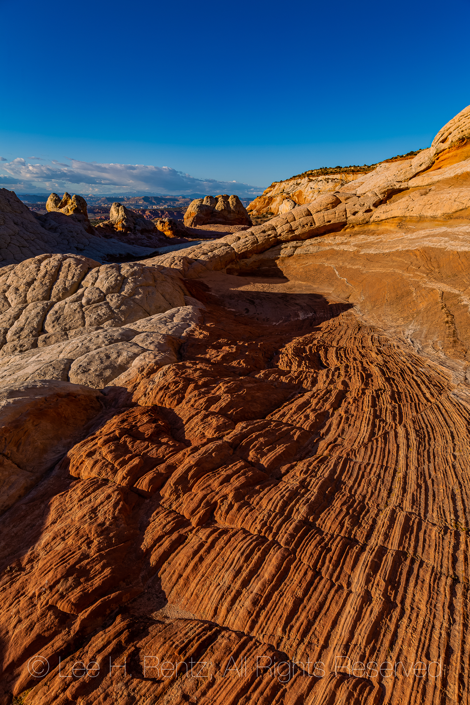
Twisting and swirling, the red rock follows the random paths of a wild dream, then skirts a dome of white Navajo Sandstone cracked into nearly perfect polygonal plates, enchanting under a perfect sapphire sky. All of it originated 190 million years ago with a Jurassic sand dune that became saturated with groundwater, then experienced a sudden disruption–perhaps by an earthquake–that suddenly contorted the whole wet jumble while it had been hardening into sandstone. Incredible beauty resulted from this chaos.
Our time is short for exploring before the short period of golden light near sunset, so we walk around quickly to get a feeling for the whole area, which is about a square mile in size. An outfitter got us here and we have about 20 hours from mid-afternoon today to mid-morning the next day to explore and photograph before we have to leave. We are on our own, except that the outfitter provides dinner, a tent, and breakfast the next morning. The reason we came with a touring company is that we don’t have a rugged 4-WD vehicle to get us through the March mud quagmires and deep sand traps along the access roads. A tow out would cost $2,000 and is not covered by AAA. So here we are.
I once worked for the Bureau of Land Management on the Arizona Strip, a part of Arizona between the Grand Canyon and the Utah state line. This is an arid landscape that includes pockets of incredible beauty, such as Paria Canyon, The Wave, and White Pocket. When I was there with BLM in 1977, I was working as a writer and pen-and-ink illustrator for a book of wildflowers (still in print 43 years later!), but White Pocket was virtually unknown at the time, except for some ranchers and probably a handful of government employees. I certainly didn’t know about it and even if I did, my big Chrysler at the time couldn’t have dreamed of getting there. The name White Pocket originated from the desert term “pocket” which referred to a rock depression that can hold water–an important feature for cattle ranching and desert travelers. At that time the world hadn’t yet discovered much of the stunning beauty of red rock country. While at BLM, I heard the geologist for our district remark to my boss that he thought it was better in the desert when it was all considered a wasteland, and environmental regulations didn’t need to be followed. Fortunately, times have changed.
We spend the hours before dark exploring and photographing in great light, then walk back to camp for a meal of barbecued salmon or chicken or steak (another value in contracting with an outfitter!), then we venture back out into the contorted lands for hours of night photography. We return to camp sometime after midnight, then get up at 4 a.m. for dawn photography, so not much sleep. We stay until afternoon, delayed for a couple of hours by a vehicle problem, and we don’t mind the delay in the least, because it gives us more time to explore this place torn from time.
The photographs here give the visual story of White Pocket, which is the most stunning desert location we have visited.
Navajo Sandstone formations of White PocketA dome of Navajo Sandstone shaped like cauliflower, cracked into polygonsLayered sandstone formations in White PocketSculptured and striated Navajo Sandstone formations of White PocketA polygon of Navajo Sandstone with etchings in the shapes of lichens, the etchings created by acids from the fungal hyphae of the lichens that dissolve rock to obtain nutrientsA closeup view of the lichen etchings, created when living Tile Lichens, Lecidiea tessellata, dissolve rock using acidsSculptured and striated Navajo Sandstone at White PocketKaren Rentz exploring a once-inhabited cave at White PocketAncient corncobs, potsherds, and animal bones left in the cave by early inhabitants at White Pocket, probably over 800 years ago. Remember that it is against the law to remove anything from federal lands!Bighorn Sheep and Elk or Mule Deer Petroglyphs made by ancient peoples at the cave in White PocketHiker’s shadow crossing sculptured and striated Navajo SandstoneThe golden hour light just before sunset is particularly stunning on these formationsKaren Rentz illuminating a cauliflower rock formation in White Pocket with her headlampStarry sky above the Navajo Sandstone formations of White PocketWe illuminate the rock formations with a headlampAs the night wore on, the Milky Way above White Pocket is the brightest I’ve ever seenThe next morning, photographers are out before dawn to explore the formationsFirst light is magicalSunlight descending upon the Navajo Sandstone formationsEarly light on a Pinyon Pine heroically growing in a crack in a sandstone domeReflections of Navajo Sandstone on a pond at White PocketSwirling and sculpted sandstone formations; this photograph gives a good sense of the whole areaThe natural designs of these formations, originating in the Jurassic world, is astoundingThere is little evidence of human use here, except for an old cattleman’s barbed wire fence and the damming of the pond to make it largerThe oranges and reds of the sandstone are colored by iron oxideA stunning chaos of sandstoneAll good things must pass, and we must say goodbye as a cirrus cloud appears over a sandstone dome
Rather than give you directions and maps and more cautions, I will refer you to three good websites that cover all that information. Be advised that there have been discussions at the Bureau of Land Management about requiring a permit so the area does not become overused, so make sure you check with them about current rules and regulations (and road conditions) before you attempt traveling to White Pocket.
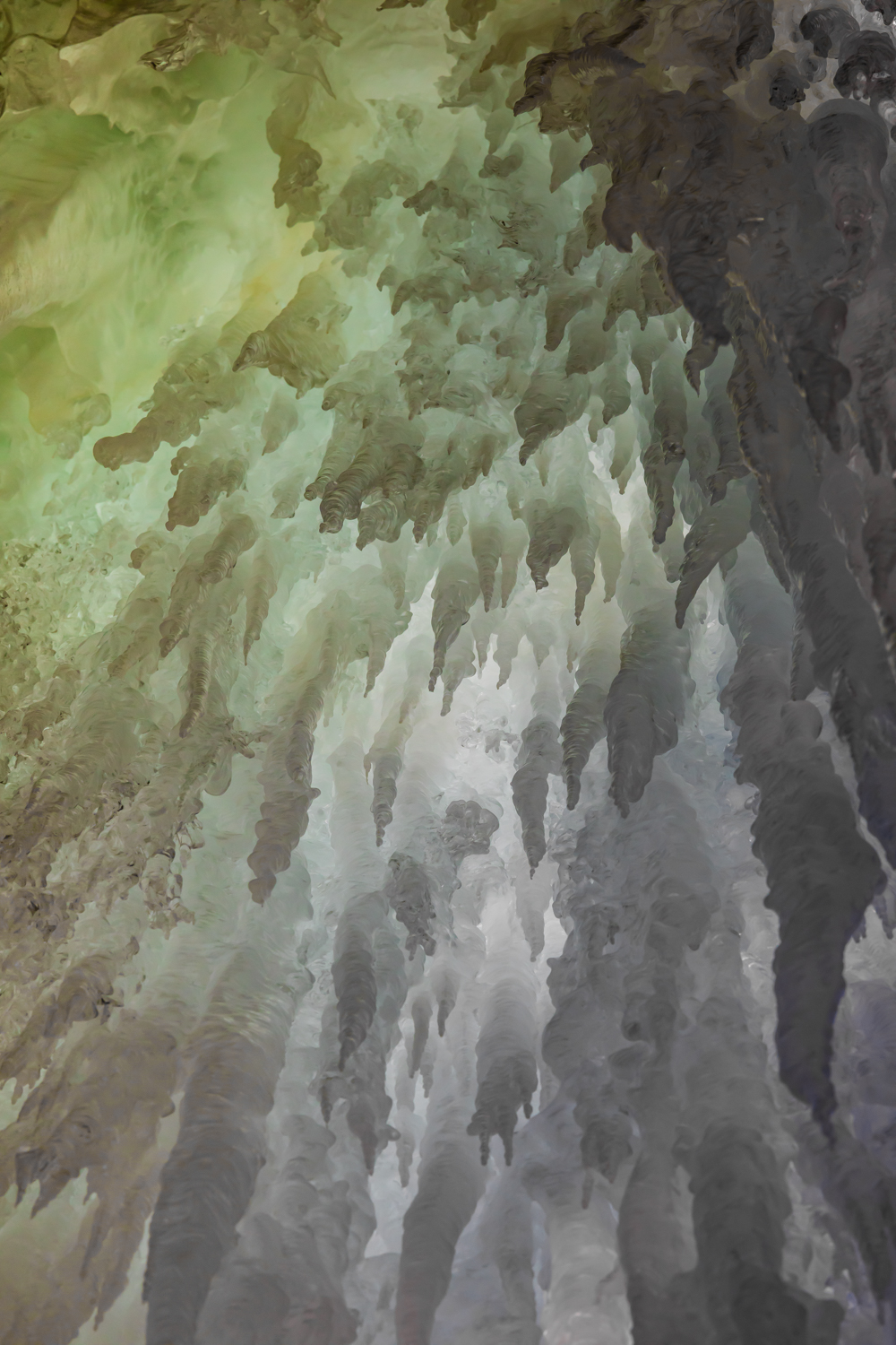
Thousands of years passed, blizzards howled over Iceland’s Katla Volcano in whiteouts that blocked out time and place. Uncountable snowflakes fell, dissolving the landscape. Immense compression squeezed the forming ice, forcing out air bubbles and creating a material of intense clarity and glacial plasticity. Gravity took over as the ice accumulated, and glacial ice flowed like a river that ignored time, down the volcano’s hidden ridges, scraping and sculpting the mountain, which was now hundreds of feet below the gleaming ice cap.
When we arrived at Kötlujökull glacier, a lobe of Mýrdalsjökull Glacier, we saw ice that was thousands upon thousands of years old. It ended abruptly at the glacial terminus, which was a sheer wall of ice over 100 feet high. Our small group entered a cave in the glacier, created by a flowing glacial stream and polished by air currents. These photographs represent the incredible sculpted and colored walls of the inner sanctum of the glacier.
Passage into an ice cave in Mýrdalsjökull Glacier on Katla VolcanoA melted vertical shaft, called a moulin or glacier mill, was the most dramatic feature of our ice cave tourAnother view looking straight up the moulin toward the sky; imagine trying to climb out, even with ice climbing equipment!Bands of scalloped ice in the moulin, with the different colors representing changing conditions when the ice formed and compressedPolished ice surfaces approaching the moulin openingIce fantasy fringed with icicles inside the ice caveWall of melting ice and icicles, reflecting the blue sky outsideThe highlight of our journey was entering a narrow cavern in the ice and following it into the glacier until we were blocked by a wall of ice. Here Karen Rentz is inside an ice cave channel, formed seasonally by running water, her headlamp and mine illuminating the iceThe ice channel curved and twisted through the glacierFanciful textures and patterns of ice, rich with glacial aquamarine coloringIcicles at entrance to the ice cave, with hardly a hint of what awaits withinThe glacial terminus, which we approached and then entered through a small openingKaren Rentz using rope and crampons to ascend to cave entranceAdventurers walking toward an ice cave entrance. If you go to Iceland and wish to explore an ice cave, make sure you spend the extra money and go on a small tour led by a leader driving a SuperJeep (the Icelandic name for any really rugged 4WD vehicle). Some bus tours pack people into a large cave along with hundreds of others, and the experience is that of a herd.Mýrdalssandur outwash plain looking out from the ice cave entrance, Hafursey Mountain. This is where part of Rogue One: A Star Wars Story was filmed.Dramatic entrance to an ice cave in a lobe of Mýrdalsjökull Glacier
We visited Iceland in March of 2018, with the intent of seeing the Aurora Borealis, which we did on three nights, and the South Coast, where these glacier pictures were taken. We also wanted to experience the Westfjords region in winter, which was also spectacular. We rented an all wheel drive Subaru so we could have more freedom of movement and spontaneity than a bus tour allows, and we stayed in modest AirBnBs to keep down the costs. Except for a couple of meals at restaurants, we ate simply, buying from small grocery stores (and Costco!). Our biggest splurges were for two guided ice cave tours, in which a driver and guide using a SuperJeep 4wd vehicle takes visitors to really spectacular places that would otherwise not be accessible. Well worth it!
Most of my work is available as prints on metal or cotton rag paper. To see a large selection of my work go to leerentz.com.