A journal of the thoughts, pictures, and adventures of photographer and writer Lee H. Rentz. Inspired by nature, with a passion for ideas both visual and literary.
Spring Peeper, Pseudacris crucifer, male peeping during spring mating season
Spring is nature’s most joyous time to be a naturalist in northern latitudes as the world awakens from its long winter sleep. Near our Michigan home, Amish farmers are out in early March, when they begin to collect Sugar Maple sap from the awakening trees, and they use horse-drawn plows to prepare the earth for planting. Wave after wave of birds arrive from the southland, from Sandhill Cranes to Baltimore Orioles and hundreds more. The land awakens with spring wildflowers before the trees leaf out. The first insects appear, including Mourning Cloak butterflies that have overwintered under bark or leaves, and the Common Green Darner that has migrated up from the south. These are all great stories for a naturalist, but there is also a chorus that, to me, signifies that spring is here.
Video of Spring Peeper calling next to the pond
When night time air temperature rises into the range of about 35 to 40 degrees Fahrenheit, each little pool in the forest comes alive with the songs of Northern Spring Peepers. These tiny chorus frogs, each about the size of a thumbnail, peep together around the shores of a permanent or temporary pond–one that has no fish as predators. These are all male frogs trying fervently to attract mates. The calls begin shortly after sunset and end in the early morning hours, before the first traces of dawn light bring predators in the form of birds to the ponds.
Where I live in the middle of Michigan’s mitten, there are numerous little glacial kettle ponds, left as chunks of ice by the last ice age. When the ice melted, it left a depression filled with water, with high banks surrounding the new pond. These ponds are too small to support fish but are just right for Midland Painted Turtles, Common Eastern Toads, and Northern Spring Peepers. I set out on two nights to figure out how to see and photograph the peepers and I chose a pond that I could have easy access to. On the first night, the peepers were calling loudly when my nephew and I slip-slided down the steep hill leading down to the kettle lake. The frogs heard us coming and immediately became deathly quiet. We patiently waited without moving, and the peeps gradually slipped from stealth mode and awakened the heavens again with joyous noise. I spent a long time looking for the source of the calls, and finally found one little peeper calling from under the overhang of a fallen oak leaf right next to the pond. I was only able to get one photograph with a macro lens, a large bulky lens next to these tiny creatures. It was the opposite of stealth.
The setting: a small glacial kettle pond in the forest
Two nights later, I returned to the same pond, this time with my wife, Karen, and with the plan of using a snout wide-angle macro lens, which is about 18” long and only 5/8” in diameter at the lens end, which meant my face could be farther away from the peepers and I could approach them with stealth and cunning, or at least my version of stealth and cunning, which is usually clumsy and loud.
We were quieter in approaching the pond than on my previous expedition, so the peeps barely interrupted their chorus of desire upon our approach, despite our use of bright flashlights. I showed Karen where I expected to see the frogs based upon my previous night’s work, but that proved to be fruitless, or frogless. In searching around a patch of shoreline where a peeper was loudly calling, we just couldn’t find it on the forest floor. But then I happened to see movement about 18” off the ground, and it was a Spring Peeper calling while clinging to the dry stalk of a wild perennial left over from last fall. Its little vocal sac was expanding with each call–so incredibly exciting to see in real life!
Spring Peeper male calling using air sac at throat [photo shows how sac expands]Spring Peeper male vocalizing from its perch on an oak leaf
So I set up my snout lens on a tripod and approached to within about an inch of the calling frog. Meanwhile, Karen used a dive light–a powerful LED flashlight meant for deep dives in the ocean–to light the frog. Somehow, it didn’t mind the light too much and I was able to get hundreds of close-up photographs and videos of this frog and two of its nearby rivals in some of the most exciting hours I’ve ever spent (and, yes, I am truly a boring person). If you ever have the chance to experience the sounds of Spring Peepers while standing among them, don’t miss the opportunity!
MORE DETAILS ABOUT THE LIVES OF SPRING PEEPERS
The Spring Peepers calling in a chorus around a pond are all males, trying desperately to attract mates. Presumably the biggest and loudest male wins the wooing contest, allowing them to mate with the quiet and choosy females. After mating, the female lays eggs in the little pond. Tadpoles are the hoped-for result, and the cycle of life continues.
Spring Peepers are the color of leaf litter on the forest floor: tan or brown or green. Hence they can remain disguised. The second word of their scientific name, Pseudacris crucifer, refers to the large dark cross on the back of each frog. I believe this is part of the camouflage, which breaks up the otherwise uniform color and looks like the veins of a leaf.
A Spring Peeper looks a bit like a dried leaf on the forest floor; the cross marking on the back and other markings on the legs break up the color, making it look more like fallen leaves
These are tiny creatures. In fact, were you so inclined, you could mail seven of them in a one ounce first-class mail envelope, though the USPS and peeps wouldn’t be very happy.
Spring Peepers are tiny in comparison with the loudness of their group
Peepers go into suspended animation all winter, spending the long, cold months hiding behind a flap of bark on a tree or under a fallen log or under the leaf litter on the ground. Their bodies can survive freezing down to about a 17 degree Fahrenheit body temperature because of glucose and other chemicals in the blood that act as antifreeze.
To get these pictures, I used a long Laowa Macro Probe lens with a strong dive light
To make their calls, the males take air into their lungs, then close off their nostrils and mouths. As air is forced from the lungs by muscles, it passes over vocal cords and into the inflated air sac, creating the sound variously described as peeping, chirping, or sleigh bells. The sound is loud enough to prevent sleeping for some people, and is a shimmering shower of sound when it surrounds us next to a pond.
The slightly bulbous toe pads are designed to stick to wet or dry vegetation to facilitate climbingJust to the right of this calling Peeper is the warty leg of a much larger Eastern American Toad
A typical male peeper can make up to 13,500 calls per night, though I didn’t do the math and am depending upon scientists for this factoid.
And the most astounding fact of all: a group of Spring Peepers around a pond is referred to an an “army.” A noisy and tiny army, but an army nonetheless.
Video of the calling Spring Peeper right next to the Toad
The photographs below include other inhabitants of this pond: an Eastern American Toad showing off the gold flecks in his eye; Midland Painted Turtles basking on logs; a few more Spring Peepers; and a view of tree reflections on part of the pond. Click on each to make it larger.
Each winter temporary ice formations form along the orange sandstone cliffs of Pictured Rocks National Lakeshore in Michigan’s Upper Peninsula. Wherever a tiny stream cascades over a cliff, or where water oozes through porous stone, ice forms upon hitting the frigid temperatures of a Lake Superior winter. These formations are reliable enough to have descriptive names given by the ice climbers who return each winter to test their skills on the frozen columns.
I have photographed the formations over several winters, but the winter of 2023 was my favorite because Karen (my wife) and I experimented with backlighting the ice at twilight and at night to give a sense of the color and translucency of the beautiful formations. I find the natural artistry of the ice as stunning as the sandstone formations of the Utah desert, but these are ephemeral and have to recreate themselves each winter. What an experience!
Ice climbing on Curtainsat sunseKaren Rentz at Amphitheater ice formation, with ice daggers overheadAmphitheater ice formationDetails of ice formations in Pictured Rocks National LakeshoreCurtains ice formation lighted by us at nightCurtains ice formation at the end of a winter dayTwo views of naturally sculpted ice behind the CurtainsBehind the Curtains ice formation, lit by the photographer’s lights and by the twilight outsideIce Daggers of the Amphitheater formationCurtains ice formation lighted at nightIce climbing on Curtains; note the ice tools, rope, helmet, and cramponsNorthern White Cedar twigs encased in ice in the Curtains ice formationBehind the Curtains ice formation with blue twilight coloring the translucent iceDetails of Curtains ice formation lighted at night; the round bubble-like shapes are created by water drops melting from the ice column aboveLate afternoon light on the Amphitheater ice formationSculptural details of the Curtains ice formation lighted at nightKaren Rentz at Amphitheater ice formation: the ice columns emerge from seeps in the sandstoneKaren Rentz exploring behind the Curtains ice formationBehind the Curtains ice formation, the translucent ice is reminiscent of a bridal veilFront view of Amphitheater ice formation named for the shape of the alcove in the cliffsDetails of Curtains ice formation; note how the ice takes different shapesDetails of Curtains ice formation lighted at nightAmphitheater ice formation used by ice climbers in Pictured Rocks National LakeshoreIcicle details of the Curtains ice formationDagger icicle details of the Amphitheater ice formation
Pictured Rocks National Lakeshore is located along Lake Superior in Michigan’s Upper Peninsula. Its namesake cliffs are miles long and make for great adventures all year, whether kayaking, backpacking, day hiking, snowmobiling, snowshoeing, cross-country skiing, or taking a guided cruise past the cliffs at sunset.
When we go in winter, we wear Kahtoola MICROspikes when navigating sheer ice at the ice formations, and we watched many people trying to stay upright when they walked in regular snow boots. Wear them! We also take snowshoes in case there has been a fresh snowfall and the trails are buried in deep fluff, though the short trails from Sand Point Road are often packed down by climbers. We also take cross-country skis to use on the nearby groomed trails. When venturing out in winter, we always wear insulated boots, and dress in layers of merino wool long underwear, waterproof snow/rain pants, and down, fleece, and a Gore-Tex shell. Mittens are essential, and chemical handwarmers can help when it’s really cold out. Take high energy snacks. To us, navigating winter is far more rewarding than enduring the bugs of early summer in the Upper Peninsula; just be prepared.
Important information about Pictured Rocks National Lakeshore:
Loading freshly cut blocks of ice onto a horse-drawn sleigh at an Amish farm
Today was a gift from the universe.
I had an instinct that today (4 February 2023) could be the day when Amish farmers cut ice from their ponds to fill their icehouses after the cold snap of the last week, a warming weather trend ahead, and tomorrow the sabbath. We drove out into the Amish community this morning, and almost immediately saw a freight wagon loaded with ice. We drove on, and found another farm where wagons were lined up in front of a pond, where men wearing straw hats were cutting ice.
We parked at a respectful distance, watching and discretely photographing for about an hour. Then an Amish man came walking up to where we were parked along the road. He was a young man and kindly asked if we had ever seen Amish ice cutting before. We said “only at a distance,” and he invited us to come down closer to see it. I asked if it was okay if I took pictures, and he said “Yes. Just not too close.”
So we went down near to where ten men and teen boys worked as a team to cut the ice with a gas-powered circular saw and load six sleighs and wagons, each drawn by two draft horses. Assorted young boys all wearing matching dark knit hats and a dog completed the perfect rural scene.
We got to talking with the young man and his little brother, and he invited us to have a meal with them. So we sat down for a noontime dinner with the father, mother, 11 of their 13 children, and a couple of young men from a nearby farm. After a hearty meal, they went back to ice cutting and me to my pictures. Magic happens.
As I said, a gift from the universe to two shy people.
Amish men cutting and moving floating blocks of ice to conveyor liftCutting ice with a large circular saw blade
Notes from our conversations with an Amish family:
Since most English (the word used by the Amish for non-Amish people like us) know little about the Amish, I will tell you about our discussions with this kind and generous family. My wife Karen and I talked to the farmer and his wife, as well as with some of their sons, both before and during the meal, learning a bit about their lives. They have 13 children, of whom 11 still live at home. The other two are the older adult children, both married, with the son living on a small farm in an Amish community in Illinois and the daughter at a farm nearby. The children were spaced quite regularly in age, with the youngest son being two. Of their children, nine were boys and four girls. The eldest daughter still living at home now teaches at an Amish one-room schoolhouse eight miles from their house.
The Amish have not been here for as long as they’ve been in Pennsylvania. My parents moved to the area in 1980, when they built the house that we now own. A couple of years after they moved in, one of their friends said that Amish were starting to buy up the surrounding farms, and that the land was about to blossom with new activity and a flourishing of crops. The farmer in my story moved here when he was a boy, in that first wave of Amish. He said that the price of the land was good. The families here have done well, with what appear to be prosperous and beautiful farms.
Amish men moving floating blocks of ice to conveyor belt liftUsing ice tongs to move blocks onto sleighA full load heading to the icehouse
The family has an extensive summer garden, where last year they planted and harvested over five acres of pumpkins and winter squash. Some of their crops are sold at a local open-air produce auction, which we’ve driven past at times when it wasn’t open. It is like a farmer’s market, open only prescribed days each month. At this time of year firewood and hay are for sale, but in summer and fall there would be a wonderful variety of produce and flowers. I remember last year seeing a horse-drawn farm wagon with clear plastic sheeting forming a greenhouse structure over the wagon. Inside there were colorful hanging baskets of flowers protected from wind by the plastic. I think the flowers were headed to the farm auction. Here is an article about this particular auction facility: Stanwood Produce Auction
The young man who initially invited us down to see the ice cutting is 18 years old, friendly, and personable. He talked about the economics of the farm. They have a sawmill, as many of the local Amish farmers do, where loggers bring loads of softwood logs. The farmer brings the logs one by one into the mill, where they are sawn into 2×4’s and other dimensional lumber that is sold to a pallet maker south of Grand Rapids; that factory is perhaps 80 miles away, so the wood has to be transported by truck to the buyer. I’m sure the sawmill is a major source of income for the family. I mentioned that there has been a great increase in the number of Amish farms in our area with sawmills and wondered about the competition. The father said that so far it wasn’t a problem, that there was enough demand and that some of the sawmills were for softwood and others for hardwood. I think they also have a maple sugaring operation, as do many of the local families.
Loading blocks of ice onto a freight wagon to take down the road to another farmStopping to chat
The farmer would also grow corn and hay for feeding the livestock. In early spring he would use a horse-drawn plow (on local farms we’ve seen up to six draft horses pulling a plow!). Horses would also be used in the harvest of hay, with freight wagons piled incredibly high with freshly dried hay.
The farm has ten cows for milking, which has to be done twice each day. In fact, the purpose of this family’s ice harvesting is to build a store of ice that can be used the rest of the year to keep the milk cold. The milk is sold to nearby people who come by once a week to pick up a gallon as part of a farm share program.
We asked the son if Amish had to get jobs to make ends meet. He said that in the last few years the economics of farming alone don’t work, so it is common to have to get a job outside the community. In the local Amish community, all the farms have a small business of some sort: making rustic furniture, creating poly-wood furniture, repairing clocks, caning chairs, butchering cows, making rugs, selling eggs, making boat covers, and probably a dozen more crafts that bring in money.
The day looked like fun for all involved, especially the young boys looking on
On our visit there were two families working together to cut ice to fill two icehouses. The patriarch of the host farm operated the gasoline-powered circular saw used to cut the ice. This year the ice was only about six inches thick; more commonly it has been eight or up to twelve inches thick, so it would be harder to heft those blocks. The ice cutting machine is homemade, with a long lever used to raise and lower the spinning blade. He cut the pond ice almost all the way through, stopping about 1/2” short of cutting through. Then another man used a long steel pole to break off the blocks. A heavy rope stretched across the pond was used by two workers to move the floating blocks of ice to where the loading conveyor belt was located at one end of the pond. Then the men used pitchforks to prod the blocks onto the conveyer, which is also their hay lifter, powered by a gasoline motor. The Amish use some modern assistance when they deem it appropriate.
The family that owns the ice pond uses horse-drawn sleighs to transport blocks of ice to their icehouse, while young men from the farm down the road used horse-drawn freight wagons. We counted a total of six sleighs and wagons, each pulled by a team of two massive draft horses. They took turns at the conveyor machine that was lifting ice from the pond. Once one vehicle was filled with a layer of ice, the driver would quickly move it away. Another was already lined up to move into position, with the driver sometimes using the team of horses to back up the wagon to the loading chute. Managing horses to back up this way is an incredible skill and they do far better than I do trying to back up a trailer with a car! Most of the sleighs and wagons were drawn by two Belgian horses, the predominant breed in our area, which are usually chestnut-colored with blond manes. A few of the wagons were drawn by black Percheron horses. We were told that the white horse in one team was actually a Percheron, born black and then it had turned pure white.
The massive Belgian horses make great teams for hauling ice and plowing land
One young boy named Neil enjoyed talking to us and telling us about his life on the farm. He asked if we had a farm, and we had to answer no, but that it looked like a lot of fun to live on a farm. He was in the fourth grade at school; I asked him what his favorite subject was and after thinking for a moment, he said “reading.” He said they were reading a book by Laura Ingalls Wilder called “Little House in the Big Woods.” He said that sometimes the teacher reads and that the children also take turns reading. He said that another grade level reads “Farmer Boy,” another Wilder book that I told him I had read as a boy. It has been many years since I read it, but I remembered that I first learned about tapping maple trees from that book. I needed a refresher about the story, so here is what Wikipedia says about Farmer Boy:
“The novel is based on the childhood of Wilder’s husband, Almanzo Wilder, who grew up in the 1860s near the town of Malone, New York. It covers roughly one year of his life, beginning just before his ninth birthday and describes a full year of farming. It describes in detail the endless chores involved in running the Wilder family farm, all without powered vehicles or electricity. Young as he is, Almanzo rises before 5 am every day to milk cows and feed stock. In the growing season, he plants and tends crops; in winter, he hauls logs, helps fill the ice house, trains a team of young oxen, and sometimes — when his father can spare him — goes to school.”
This sounds exactly like the life of young Neil: no wonder he loves the Laura Ingalls Wilder books!
I asked Neil if he milks the ten cows, and he said he was still too little for that, but that he feeds their five calves and many chickens each day. He also collects the eggs daily from two chicken coups. I asked him how many eggs: he was unsure of the numbers, but maybe 30-50 from each coup (he said the total was never 100). He pointed out the pony they had gotten and was very fond of it. We asked if they name their animals and he said “no” and he laughed; that seemed like a strange idea to him. He was really glad that this year ice cutting was on a Saturday when he wouldn’t be at school, so he could watch and be part of it. He recalled when they had a backhoe come in to dig the large bowl-shaped pond for the ice. Later we saw him riding on an ice sleigh, and it looked like it would be a day of heaven for a ten year old! Neil has an infectious smile and enjoyed telling us about his life.
With six sleighs and wagons, there was always a wait to get to the loading areaThis scene could have been from 150 years ago
My dear readers, you must be wondering what it’s like to be inside an Amish house; I know we have been curious for years. We finally got our chance when we were invited in for noon dinner. We drove into their driveway and were shy about knocking on the door, in case the Amish wife hadn’t been told of our arrival. After a moment, she appeared at the door with a small son and I walked up to say hello. She said “Will you be joining us for dinner?” So of course I said “yes.”
We went inside, and she escorted us from the entry room, through the dining room/kitchen, to the living room. The living room had a wood-burning stove and the dining table/kitchen area was warmed by the cook stove. The openings between the rooms were large, giving the feel of one big room and also helping to provide even heat to the first floor. We believe that the large room is also used for community church services, but on some farms they use the barn instead of the house. The Amish don’t have a church to go to; instead, they take turns holding services for the nearby community. Every two weeks the community holds Sunday services; each farm hosts for two Sundays, then they rotate to another farm. This family was going to host church services at their home the next day. We have seen Sundays when a farmyard is filled with buggies, perhaps 20 to 30 at a time. Recently we saw children walking home from church, the girls in their black woolen coats, white aprons, and black bonnets, and the boys dressed formally as well.
The Amish house where we had our noontime dinner is in the distance
There is no electricity in an Amish home, so natural light during the day and oil or gas lamps at night are the sources of illumination. No televisions or computers, of course. And no plush furniture. Around the perimeter of the living room were wooden rocking chairs, which is where Karen and I sat while waiting for the meal. The youngest boys sat lined up on rocking chairs along one wall, reading long hand-written letters. I didn’t ask who the letters were from, but I could imagine that they could be from the family of their brother who had moved to Illinois and other distant relatives. And, unlike most English children today, they had no problem reading the letters written neatly in cursive!
The house was a comfortable temperature. The lady of the house said she is fortunate that her husband has a sawmill, because there is always plenty of wood to keep their home warm. They cooked on a huge old cast iron wood-burning stove, which also helped heat the house.
There were no family portraits or pictures on the walls, since the Amish don’t wish to have recognizable pictures of themselves, instead believing that humility is to be honored, and individuality and pride are harmful to the community. They follow the Biblical commandment “Though shalt not make unto thyself a graven image.” I took pictures after getting permission from one man and nobody seemed to object, but I was careful to photograph the activity and not the individual. No portraits.
After a few minutes, the Amish wife told us it was time for the meal and indicated two places where we could sit. As you might imagine from the size of the family, the long rectangular table was huge; I think there were 13 of us sitting around it, with the father at the head of the table. Three daughters remained in the kitchen and served the food. When everyone was seated, the Amish father bowed his head; everyone took his cue and bowed their heads as well and all thought a silent prayer for about a minute. Following that, bowls of food were passed.
Dinner was hearty; after all, the men working outside had been cutting and hauling ice, hitching and unhitching teams of huge horses, and lifting heavy blocks of ice into and out of wagons. They were hungry! There were two sets of bowls serving each of the foods because the table was so large. The young men took huge helpings of mashed potatoes and gravy. The meat entree was excellent meatballs and sauce (Karen had to poke me for initially trying to take three meatballs when she noticed that everyone else took two!). There was a bowl of mixed vegetables, a smaller bowl of cabbage salad, and a plate of sliced cheese. After everyone had their fill, two desserts were passed: a chocolate pudding pie and an apple dish that might have been apple crisp. The oldest daughter was the baker.
The young Amish men were curious about our Washington license plates, and we told them we live there most of the year. They asked about Washington state and had heard that part of the state got considerable rain. They wondered why rain and not snow, since it was about the same latitude as Michigan and they seemed to understand when we explained how the influence of the warmer ocean moderates the temperature.
The family enjoyed hearing our story from several years ago of driving an icy road and coming upon a wagon loaded with ice blocks off the road in a ditch. I stopped and asked if I could help. The young man asked me how many horse power I had under the hood of my Subaru and we all laughed. They had another team of horses on the way to help.
They wanted to know where we lived locally and what we did during the day, though what we do is less interesting than what they do! We were at a bit of a loss as to what to say we do, as it didn’t seem appropriate to tell them how much time we spend with our computers or watching television. We asked a lot of questions about their lives and they were pleased to answer. Nice people. I noticed that the school-age children said virtually nothing during the meal (perhaps something about being seen and not heard!). They also all noisily completely cleaned their plates with the sharp sound of silverware striking china. No food was wasted.
After dinner, all bowed their heads again to thank God for the meal. Then everyone disappeared to complete their ice cutting tasks, with the women and girls staying inside to clean up after the meal. In Amish life the roles of men and women are well defined and traditional.
The men had to gather up the horses, who had also been given a break from the harness to feed on hay in the barn, so they all had to be reattached to their sleighs and wagons. We said our thank-yous and goodbyes, pulled on our boots, and went back to our car. I took a few more pictures–actually, the best of the day–and we took our leave. It was an extraordinary experience for us, and it felt like the family enjoyed talking with us, letting us into each other’s lives for a few hours. I bow my head in grace for the time we spent among the Amish.
A day’s work well done, with all enjoying the experience
This article was completed with the kind help of my wife Karen, who contributed immensely to the memories, writing, and editing. To see many of the photographs I’ve taken over a lifetime, go to leerentz.com
We give our lives meaning and weight by the stories we remember. This has become more difficult with scattered families and friends, and with the blizzard of media that is available every waking second. It has become hard to hear ourselves think and to remember that we have stories to tell that make up the fabric of our lives.
One of the few places of respite is hiking, where the mind is able to focus outward instead of re-exploring the details of frustrating work lives and relationships and politics. Even better is to spend time living in a fire lookout, where the focus is on looking at the vast panorama visible from a peak. Working as a professional lookout is a scarce job these days, but there are opportunities to visit lookouts. There are lookouts that people can rent just to enjoy the sensations of observation and isolation. There are also lookouts where people can volunteer to spend days looking for smokes and greeting hikers. Either opportunity gives people time to experience the solitude and wonder of being in a place apart.
Twilight at Evergreen Mountain Lookout
When we rented the Evergreen Mountain Lookout in August of 2022, we experienced the quiet and intimate setting we so desired. Life was simple there for two nights, with watching the stars and clouds, and waking up to the lookout hidden deep within fog. It was wondrous.
But we weren’t the only ones to have a profound experience here. In looking at the visitor register kept in the lookout, we found that people often wrote poetic passages about their experience with nature in this place. I transcribed some of them here, without names so privacy can be assured, to show how the solitude of an individual or the intimate experience of a small group can be so enthralling.
5 October 2006 “Dinner of steak, rice, and broccoli about 9 p.m. then to bed. By this time the wind was blowing hard. The shutters along the south side of the lookout were bouncing loudly, making a grating noise. Cold out and it was seeking a way inside through every small crack so we tore a towel in strips and chinked the larger cracks. Settle in around 10 p.m. hoping for some sleep. Extremely strong winds blasted the lookout around 1:30 a.m. and the center support holding the shutters on the south side gave way. The heavy shutters bounced wildly. We worried that all the shutters would fall in and smash the glass down upon us. We got up and placed a tarp and air mattress across the inside of the glass and tried to settle down. Sleep was almost impossible. Sunrise was around 6:30 and we rose to clear, very cold skies. The wind had not abated and the shutters still bounce in the daylight. We saw that the center support had thrown its top bolt and we were able to replace it. The wind keeps blowing. Two hawks are braving the wind and hunting in the southern meadow. Wind somewhat easier at noon. Time for a last walk east along the ridge and then out.”
18 September 2009 “Came up to fix a few things reported broken. Unfortunately it was worse than reported. Locks and windows broken, garbage and stuff everywhere. So sad. But we did what we could so hopefully it will last. Weather was absolutely perfect! Could not have been better. No fog, not too hot, cool wind constantly blowing. The sky was so clear we could see forever in every direction. I can’t believe how many peaks there are! Thanks so much for allowing me to come up here. It was a perfect trip. And please, please show respect for this place and take care of it.”
9 August 2013 “Lightning and thunder started in the south at about 10:30 p.m. By 12 a.m. all of us were awake from the wind and by about 1:30 a.m. the storm was right above us and lasted until about 3:30 a.m. when the wind picked up again. Very beautiful and terrifying. A once in a lifetime experience.”
Visitor register for making comments about the experience on Evergreen Mountain Lookout
2 October 2017 “This is my third time at the lookout, but the first time without human companions. Just me and the dog, seeking solitude and some healing after a death in the family. I woke up to a stunning sunrise, mountain peaks visible all around but a magical cloud cover down below. Cold though! Icicles on the lookout–glad I had the dog to keep me warm through the night. Although not healed, the mountains and solo time did me good. Focus on enduring beauty, on the things that knock us breathless and senseless. This helps.”
13 August 2018 “The red sun sits still in the haze of smoke, like an ember burning in a sea of ashes. It is hot outside. The world sits and waits as the earth is changed forever by fire. Brave men and women will risk lives to stop the fire, but we didn’t start it. We have only accelerated this changing world. Water is as pure as gold. Nature is more pure than the love that many have for it. Love and kindness will save the world from fire.”
15 August 2018 “A beautiful smoky day of repairs at the ol’ fire lookout. Met a wonderful woman hiker who used to live in this very lookout almost 40 years ago! The magic of this place is still alive and well!”
15 August 2018 “Smoky. Still a lovely hike, tho seems a lot harder than in the summer of 1976, when I was the lookout here.”
5 September 2018 “Simply beautiful up here. Mountains in every direction, too many to name. Wonderful artwork of nature. Had fun picking huckleberries. Wish we would have stayed the night. Next time. Our 3rd anniversary activity of choice.”
16 September 2018 “A rainy, snowy, cloudy trip and we couldn’t ask for anything more. Had a fantastic time hanging out in the cabin watching the weather. Can’t wait to come back and do it again.”
Stories written in the vistor register
10 August 2019 “On this day 5 years ago I stayed overnight in 3 Fingers [another lookout]. After going home on the 10th I had a heart attack. Was great to be able to spend the night and celebrate life. If you go to 3 Fingers check out the lightning stool I made for my first year anniversary of the heart attack!”
11 August 2019 “It felt like something out of a storybook to hike up and up into the clouds where you couldn’t see thirty feet ahead or behind you. Wildflowers that I thought I wouldn’t see again this late in the year bloomed along the trailside. It was magical finally seeing the lookout appear out of the mist. Then to wake up surrounded by it just makes me feel like I’m in another world.”
Interior of Evergreen Mountain Lookout
Hikers are not the only people who have found the fire lookout to be an inspiring muse. There is a long tradition of writers who have spent summers working for the U.S. Forest Service and National Park Service perched in their mountaintop retreats, looking for smokes while simultaneously thinking and taking notes and working on poems and novels. Without a boss looking over their shoulders, the thoughts could rise from the depths like columns of smoke on a distant ridge.
Gary Snyder, a poet who has written a lifetime of poems of depth, infused with Zen Buddhism and nature, watched the landscape atop Sourdough Mountain Lookout in the North Cascades of Washington in the summer of 1953. His meditative book Riprap and Cold Mountain Poems begins with this gem from that time:
Mid-August at Sourdough Mountain Lookout
“Down valley a smoke haze Three days heat, after five days rain Pitch glows on the fir-cones Across rocks and meadows Swarms of new flies.
I cannot remember things I once read A few friends, but they are in cities. Drinking cold snow-water from a tin cup Looking down for miles Through high still air.“
Decades later Tim McNulty, a writer from the Olympic Peninsula, also stayed in Sourdough Mountain Lookout for a season. He found it a profound experience, and wrote evocative poems about his time there. These are included in his book of poetry called Ascendence; here is a wonderful excerpt from one poem
Night, Sourdough Mountain Lookout
“I light a candle with the coming dark. Its reflection in the window glass flickers over mountains and shadowed valleys seventeen miles north to Canada.
Not another light.
The lookout is a dim star anchored to a rib of the planet like a skiff to a shoal in a wheeling sea of stars.
Night sky at full flood.
Wildly awake.“
Smoke from Irving Peak and White River Fires (2022) viewed from Evergreen Mountain Lookout
Jack Kerouac, writer of the cultural phenomenon On the Road, a vibrating-with-life contrast to the staid and conforming 1950s and early 1960s, worked on Washington’s Desolation Peak Lookout in 1956, a time that inspired some of his work on the books Desolation Angels, The Dharma Bums, and Lonesome Traveler.
“Thinking of the stars night after night I begin to realize ‘The stars are words’ and all the innumerable worlds in the Milky Way are words, and so is this world too. And I realize that no matter where I am, whether in a little room full of thought, or in this endless universe of stars and mountains, it’s all in my mind.” fromLonesome Traveler
Twilight at Evergreen Mountain Lookout
Norman Maclean worked on Elk Summit Lookout in Idaho, and later went on to pen Young Men and Fire and A River Runs Through It and Other Stories. These stories captured tragedies in the American West where he made his home.
“In the late afternoon, of course, the mountains meant all business for the lookouts. The big winds were veering from the valleys toward the peaks, and smoke from little fires that had been secretly burning for several days might show up for the first time. New fires sprang out of thunder before it sounded. By three-thirty or four, the lightning would be flexing itself on the distant ridges like a fancy prizefighter, skipping sideways, ducking, showing off but not hitting anything. But four-thirty or five, it was another game. You could feel the difference in the air that had become hard to breath. The lightning now came walking into you, delivering short smashing punches.” from A River Runs Through it and Other Stories
Historic Evergreen Mountain Lookout in sunset light
Edward Abbey wrote Desert Solitaire: A Season in the Wilderness which became one of my personal guiding lights since the time I first read it as a college freshman over 50 years ago. Abbey writes of his adventures in the old days of Moab, Utah, before it became a recreation mecca. Abbey’s book helped turn Moab into the “industrial tourism” machine that he detested, but I’ll save that rant for another time. Abbey needed to make ends meet, like all of us, so he worked at the Bright Angel Point Lookout on the North Rim of the Grand Canyon for four seasons, where he stationed his typewriter near the Osborne Fire Finder.
“Wilderness is not a luxury but a necessity of the human spirit, and as vital to our lives as water and good bread. A civilization which destroys what little remains of the wild, the spare, the original, is cutting itself off from its origins and betraying the principle of civilization itself.”
“No more cars in national parks. Let the people walk. Or ride horses, bicycles, mules, wild pigs–anything–but keep the automobiles and the motorcycles and all their motorized relatives out. We have agreed not to drive our automobiles into cathedrals, concert halls, art museums, legislative assemblies, private bedrooms and the other sanctums of our culture; we should treat our national parks with the same deference, for they, too, are holy places.” both quotes from Desert Solitaire
Mountain Hemlocks above low clouds at twilight
Fire lookouts, and hikes, and long bike rides, and long road trips: times and places that are apart from the rest of life. Places and times to think deeply, to breathe in the subterranean thoughts swirling up from our brains and the soil and the landscape.
Karen and I have encountered Black and Grizzly Bears occasionally, and these sometimes make for memorable stories. Here are five adventures that we can’t possibly forget, along with assorted bear photographs I’ve taken in recent years.
American Black Bear feeding on Gray’s Lovage in July, Mount Rainier National Park in Washington State
WATCHING BEARS AT THE DUMP
Copper Harbor on Michigan’s Keweenaw Peninsula, circa 1959
My family used to take camping vacations to state parks back in the 1950s and 1960s. Of those, Fort Wilkins State Park at the tip of Michigan’s Keweenaw Peninsula, which sticks up like a long curved finger into Lake Superior, was a favorite. This was an early army outpost established in 1844 to keep order during a copper boom in the region, and there were cannons and a fort that excited the small boy in me.
But the coolest thing we did as a family there was to drive the ’57 Chevrolet station wagon to the dump and wait until dark, lined up with all the other classic Detroit cars. At deep dusk the bears arrived one by one, until there were five. They poked their snouts into the fresh garbage and turned over cardboard boxes with their powerful legs and claws, each working independently of the others. I remember one was a big cinnamon-colored bear, while the others had black hair. I’m sure the dump smell and flies were awful, but it was thrilling to see bears up close for the first time in my life.
Dumps used to be a special way for families to experience bears outside each small town in the Upper Peninsula. Those days are long gone, but those of us who experienced bears at the night dumps will never forget the adventure. Here is a sampling of memories of that time by many people: https://www.pasty.com/discuss/messages/313/617.html
American Black Bear traversing in an alpine meadow on Sahale Arm, North Cascades National ParkAmerican Black Bear foraging in a Ponderosa Pine forest near the ghost town of Garnet, Montana, USA
SLEEPING WITH A BEAR
1982 in the High Peaks of the Adirondacks
We were camped in a dense stand of Red Spruce high in the mountains. We knew that there were bears in the mountains, so we hung our food, but we didn’t have the mental acuity or experience to hang the food correctly in a tight grove of toothpick trees.
An hour later, in the tent, we heard a dreaded sound outside. I opened the zipper, and of course it was a big American Black Bear of the bad boy kind. I startled it by poking my head out the opening, and the bear responded by immediately climbing a tall spruce within five feet of our tent. So, it was a standoff, with me looking nervously up at the bear and it looking nervously down at me, occasionally clacking its teeth to warn me how fierce he was.
The standoff lasted all night. I had finally fallen asleep and didn’t wake up until we heard the sound of claws descending on bark. We quickly got dressed and I assumed the bear had skedaddled away, but instead it went directed to our hanging food bag. I think the bear had gotten into the food before coming close to the tent the night before, and the torn bag waving in the breeze and a pile of plastic bags below told the story. We finally chased the bear away, but we were short on food the rest of the weekend trip. My morning ration of instant coffee had bear saliva on its torn plastic container, and we never did find the peanut butter.
In the years since then we have learned to engineer a relatively bear-proof hanging bag under most circumstances, but it is often a challenge that most hikers don’t master, based upon most of the hanging food bags we see. Bear spray is also a good idea, though I don’t normally carry it in Black Bear country.
Grizzly Bear searching for food, accompanied by a scavenging Coyote, in Yellowstone National Park
FENDING OFF A BLACK BEAR WITH STONES
1989 in the Mount Baker Wilderness, Washington State
We left our rental car in the parking lot at the trail leading to Hannegan Pass to begin a backpacking adventure in North Cascades National Park. At the trailhead we had an unusual siting of a Black Bear wandering around, and in the trail register comments someone wrote “pesky bear!” We set out on our ten day backpack into lowering clouds.
We set up camp among blueberry bushes and conifers, cooked dinner and hung our food in two heavy bags from a tree branch, then retired to our tiny tent. The next morning, we got up and immediately found a Black Bear under our food hang, trying to get at it. I yelled at it and threw some stones to try and chase it away, and it left, But I had a feeling that it wasn’t done with harassing us, so I went to where I anticipated it might approach the bag next, and lo and behold, there it was! So I threw more stones, hoping to discourage it. After a couple more parries, the bear finally left us alone.
Later in the day however, as we were hiking, a bear descended a mountainside at an angle that would intersect with us, causing us to be really apprehensive about its intent. It came within 20 yards of us, and I suspect it was the same pesky bear, but we hiked beyond without incident. The rest of the trip was bear-free, but those first two days were more than a bit unnerving.
Tracks of Grizzly Bear 399, who was accompanied by her two cubs of that year in snow in Grand Teton National Park, Wyoming. She had been seen here five minutes before we came on the scene.
BEING BLUFF-CHARGED BY A BLACK BEAR
1991 in Enchanted Valley, Olympic National Park
We hiked the 13+ mile trail to Enchanted Valley on a spring day, early in the season when Red Alder leaves were emerging. It is a long hike but the setting in the valley was worth it, with waterfalls cascading off the gray cliffs. We set up camp and talked to a national park ranger about a murder mystery we were reading called The Dark Place, by Aaron Elkins, which was set in that very part of Olympic National Park. We hung our food from a tree, then soothed our hike-weary bodies in our warm sleeping bags.
The next morning we awoke to see a bear foraging in the hummocky gravel of the Quinault River’s flood plain. I went out with my camera on a tripod and got too close to the bear; I knew that when it bluff-charged me and I hurriedly backed up, even with my long telephoto lens.
Then the ranger came out of the old hotel building, converted to a ranger station, and also saw the bear. He thought it was an opportunity for a photo, just like I had. He was wearing a wife beater undershirt instead of his uniform at that early hour, and he also had a camera. Only his was a point-and-shoot camera without a telephoto, so he had to get much closer to the bear than I did. It then bluff-charged him! It was really funny to watch a ranger–who knew better–get so close to a bear!
Evidence of an American Black Bear feeding on the cambium of a Subalpine Fir using claws and teeth, in Mount Rainier National Park, Washington State
SURPRISING GRIZZLIES ON THE TRAIL
2010 Mount Assiniboine Provincial Park, British Columbia
We were high in the Canadian Rockies, staying in log huts with hobbit-height doors during a snowy September. This park is known for its Grizzly Bears, and we had to be careful about walking to the outhouse from the cabin. One morning we awoke to Grizzly tracks near the cabin, heading up a nearby trail we were going to walk later in the day. When we did the hike in a group, we came upon big rocks that the bear had turned over and dug around using the enormous strength in its front legs and claws (these huge muscles terminate in the hump on the back that is characteristic of this species). It had been searching for hibernating ground squirrels or marmots and could quickly dig them out of their winter chambers.
One morning our group rose well before the crack of dawn to walk a trail past Lake Magog and the Mount Assiniboine Lodge and into the trail system beyond. We had headlamps on because it was a dark, cloudy morning. The man ahead of me suddenly stopped and said “There is a big mammal in the trail just ahead.” We waited, and a Grizzly cub, hefty after a summer of ground squirrels and berries, crossed the trail. Then there was another, soon followed by mama. We had our bear spray unholstered and at the ready, and Karen began whistling three loud blasts with her whistle to alert another part of our group that had been late in getting started.
Fortunately nothing bad happened, even though we were in extremely close proximity to the mother and cubs. They left the trail area and moved off about two hundred yards, where the mama began furiously digging for ground squirrels, with the two cubs imitating her. She even stood up on her hind legs repeatedly to sniff the air; we think there was probably a big male–dangerous to her cubs–in the area, based upon a guy we met who was camping with his dog in the nearby campground. His bear encounters were scary enough that he rented a cabin for the next night.
Nothing like Grizzly encounters to set the heart racing!
Grizzly Bear mother standing on hind legs after scenting or hearing a possible threat to her cubs at Magog Lake, Mount Assiniboine Provincial Park, British Columbia, CanadaKaren Rentz showing the depth of a fresh hole dug by a Grizzly Bear into the burrow of a Columbia Ground Squirrel, on the border of Mount Assiniboine Provincial Park and Banff National Park, CanadaGrizzly Bear staring with menace at the photographer near Magog Lake, Mount Assiniboine Provincial ParkGrizzly Bear sow and cubs digging for Columbian Ground Squirrels near Magog Lake in Mount Assiniboine Provincial ParkAmerican Black Bear feeding on Gray’s Lovagein Mount Rainier National Park in Washington StateAmerican Black Bear feeding on Gray’s Lovage in Mount Rainier National Park in Washington State
You can see more of the work of photographer Lee Rentz at his website: leerentz.com
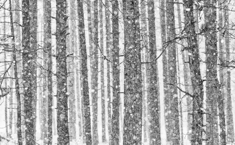
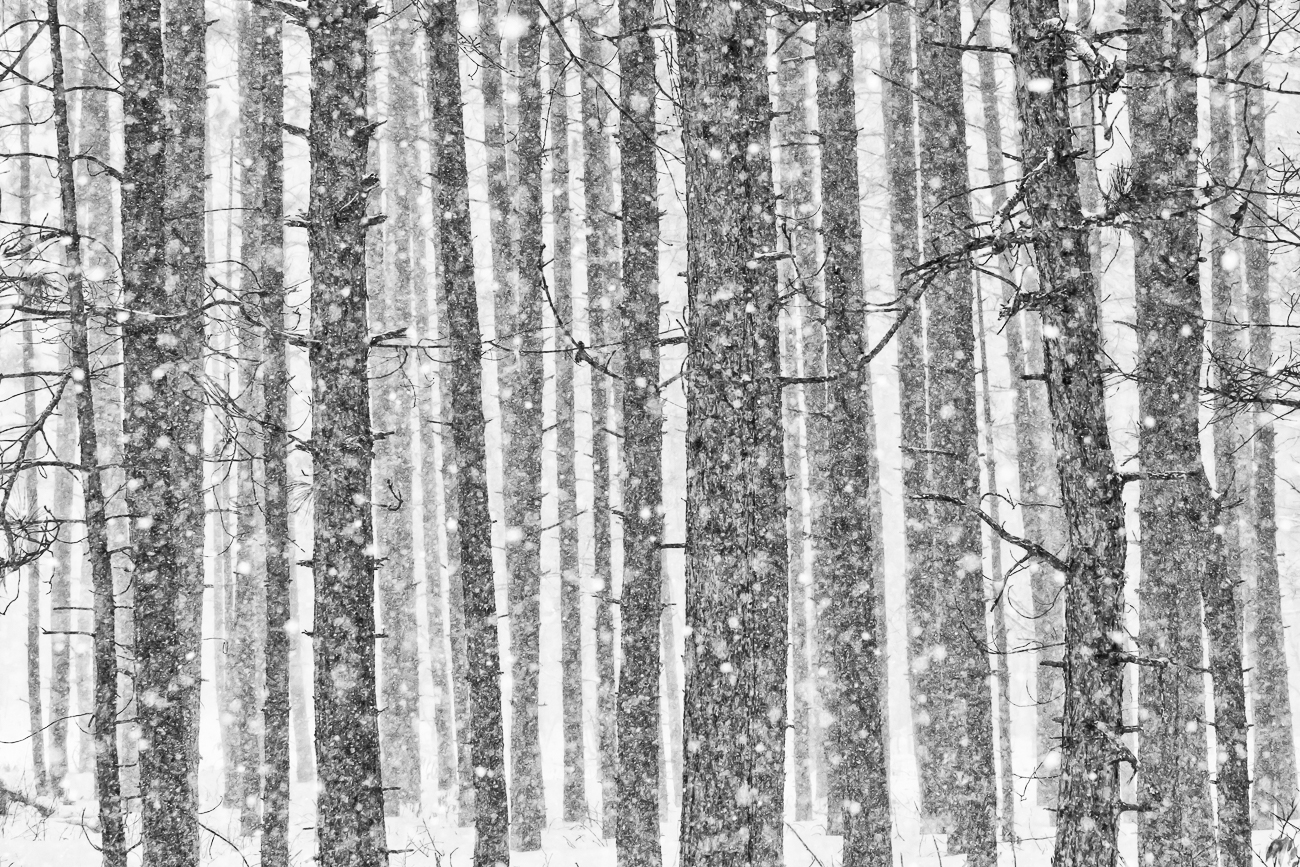
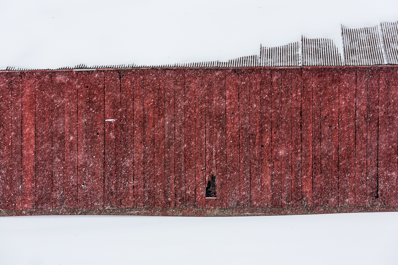
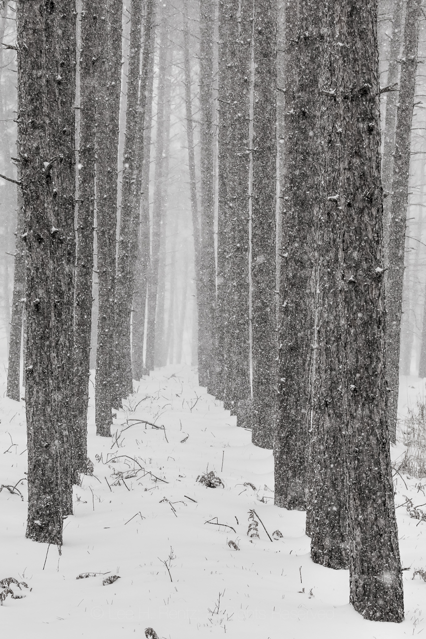
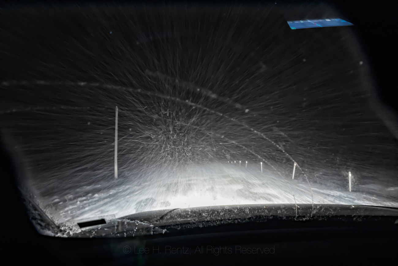
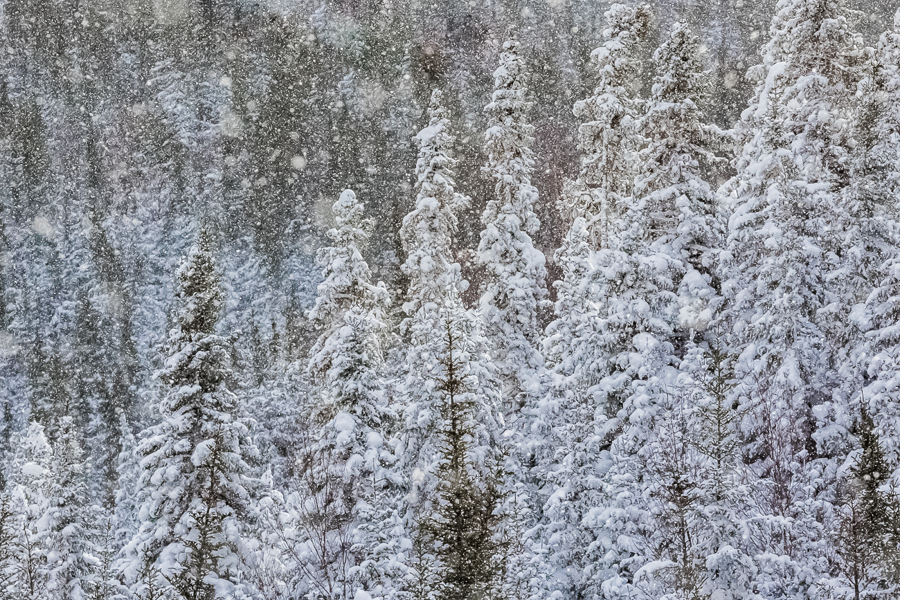
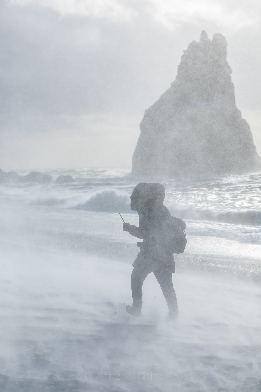
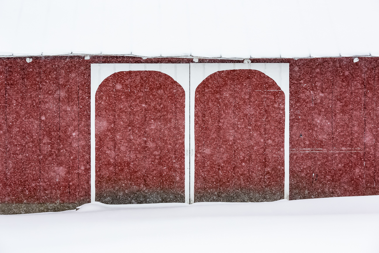
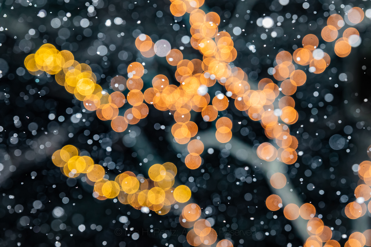
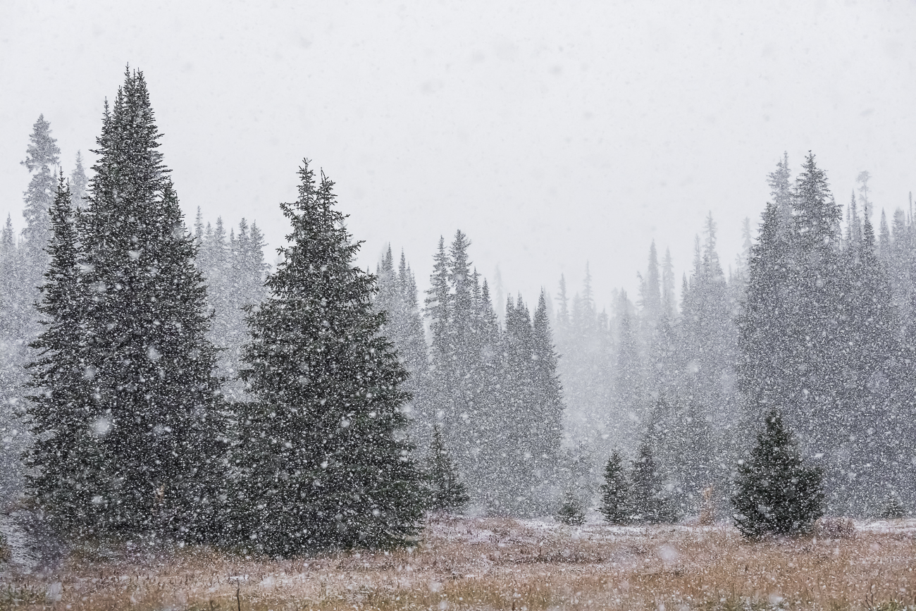
My wife and I made a decision long ago that we enjoy the dramatic cycle of seasons in the north, so we avoided the rush of our generation to move to Florida or Arizona. I’m paler as a result, but am especially enjoying winters in central Michigan because of the snowfall. In fact, when the fat flakes are softly falling, I will often venture out on foot or in the Subaru to see what I can find to photograph.
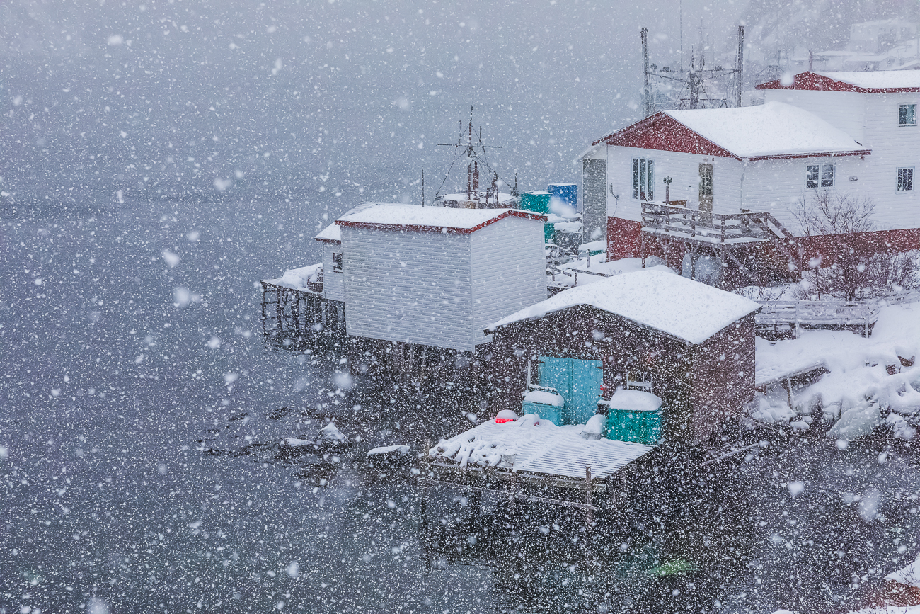
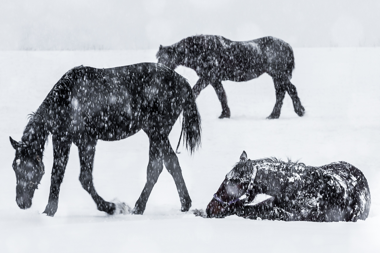
The pictures here, taken over the last six years in Michigan, the Canadian Rockies, Newfoundland, Iceland, and a few other places represent my passion for falling snow. I love how the thickly falling flakes dissolve the landscape into what seems like molecules, where I get a glimpse of the fundamental nature of the universe. Nothing is as solid or as stable as it seems, and everything we know and love is made up of infinitesimal and fundamental particles buzzing around each other in the void. My glimpse into the great mystery.
You can click on any of the photographs here to see it larger and to view all of them using the arrow on the right. Each is available for $100 in a 12 x 18″ print that you can mat and frame however you like. Free shipping in the USA and each limited edition cotton print comes with a Certificate of Authenticity and a description of the photograph. Contact me at lee@leerentz.com for information; you can also go to http://leerentz.com for more options, including metal prints.
Southern Flying Squirrels, Glaucomys volans, glowing hot pink on their underbellies when illuminated by a 365 nm UV flashlight, in a rare phenomenon known as biofluroescence
I awoke last night at midnight to flashes of light from a motion sensor floodlight on our deck. I wasn’t thinking of prowlers, because I suspected the flashes of light were triggered by Southern Flying Squirrels coming to visit for the sunflower seeds I had tossed out just before going to bed.
I crept downstairs and carefully opened the sliding door, letting in frigid February air. The deck light came on briefly, enough that I could see the tiny squirrels dashing up through an opening in the deck around a huge Northern Red Oak. Each squirrel would come up, grab a sunflower seed, then dash down the tree trunk out of sight. This happened so fast that I couldn’t see how many squirrels there were, though at one point I saw three. There may have been more. On this night they were nervous and did not stop long enough for any photos.
We’ve had Southern Flying Squirrels at our home in Michigan each winter, and I’ve photographed them at night several times using incandescent lights on the deck. They made for good photographs, with their gray-brown fur and a cuteness factor of huge bulging eyes and little pink lips, but their coloration was subtle to my eyes and essentially no different from most mammals, which are colored for camouflage rather than display.
Then scientific knowledge suddenly changed. About four years ago a Wisconsin forestry professor, Dr. Jonathan Martin at Northland College, was in the woods at night looking up toward the forest canopy with an ultraviolet flashlight for lichens and other fluorescing lifeforms, when a hot pink missile glided overhead. He identified this as a Northern Flying Squirrel, and its normally white belly lit up hot pink in ultraviolet light. He found this astounding, and asked a colleague to investigate flying squirrel skins in a couple of museum collections to see if the phenomenon could be confirmed. It turned out that in those collections, the bellies of all three species of North American flying squirrels–Southern, Northern, and Humboldt’s Flying Squirrels–glowed bright pink under UV light. Even specimens over 100 years old. Male and female, young and old, they nearly all glowed.
Since we have easy access to flying squirrels at our home in Central Michigan, I decided to observe this phenomenon for myself. I obtained a 365 nm UV flashlight that is powerful enough to look almost into the treetops and began looking at these squirrels on nights they chose to come to our feeding station. They don’t come every night, but when they do I often get up in the middle of the night to observe and try to photograph them. It isn’t easy to photograph little nervous squirrels by a relatively dim (to our eyes) UV light, but I’ve had some success represented by the pictures here.
Southern Flying Squirrel showing biofluorescence under UV light on the left, with the same species illuminated by tungsten light on the right. The belly fur changes from off-white to bubblegum pink when struck by UV light.
Why do flying squirrels glow? That is still unknown. What is known is that at dusk, dark, and dawn, the air is bathed in proportionately more ultraviolet light and far less light from the visible spectrum than in daytime. This UV light–when converted to visible light by fluorescence–makes the flying squirrels more visible to each other. This is even more true when snow blankets the forest, since snow reflects UV light. It also appears that flying squirrels’ eyes, unlike ours, can see into the UV spectrum, so this ability may also be involved.
Again: why do they use biofluorescence and UV light at night? There are a couple of possibilities that spring to mind. Based upon the three flying squirrels I observed on that recent February night, I think it’s possible that the squirrels use their bubblegum pink undersides to keep track of each other at night. These squirrels are highly social, with reports of 25 to 50 Southern Flying Squirrels roosting communally in a hollow tree. So why wouldn’t they follow each other to food sources? Some of my pictures show them sitting side by side, dining quietly together on the sunflower seeds I put out. They seem to enjoy a more peaceable kingdom among their kind than do the daytime Eastern Gray Squirrels and American Red Squirrels we also get in Central Michigan. Feeding together also means more big eyes to look for predators–much as goldfinches and other songbirds feed communally as a strategy to detect hawks.
There is another tantalizing possibility for the pink color. Three large owls that also live in this region–Barred, Barn, and Great Horned Owls–also have bellies that fluoresce hot pink under UV light, though their coverings are feathers rather than fur. These owls are the chief predators of flying squirrels. Do the flying squirrels mimic the owls to fool the predacious birds into thinking they are seeing other owls when in the air? Maybe. I find this possible. The fluorescing fur is mostly on the belly and undertail of the squirrels, with just a minor hint of color change on the back and virtually none on the tail. Once a flying squirrel lands on a tree trunk, its back and tail make it almost invisible to predators because the glowing belly is nearly hidden.
Alternatively, perhaps the owls are mimicking the flying squirrels, fooling the little squirrels into thinking they are seeing others of their own kind. This would allow the owls to silently approach the flying squirrels and suddenly grab the little creatures.
Or perhaps all three of these mechanisms are in play: bubblegum pink signals the presence of flying squirrels to each other, but also both disguises them from owls and identifies them to owls, if any of that makes sense. Coevolution at work.
Biofluorescence also extends to the Virginia Opossum in this region, but is apparently unknown in other mammals here. It turns out the phenomenon is new enough that the chemical and physical mechanism is still unknown. I suspect this will be studied in coming years, with possible applications for industry. Or not. Knowledge is its own reward.
I will be watching these creatures over the coming weeks and years, both with and without the assistance of UV light. The mysteries of nature are an ingrained part of my life and I find observations and photography endlessly fascinating.
The photographs above are a good representation of the Southern Flying Squirrel in UV vs visible light. The final photograph shows the deck setting at night where all the pictures were taken, and includes one flying squirrel for scale. Click on the photographs to see them larger.
Here are some other sources that examine this discovery: