A PLACE APART: Views from a Fire Lookout

We give our lives meaning and weight by the stories we remember. This has become more difficult with scattered families and friends, and with the blizzard of media that is available every waking second. It has become hard to hear ourselves think and to remember that we have stories to tell that make up the fabric of our lives.

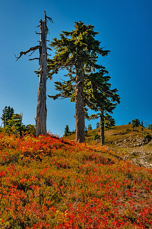
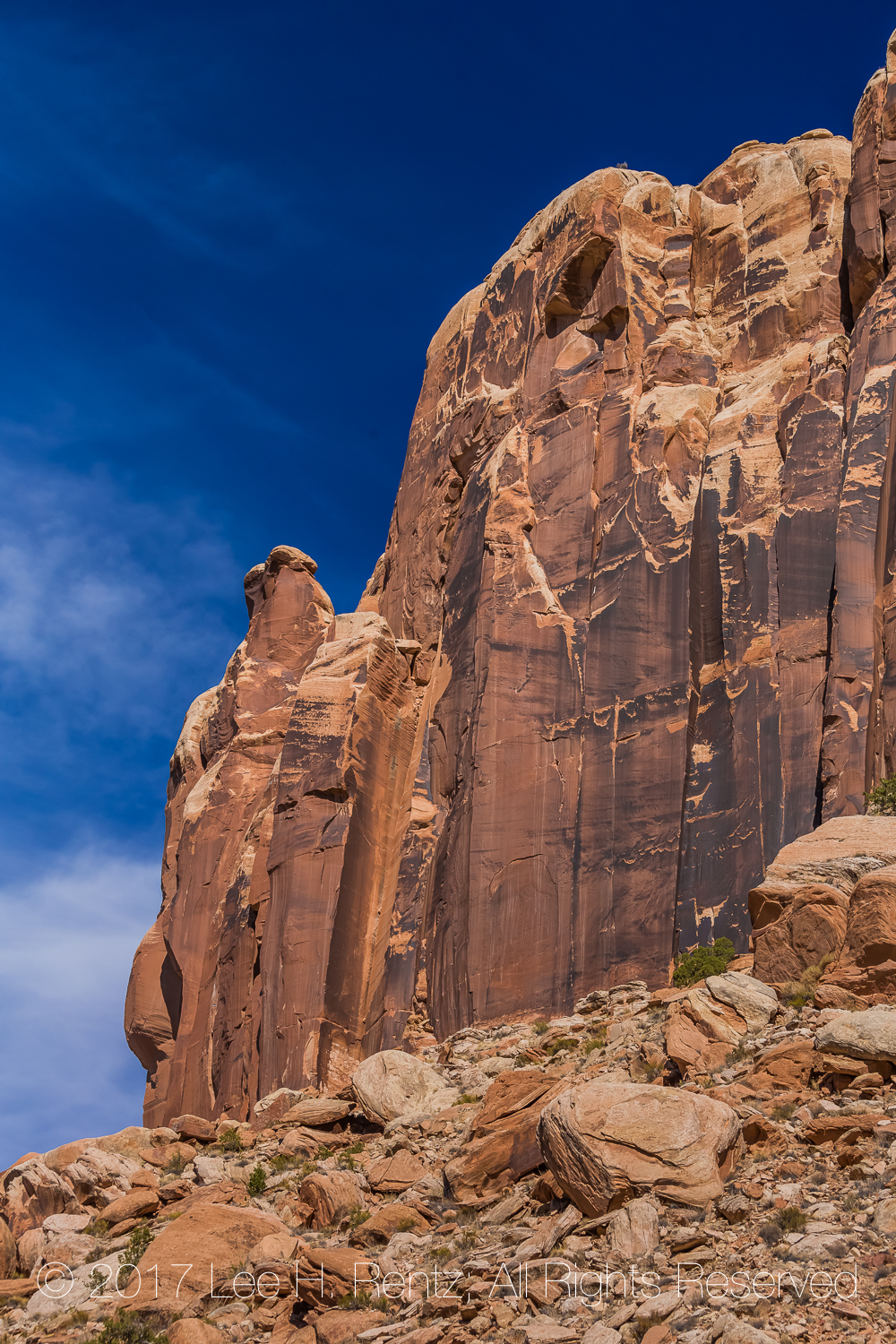
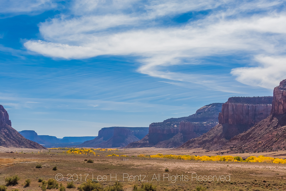
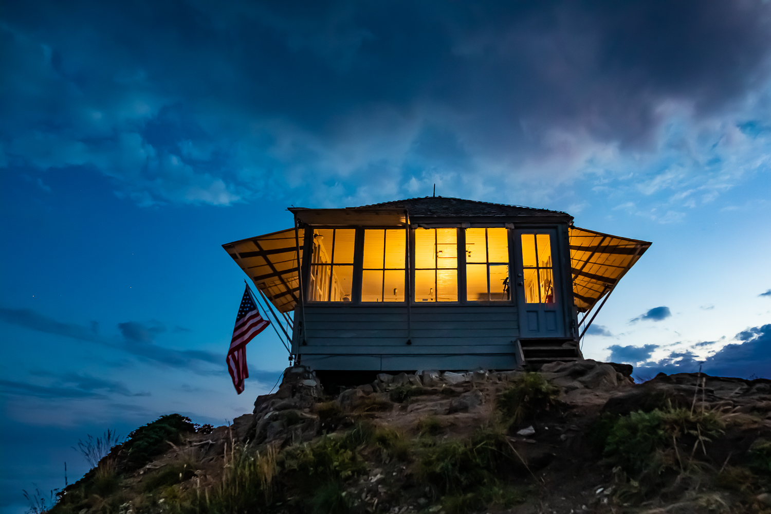
One of the few places of respite is hiking, where the mind is able to focus outward instead of re-exploring the details of frustrating work lives and relationships and politics. Even better is to spend time living in a fire lookout, where the focus is on looking at the vast panorama visible from a peak. Working as a professional lookout is a scarce job these days, but there are opportunities to visit lookouts. There are lookouts that people can rent just to enjoy the sensations of observation and isolation. There are also lookouts where people can volunteer to spend days looking for smokes and greeting hikers. Either opportunity gives people time to experience the solitude and wonder of being in a place apart.

Twilight at Evergreen Mountain Lookout

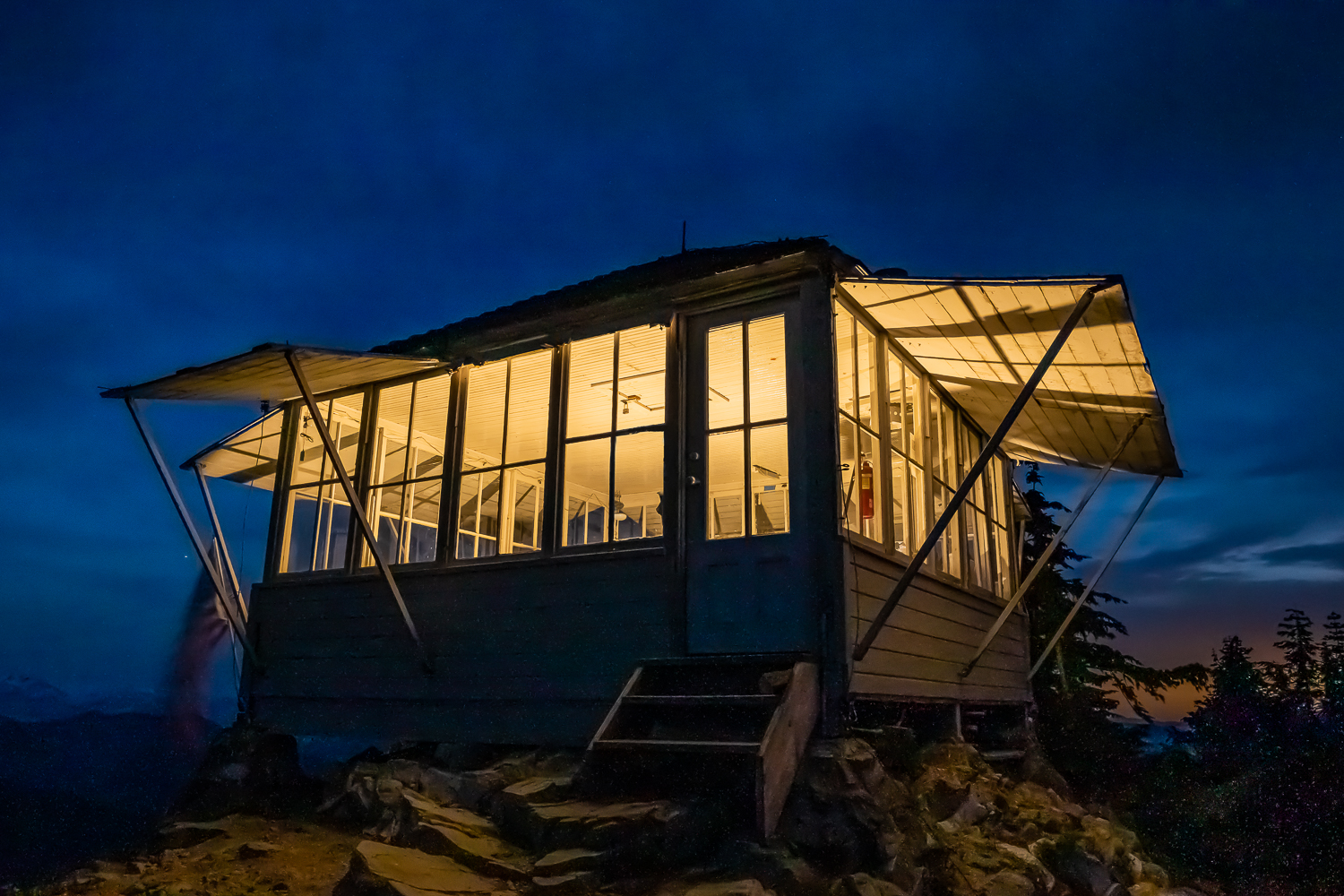
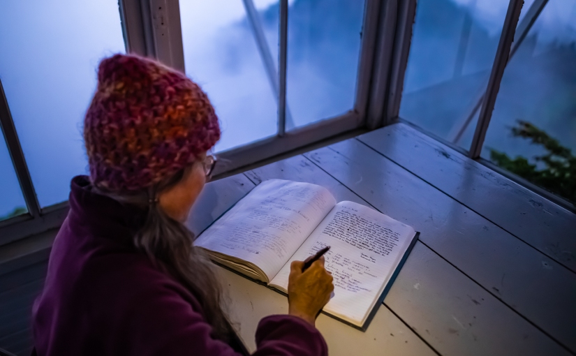
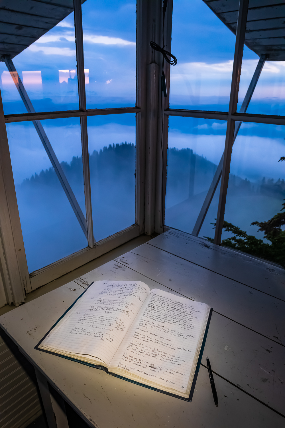
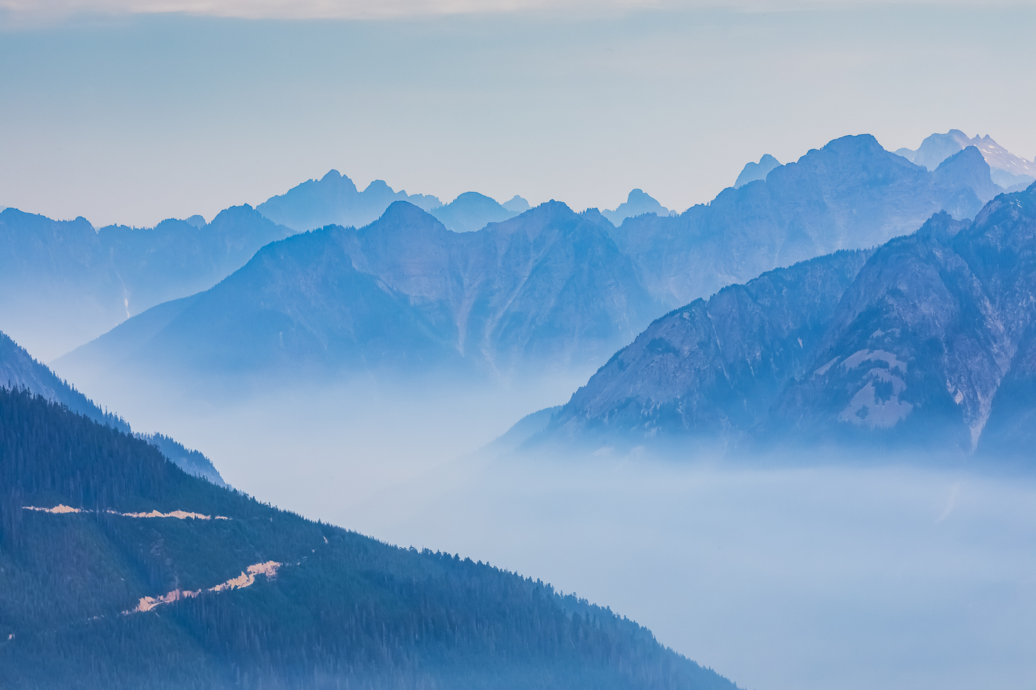
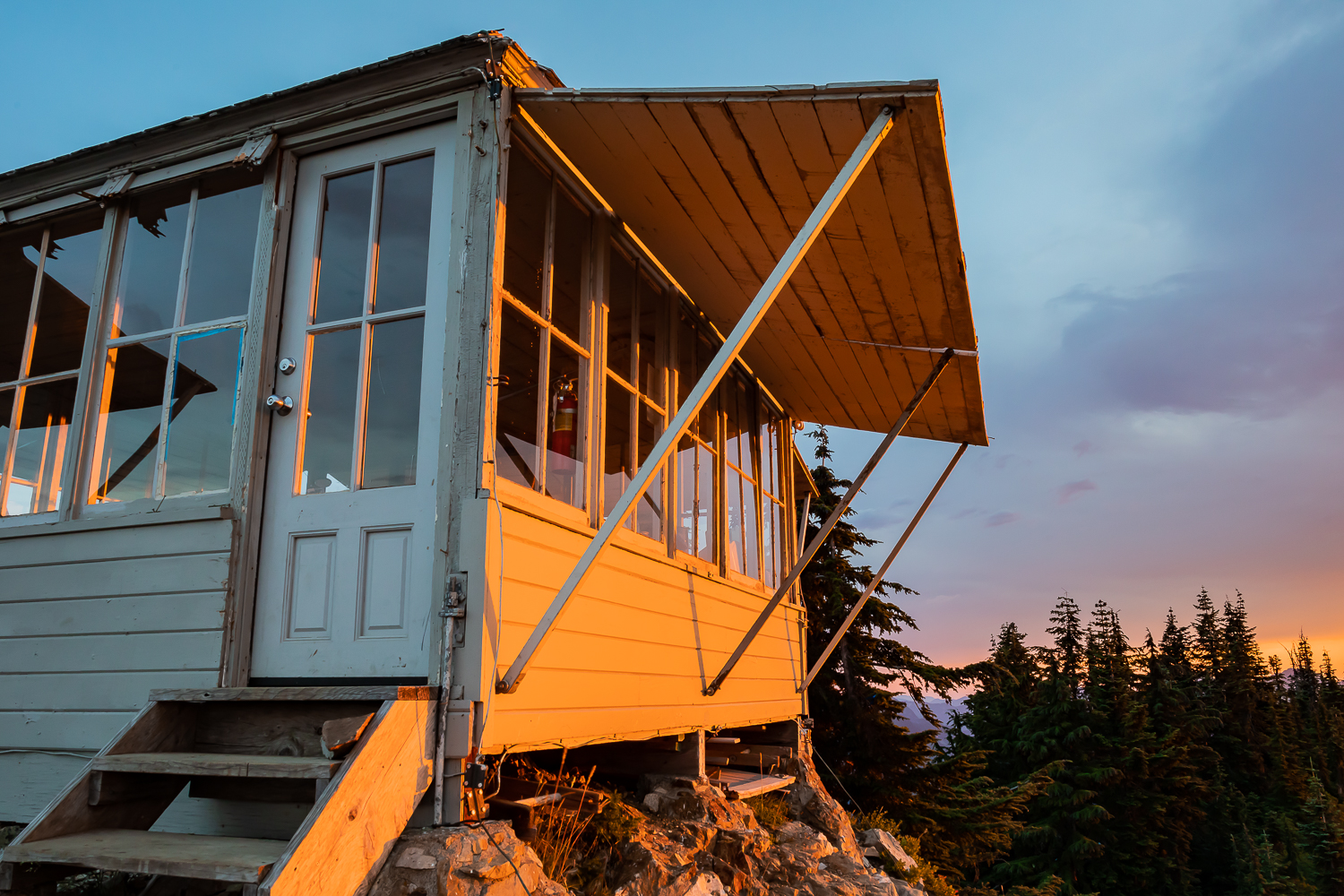
When we rented the Evergreen Mountain Lookout in August of 2022, we experienced the quiet and intimate setting we so desired. Life was simple there for two nights, with watching the stars and clouds, and waking up to the lookout hidden deep within fog. It was wondrous. 

But we weren’t the only ones to have a profound experience here. In looking at the visitor register kept in the lookout, we found that people often wrote poetic passages about their experience with nature in this place. I transcribed some of them here, without names so privacy can be assured, to show how the solitude of an individual or the intimate experience of a small group can be so enthralling.

5 October 2006
“Dinner of steak, rice, and broccoli about 9 p.m. then to bed. By this time the wind was blowing hard. The shutters along the south side of the lookout were bouncing loudly, making a grating noise. Cold out and it was seeking a way inside through every small crack so we tore a towel in strips and chinked the larger cracks. Settle in around 10 p.m. hoping for some sleep.
Extremely strong winds blasted the lookout around 1:30 a.m. and the center support holding the shutters on the south side gave way. The heavy shutters bounced wildly. We worried that all the shutters would fall in and smash the glass down upon us. We got up and placed a tarp and air mattress across the inside of the glass and tried to settle down. Sleep was almost impossible.
Sunrise was around 6:30 and we rose to clear, very cold skies. The wind had not abated and the shutters still bounce in the daylight. We saw that the center support had thrown its top bolt and we were able to replace it. The wind keeps blowing. Two hawks are braving the wind and hunting in the southern meadow.
Wind somewhat easier at noon. Time for a last walk east along the ridge and then out.”

18 September 2009
“Came up to fix a few things reported broken. Unfortunately it was worse than reported. Locks and windows broken, garbage and stuff everywhere. So sad. But we did what we could so hopefully it will last.
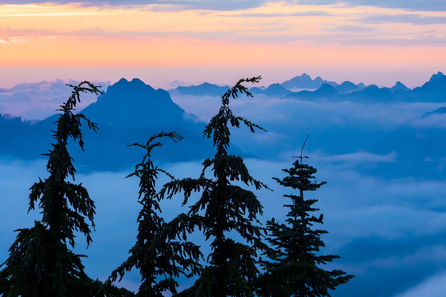
Weather was absolutely perfect! Could not have been better. No fog, not too hot, cool wind constantly blowing. The sky was so clear we could see forever in every direction. I can’t believe how many peaks there are!
Thanks so much for allowing me to come up here. It was a perfect trip. And please, please show respect for this place and take care of it.”

9 August 2013
“Lightning and thunder started in the south at about 10:30 p.m. By 12 a.m. all of us were awake from the wind and by about 1:30 a.m. the storm was right above us and lasted until about 3:30 a.m. when the wind picked up again. Very beautiful and terrifying. A once in a lifetime experience.”

Visitor register for making comments about the experience on Evergreen Mountain Lookout

2 October 2017
This is my third time at the lookout, but the first time without human companions. Just me and the dog, seeking solitude and some healing after a death in the family.
I woke up to a stunning sunrise, mountain peaks visible all around but a magical cloud cover down below. Cold though! Icicles on the lookout–glad I had the dog to keep me warm through the night.
Although not healed, the mountains and solo time did me good. Focus on enduring beauty, on the things that knock us breathless and senseless. This helps.”
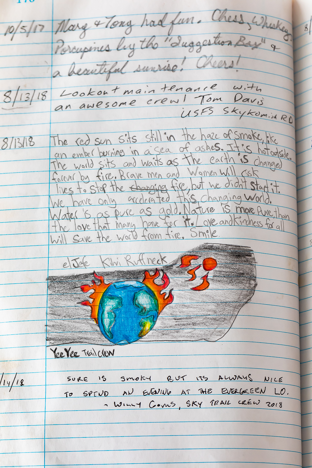
13 August 2018
“The red sun sits still in the haze of smoke, like an ember burning in a sea of ashes. It is hot outside. The world sits and waits as the earth is changed forever by fire. Brave men and women will risk lives to stop the fire, but we didn’t start it. We have only accelerated this changing world. Water is as pure as gold. Nature is more pure than the love that many have for it. Love and kindness will save the world from fire.”

15 August 2018
“A beautiful smoky day of repairs at the ol’ fire lookout. Met a wonderful woman hiker who used to live in this very lookout almost 40 years ago! The magic of this place is still alive and well!”

15 August 2018
“Smoky. Still a lovely hike, tho seems a lot harder than in the summer of 1976, when I was the lookout here.”

5 September 2018
“Simply beautiful up here. Mountains in every direction, too many to name. Wonderful artwork of nature. Had fun picking huckleberries. Wish we would have stayed the night. Next time. Our 3rd anniversary activity of choice.”

16 September 2018
“A rainy, snowy, cloudy trip and we couldn’t ask for anything more. Had a fantastic time hanging out in the cabin watching the weather. Can’t wait to come back and do it again.”

Stories written in the vistor register

10 August 2019
“On this day 5 years ago I stayed overnight in 3 Fingers [another lookout]. After going home on the 10th I had a heart attack. Was great to be able to spend the night and celebrate life. If you go to 3 Fingers check out the lightning stool I made for my first year anniversary of the heart attack!”

11 August 2019
“It felt like something out of a storybook to hike up and up into the clouds where you couldn’t see thirty feet ahead or behind you. Wildflowers that I thought I wouldn’t see again this late in the year bloomed along the trailside. It was magical finally seeing the lookout appear out of the mist. Then to wake up surrounded by it just makes me feel like I’m in another world.”

Interior of Evergreen Mountain Lookout

Hikers are not the only people who have found the fire lookout to be an inspiring muse. There is a long tradition of writers who have spent summers working for the U.S. Forest Service and National Park Service perched in their mountaintop retreats, looking for smokes while simultaneously thinking and taking notes and working on poems and novels. Without a boss looking over their shoulders, the thoughts could rise from the depths like columns of smoke on a distant ridge.

Gary Snyder, a poet who has written a lifetime of poems of depth, infused with Zen Buddhism and nature, watched the landscape atop Sourdough Mountain Lookout in the North Cascades of Washington in the summer of 1953. His meditative book Riprap and Cold Mountain Poems begins with this gem from that time:

Mid-August at Sourdough Mountain Lookout

Down valley a smoke haze
Three days heat, after five days rain   
Pitch glows on the fir-cones
Across rocks and meadows
Swarms of new flies.

I cannot remember things I once read   
A few friends, but they are in cities.   
Drinking cold snow-water from a tin cup   
Looking down for miles
Through high still air.

Decades later Tim McNulty, a writer from the Olympic Peninsula, also stayed in Sourdough Mountain Lookout for a season. He found it a profound experience, and wrote evocative poems about his time there. These are included in his book of poetry called Ascendence; here is a wonderful excerpt from one poem

Night, Sourdough Mountain Lookout

I light a candle with the coming dark.
Its reflection in the window glass
flickers over mountains and
shadowed valleys
seventeen miles north to Canada.

 
Not another light.
 

The lookout is a dim star
anchored to a rib of the planet
like a skiff to a shoal
in a wheeling sea of stars.

 
Night sky at full flood.
 
Wildly awake.

Smoke from Irving Peak and White River Fires (2022) viewed from Evergreen Mountain Lookout

Jack Kerouac, writer of the cultural phenomenon On the Road, a vibrating-with-life contrast to the staid and conforming 1950s and early 1960s, worked on Washington’s Desolation Peak Lookout in 1956, a time that inspired some of his work on the books Desolation Angels, The Dharma Bums, and Lonesome Traveler.

“Thinking of the stars night after night I begin to realize ‘The stars are words’ and all the innumerable worlds in the Milky Way are words, and so is this world too. And I realize that no matter where I am, whether in a little room full of thought, or in this endless universe of stars and mountains, it’s all in my mind.” from Lonesome Traveler

Twilight at Evergreen Mountain Lookout

Norman Maclean worked on Elk Summit Lookout in Idaho, and later went on to pen Young Men and Fire and A River Runs Through It and Other Stories. These stories captured tragedies in the American West where he made his home.

“In the late afternoon, of course, the mountains meant all business for the lookouts. The big winds were veering from the valleys toward the peaks, and smoke from little fires that had been secretly burning for several days might show up for the first time. New fires sprang out of thunder before it sounded. By three-thirty or four, the lightning would be flexing itself on the distant ridges like a fancy prizefighter, skipping sideways, ducking, showing off but not hitting anything. But four-thirty or five, it was another game. You could feel the difference in the air that had become hard to breath. The lightning now came walking into you, delivering short smashing punches.” from A River Runs Through it and Other Stories

Historic Evergreen Mountain Lookout in sunset light

Edward Abbey wrote Desert Solitaire: A Season in the Wilderness which became one of my personal guiding lights since the time I first read it as a college freshman over 50 years ago. Abbey writes of his adventures in the old days of Moab, Utah, before it became a recreation mecca. Abbey’s book helped turn Moab into the “industrial tourism” machine that he detested, but I’ll save that rant for another time. Abbey needed to make ends meet, like all of us, so he worked at the Bright Angel Point Lookout on the North Rim of the Grand Canyon for four seasons, where he stationed his typewriter near the Osborne Fire Finder.

“Wilderness is not a luxury but a necessity of the human spirit, and as vital to our lives as water and good bread. A civilization which destroys what little remains of the wild, the spare, the original, is cutting itself off from its origins and betraying the principle of civilization itself.”

“No more cars in national parks. Let the people walk. Or ride horses, bicycles, mules, wild pigs–anything–but keep the automobiles and the motorcycles and all their motorized relatives out. We have agreed not to drive our automobiles into cathedrals, concert halls, art museums, legislative assemblies, private bedrooms and the other sanctums of our culture; we should treat our national parks with the same deference, for they, too, are holy places.” both quotes from Desert Solitaire

Fire lookouts, and hikes, and long bike rides, and long road trips: times and places that are apart from the rest of life. Places and times to think deeply, to breathe in the subterranean thoughts swirling up from our brains and the soil and the landscape.
Mountain Hemlocks above low clouds at twilight

Fire lookouts, and hikes, and long bike rides, and long road trips: times and places that are apart from the rest of life. Places and times to think deeply, to breathe in the subterranean thoughts swirling up from our brains and the soil and the landscape.

Good Links:

Art on High: Beat Poets on the Fire Lookouts about Gary Snyder and Jack Kerouac and others

LOOKING OUT, LOOKING IN: GARY SNYDER AND SOURDOUGH MOUNTAIN LOOKOUT an excellent blog about Snyder and his writing

Poems from Sourdough Mountain Lookout by Tim McNulty, a prominent Olympic Peninsula writer

Climbing a Peak That Stirred Kerouac by a New York Times writer

Fire Tower at Bright Angel Point the tower where Edward Abbey stayed above the Grand Canyon

A Fire Lookout On What’s Lost In A Transition to Technology an NPR interview with Philip Connors, author of Fire Season: Field Notes from a Wilderness Lookout

Dramatic sunset viewed from Evergreen Mountain Lookout

DESIGNATE MOUNT BAKER AS AMERICA’S 64TH NATIONAL PARK

If you agree that Mount Baker would be a fine addition to the National Park System, please let your national congressional representative or senator know your feelings. National Parks have been called “America’s Best Idea,” and it is time to expand the system to include all the other great areas that represent the best nature of America.

For more information about my photography or to purchase a print, go to leerentz.com. Or contact me at lee@leerentz.com or on my Lee Rentz Photography Facebook page.

ADVENTURING TO A NEWFOUNDLAND OUTPORT

Fishing Stages and Colorful Homes in Francois Outport during a S
Fishing stages and colorful homes in Francois during a snowstorm

The first leg of the journey was the drive to Burgeo, a fishing village accessed by Route 480 from the Trans-Canada Highway near Stephenville. The wild and beautiful landscape was covered with deep snow, and the conifers were magically encrusted with a thick layer of hard snow so that, in places, they looked like snow elves. We kept our eyes alert for Woodland Caribou, but didn’t see any on the drive. When we reached Burgeo, we stayed at a small motel that would be convenient for catching a ferry the next morning.

View of Bay In Burgeo, Newfoundland
View of colorful houses across rocky bay from Sandbanks Provincial Park in Burgeo, Newfoundland

We packed what we would need for the trip in two suitcases and left the rest in the car, since we couldn’t take a car on the Marine Voyager ferry. These communities have no roads and no cars, so all that is needed is a foot ferry, albeit one that can carry enough cargo to meet a small community’s daily needs. We walked up the ramp on the ice-covered boat, then descended into a room for the passengers. Comfortable seats, round portholes, and a soap opera on the television – what more could we hope for? We paid our fee of $6 per passenger, which was clearly subsidized by the government, and settled in for our sailing along the coast.

Karen Rentz on Ferry Marine Voyager In Burgeo, Newfoundland
Karen Rentz on ferry Marine Voyager, which takes foot passengers and cargo between Burgeo and the outports of Grey River and Francois, leaving the dock in Burgeo, Newfoundland, Canada

Captain on Bridge of the Ferry Marine Voyager In Burgeo, Newfoun
Captain steering Ferry Marine Voyager, which takes foot passengers and cargo between Burgeo and the outports of Grey River and Francois, leaving the dock in Burgeo

Passenger Cabin on Ferry Marine Voyager In Burgeo, Newfoundland
Passenger cabin interior on ferry Marine Voyager

There were only a couple of other passengers, and they lived in the villages of Grey River and Francois (a French name Newfoundlandized to “Fran-Sway.”) We were invited up to the bridge for a front-row seat and visit with the captain, who was a lifelong resident of Francois. One of the other passengers, a younger man named Cody who owned a fishing boat, introduced himself to us as well. He was also a lifelong resident of Francois and he told us about the community and what he liked about living there. 

Hesitantly we asked the captain if he thought the ferry would be running two days later when we wanted to make our return trip, which would give us enough time to drive back to St. John’s and catch our flight back to the USA. He said this was the first time the boat had sailed for a week because of storms but that the weather looked good for our return trip. We had two nights at Francois and could enjoy ourselves. We had been watching the marine forecast every day for the past two weeks of our trip, trying to find a three-day window of weather when the ferry would be running; there were high winds and high seas every day and then finally the forecast looked good.

Houses in the Outport of Grey River, Newfoundland
Waterfront with floating pancake ice at the outport of Grey River, which is snuggled along a fjord, viewed from the ferry Marine Voyager

The south coast of Newfoundland has a series of fjords, which provide sheltered locations and harbors for fishing communities. The village of Grey River was the first village we came to, and was located partway up a fjord. We motored through pancake ice and past colorful houses to the dock, where about ten people were waiting for the boat. All these people helped unload bread and beer and Amazon boxes full of the stuff a small community needs. Snowmobiles and ATVs were the transportation in town.

Structures in the Outport of Grey River, Newfoundland
Unloading and transporting cargo at the outport of Grey River, which is snuggled along a fjord, viewed from the ferry Marine Voyager

ATV Transporting Cargo from Ferry to Store in the Outport of Gre
Transporting cargo from dock to store by ATV at the outport of Grey River

Waterfront and Sea Ice in the Outport of Grey River, Newfoundlan
Waterfront with glaze of sea ice at the outport of Grey River

We soon set sail again, with no new passengers – after all, who would go from Grey River to Francois in the middle of winter? The sea was rough and it started to snow, and was just about dark when we carefully navigated the narrow fjord that ends at Francois. By this time the wind was howling and the driven snow stung our exposed faces. We didn’t know where our rental place was, but the captain and another man showed us the way and took our bags for us on a snowmobile. We settled into our place for two nights, and ventured outside briefly to get a feeling for the town.

Snowstorm Hitting Outport of Francois, Newfoundland
Snowstorm at night when the ferry Marine Voyager reached the outport village of Francois

Snowstorm Hitting Outport of Francois, Newfoundland
Snowstorm when ferry Marine Voyager reached the public dock in the outport village of Francois, transportation of cargo by snowmobile and ATV

Karen Rentz in Snowstorm in Outport of Francois, Newfoundland
Karen Rentz in snowstorm at night when the ferry Marine Voyager reached Francois

Snowstorm and Ferry in Outport of Francois, Newfoundland
Snowstorm when ferry Marine Voyager reached the public dock in Francois

We spent the next day wandering the village along its boardwalks and pathways – remember, there are no roads needed in a town with no cars or trucks. All the houses are connected by these paths. The town is small, but has Sharon’s Place, a grocery and liquor store that is open morning, afternoon, and evening, with breaks for lunch and supper. There is a church that sits above the rest of town, and a large school that currently has six students and one-and-a-half teachers. This must be one of the smallest schools in the world in terms of the number of students! But education also arrives by computer, with courses available to older students online. There is a medical clinic, but no permanent doctor in town. There is a helipad used during emergencies.

Colorful Houses and Fishing Stages in Francois Outport in Newfou
Colorful houses and fishing stages in Francois

Wooden Sidewalk in Francois Outport in Newfoundland
Wooden community sidewalk in Francois, a place with no roads

Colorful houses are a feature of the town, with red and purple and turquoise tones mixed together in a delightful jumble. In winter some are occupied and some are not, with some people leaving for part of the year for jobs. There are stages along the waterfront: small buildings on stilts where fishermen stored gear and later processed the catch. These are a distinctive and wonderful feature of all the Newfoundland coastal towns.

Colorful Houses and Fishing Stages in Francois Outport in Newfou
Colorful houses and fishing stages in Francois

Colorful Houses and Stages in Francois Outport in Newfoundland
Colorful houses and stages along the fjord containing Francois

Public Outhouse in Francois Outport in Newfoundland
Public outhouse in Francois, with the slogan “I take crap from everyone!”

Shed with Moose Antlers in Francois Outport in Newfoundland
Shed with Moose and Caribou antlers in Francois

FIshing Stage in Francois Outport in Newfoundland
Fishing stage window with fishing ropes coiled inside along waterfront in Francois

Cleat and Rope for Docking in Francois Outport in Newfoundland
Cleat and rope for docking in Francois

We walked past one house just as a lady in perhaps her late 70s was leaving the house on this snowy morning to meet for morning coffee with two other ladies who were 84 and 85 years old. We spoke with her briefly, and she told us she had lived her entire life in Francois. There were 89 people living in this little town in 2016, and we met perhaps eight of them – all of whom had lived here nearly their entire lives, except for time spent in the military or going to school. This lady was really concerned about the dwindling population of Francois.

As the snow continued to fall, we met up again with Cody from yesterday’s boat ride when he drove up on his Ski-Doo (the Newfoundland name for all snow machines) and chatted with him about the town. After graduating from the town’s school, the St. Simon & St. Jude Academy, he went to work on his father’s fishing boat. Later, he bought his own boat and now fishes for crabs, lobster, scallops, and sea cucumbers with his wife and up to five crew members.

Fisherman in Francois Outport during a Snowstorm in Newfoundland
Cody, a fisherman who has lived his whole life in Francois, and now owns his own boat harvesting scallops, lobster, crabs, and sea cucumbers

Fishing Boat in Francois Outport in Newfoundland
Fishing boat along colorful waterfront in Francois

Fishing Gear in Francois Outport during a Snowstorm in Newfoundl
Fishing gear on a boat in Francois

Fishing Boat in Francois Outport in Newfoundland
Fishing boat along colorful waterfront in Francois

Fishing Boat in Francois Outport during a Snowstorm in Newfoundl
Red building with firewood, crab traps, and a high birdhouse

Colorful Houses in Francois Outport during a Snowstorm in Newfou
Colorful houses and fishing stages in Francois

Colorful Houses in Francois Outport during a Snowstorm in Newfou
Colorful houses and fishing stages in Francois during a heavy snowstorm

Snowmobiles are a Great Way to get around Francois Outport in Wi
Ski-Doo operator transporting stuff on a trailer on the wooden sidewalk in Francois

Fishing Stages in Francois Outport during a Snowstorm in Newfoun
Fishing stages in Francois

Fishing Stage in Francois Outport during a Snowstorm in Newfound
Old fishing stage in Francois, where gear is kept, bait prepared, and fish cleaned

 Cody’s diverse fishing activity is a big change from the past, when the fishery was based upon the seemingly never-ending cod supplies. Alas, every time people think that a natural resource is unlimited, they use it up, and Newfoundland’s fishery was no exception. It was devastated by overfishing of the once common cod, a harvest made possible by technological advances utilized by both Canadian and foreign companies. In July 1992, with cod stocks down to less than 1% of historic levels, the Canadian government abruptly shut down the 500-year old cod fishery in order to try and save the fish. This instantly put 30,000 Newfoundlanders out of work and devastated local communities. In the years since some, like Cody, were able to diversify and found a path to the future. Others found a future in tourism, which is starting to take off in Newfoundland. The cod has since rebounded but the fishery is extremely small and limited compared to the good old days. Just try to get fresh cod in Newfoundland most of the year! 

A bit later we ran into another man on the boardwalk who was driving his Ski-Doo. He stopped to talk and told us that he was also a lifelong resident, but he didn’t make his living on the open ocean. He was a helicopter pilot who had worked for the Canadian Coast Guard, but now owns his own company and ferries a lot of people on remote hunting trips, mostly for Moose.

Snowmobiles are a Great Way to get around Francois Outport in Wi
Ski-Doo operators meeting on the wooden sidewalk in Francois

Sharons Place and Snowmobiles in Francois Outport during a Snows
Sharon’s Place, a general store, liquor store, and gathering place, with snowmobiles in Francois

Sign on Public School in Francois Outport in Newfoundland
Sign on St. Simon-St. Jude Academy, the public school, saying “A Clean Town is a Happy Town”

As I mentioned, the houses are scattered all around town seemingly randomly, with no clear lot boundaries. We asked one man about this, and he said that all the houses are built on Crown land, which is government land. People own their houses, but not the land under them.

We met another man driving his Ski-Doo who we had seen shoveling snow off a boat, which turned out to be his uncle’s boat. He works fishing for herring, crabs, lobster, and sea cucumbers. He was also a lifelong resident … are we beginning to see a pattern here? People are born here and live their whole lives here, though with a strong tether by ferry and by the internet and television to the larger world. When we asked Cody about his fellow citizens, he said that most everyone gets along well in town, but over time some people are moving away and the population is getting smaller.

Fishing Stages in Francois Outport during a Snowstorm in Newfoun
Fishing stages in Francois during a heavy snowstorm

Fishing Stage and Colorful Homes in Francois Outport during a Sn
Fishing stage and colorful homes in Francois during a snowstorm

Fishing Stages and Colorful Homes in Francois Outport during a S
Fishing stages and colorful homes in Francois

Fishing Stage in Francois Outport during a Snowstorm in Newfound
Fishing stage, where gear is kept and equipment maintained and bait prepared

Fishing Boats in Francois Outport during a Snowstorm in Newfound
Fishing boat in Francois during a snowstorm

Crab Post and Stage  in Francois Outport in Newfoundland
Crab pots and boat on a dock in Francois

The province of Newfoundland and Labrador has had a decades-long effort to move people away from the outports, which require huge government subsidies for ferry and helicopter transportation and education and medical care. By now, most Newfoundland outports have been abandoned, with the people voting to disband their towns and move elsewhere, but Grey River and Francois have been exceptions. In Francois, the question has come up for a vote twice over the years, but both times it was defeated (the latest in 2013) and the people remained. I understood that if the people voted to move out, the government would pay each homeowner $250,000 to compensate for the abandoned homes. It still could happen, but it is wonderful to see a few of the outports still hanging on against the tide of modernization.

I continued to photograph the buildings and waterfront and falling snow to my heart’s content on this wonderful day, when we talked to more strangers than we usually talk to in a week. Newfoundlanders are like that … they go out of their way to make visitors feel welcome, and we did.

Francois Outport at Night in Newfoundland
Francois at blue hour twilight

Francois Outport at Night in Newfoundland
Francois at blue hour twilight along a fjord with mountain towering above

Francois Outport at Night in Newfoundland
Francois, at blue hour twilight with lights reflecting off the fjord

Fishing Stages and Colorful Homes in Francois Outport during a S
Colorful homes in Francois

There is even a good story that might be mostly true or wholly true about a German submarine that entered the fjord containing Francois during World War II. It came to quietly get fresh water for its tanks at a waterfall entering the sea. It was on a Saturday night and there was a dance at the community center in town; some handsome but unknown young men showed up who knew little English and who danced the night away with the local girls. The young women apparently thought that these might be Basque fishermen who often fished nearby, and didn’t realize that the men were German sailors.

Francois Bay in Early Morning from the Ferry Marine Voyager in N
Francois Bay in early morning from the ferry Marine Voyager, after leaving the quaint outport of Francois in Newfoundland

Newfoundland, Canada
Francois Bay in morning light

West Point Light Tower at Mouth of Francois Bay in Newfoundland
West Point Light Tower at mouth of Francois Bay viewed in winter morning light from the ferry Marine Voyager

Ferry Smashing into Waves along South Coast of Newfoundland
Ferry Marine Voyager smashing into waves on the open ocean between the outports of Francois and Grey River in Newfoundland

Ferry Smashing into Waves along South Coast of Newfoundland
Ferry Marine Voyager smashing into waves on the open ocean between the outports of Francois and Grey River in Newfoundland

Waves from Ferry in Fjord Leading to Grey River Outport in Newfo
Waves from ferry Marine Voyager distorting mountain reflections in the fjord leading to the outport of Grey River

Colorful Houses and Sea Ice at the Grey River Outport in Newfoun
Ferry Marine Voyager passing the colorful houses and sea ice at the outport of Grey River

Ferry at Entrance to Fjord Leading to Grey River Outport in Newf
Ferry Marine Voyager passing mouth of the fjord leading to the outport of Grey River

Bridge of Ferry Marine Voyager Plying South Coast of Newfoundlan
Bridge and wheel on Ferry Marine Voyager near Burgeo

The next morning we prepared to leave Francois for the voyage back, and the ferry Captain came to retrieve us. The morning showed a bit of sun and good weather for an ocean trip, so we went down to the dock and prepared to leave. The trip back was stunningly beautiful, with morning sun kissing the snow-covered headlands. And we got back in time to make the long drive to St. John’s to catch our flight.

Ferry Passing Colorful Houses at Burgeo, Newfoundland
Arriving in Burgeo from Francois and Grey River outports in Newfoundland, Canada

To view more of the photographic work by Lee Rentz, go to leerentz.com, where you can see thousands of photographs and purchase a special one for your walls.

OUR FIRST VISITS TO POINT OF ARCHES: Looking Back to the Winter of 1991

There are places where experiences are so profound that they draw you back time after time. Olympic National Park’s Shi Shi Beach and Point of Arches is such a place for me. The words in this story are from our 1991 field notes of our first visits to this transcendent place, illustrated with new and old photographs presented in a nostalgic style.

Sunset at Point of Arches in Olympic National Park
Hikers and Point of Arches rocks at sunset, viewed from Shi Shi Beach along the Pacific Ocean in Olympic National Park

January 18-21, 1991

With a weather report of sunny weather for Western Washington through the long Martin Luther King holiday weekend, we made a quick decision on Thursday to leave Friday for a three-day backpacking trip along the coast at Shi Shi Beach and Point of Arches. Little did we know it would be the most spectacular weekend trip of our lives.

We drove to Kalaloch on the Washington coast Friday night and camped in the Olympic National Park campground along the shore. Clear skies, with intense starlight, were followed by a heavy frost the next morning.

Arising early, we drove to Neah Bay and the Makah Indian Reservation. The road between Clallam Bay and Neah Bay hugs the twists and turns of the coast. Along this stretch of the Strait of Juan de Fuca, we observed four immature Bald Eagles perched in the trees between the road and the water. Additionally, a male and female Harlequin Duck perched together on a small emergent rock. We also observed loons and scoters offshore, as well as Double-Crested Cormorants.

Neah Bay, the heart of the Makah Reservation, is like a small town on the Newfoundland coast, with scattered houses strung along the shore, a small fishing fleet, and no pretense of being a tourist town. These Indians had a centuries-old tradition of whaling from open canoes.

Hiking on Shi Shi Beach in Olympic National Park
Karen Rentz hiking on Shi Shi Beach along the Pacific Ocean in Olympic National Park

We followed a convoluted route to the trailhead, through town and along some potholed roads. Along Waatch Creek, we came upon wintering Trumpeter Swans. The brilliant white swans made a wonderful sight as they swam across the peaceful river surface, which reflected the pale blue of the winter sky. Their resonant trumpeting provided a sound track for the experience.

The two-mile hike to Shi Shi Beach was a muddy challenge [much improved in recent years], but the sounds of the roaring surf urged us on.

At our first ocean overlook, we watched waves crashing through the offshore sea stacks. As we started eating lunch, we noticed two mature Bald Eagles majestically perched together atop a high sea stack. Looking through binoculars at the ocean’s expanse, while enjoying a trail lunch of summer sausage and Wheat Thins, I spotted the spouts of three Gray Whales offshore; these were unmistakable columns of mist going straight up from the ocean.

Driftwood Logs on Shi Shi Beach in Olympic National Park
Driftwood logs deposited during fierce winter storms on Shi Shi Beach along the Pacific Ocean

As we shared a chocolate bar, Karen noticed that a “log” rocking on the waves was, in reality, a Sea Otter. Floating on its back, it was holding a Sea Urchin up to its mouth with its front paws. The back paws were stuck up in the air. The otter floated like a cork over crests and troughs of the waves–except when a giant wave toppled toward it–then it would plunge into the wave and emerge on the other side.

Hoisting our packs, we continued down the trail and in a few minutes descended to the beach. We were surprised to see a young man running along the beach and through the surf in shorts, sans top, and barefoot; his girlfriend sat in the sand and watched and shivered at the thought of it.

We decided to set up camp near the Olympic National Park boundary, at a place where a Raccoon-proof cable was strung between two trees [currently ALL overnight visitors are required to bring bear-proof canisters].

Then we hiked north along the beach we had examined from above. From the shells on the shore, it was evident that there were extensive California Mussel beds offshore. We also saw a few Razor Clam and Butter Clam shells; opened and empty, but (like the mussels) the hinges still held the two shell halves together and flexible. A Common Loon dove just offshore, as did a Surf Scoter; we saw the Sea Otter’s head poke up a few times as well. An occasional Bald Eagle sailed overhead.

Ripples in Sand on Shi Shi Beach in Olympic National Park
Sandy shore ripples of Shi Shi Beach at low tide

Karen went around the next small point to the north and saw parts of an old shipwreck. Two large rusted hulks were on the beach, one large section out near a sea stack with a “gun turret” point projecting, and other pieces of metal scattered through the bay. Karen continued north to the beginnings of a cave being formed, and then further to a deeper cave which was still inaccessible because the tide was not low enough. The sun was setting though, so it was time to head back to camp.

When we returned to camp, we discovered that a Raccoon had unzipped Karen’s pack and investigated all its contents. We knew immediately that the culprit had been a Raccoon (and not a person), since Karen’s driver’s license and credit cards lay prominently on top of the pile spread across the ground–the Raccoon apparently didn’t have much use for Master Card. It had chewed up part of a roll of toilet paper, but otherwise no damage was done, since the food was strung safely up on the wire.

We crawled into our sleeping bags at 8:30 pm, and fell asleep shortly after. At midnight, we awoke to the sound of packs being rifled. Lee checked with a flashlight and caught the eye shine of two Raccoons. He crawled and chased them off. Undaunted, they returned a few minutes later, so Lee crawled out again and escalated the conflict by tossing sticks and stones at the creatures. This worked for a time, but they were back again a couple of hours later. This time Lee was running around barefoot in his underwear yelling and throwing stones at the guerrillas.

Lee awoke to the screeching and snarling sounds of a Raccoon squabble a little while later, but soon the action quieted down and the rest of the night was peaceful.

Wet Sand at Low Tide on Shi Shi Beach in Olympic National Park
Wet sand on Shi Shi Beach after a wave subsided

Waking up groggy and grumpy the next morning, Lee had a hard time getting started–as might be expected. After hot instant coffee and cold granola with powdered milk, we started down the beach in the cold gray of dawn. Again, there was frost whitening all the drift logs and grasses on the beach. The sand above the high tide line was frozen.

Shortly we came upon a dead seal washed up during the night’s high tide. The 5-foot long seal appeared freshly dead; one eye had been pecked out by crows or gulls.

Point of Arches and Shi Shi Beach in Olympic National Park
Rock formations of Point of Arches with a tide pool along Shi Shi Beach at low tide

Far down the beach we spotted a live Harbor Seal wiggling its way from the high tide line toward the sea. Obviously uncomfortable on land, it moved vigorously with ripples of fat rolling like ocean waves down its body. It would rest briefly, then struggle on. It finally reached the water and prayed for a big wave to carry it off–one of which arrived several waves later. We examined the tracks, which showed the lines where flippers made their marks, perhaps 2 feet apart. One flipper consistently dug in deeper than the other–perhaps indicating an injury that would have made movement more difficult.

The beach was relatively free of human detritus, though there were the usual fishing net floats, lengths of bright polypropylene rope, and tattered net fragments. At the highest wave line, there was a sprinkling of tiny bits of brightly colored plastic–which looked like plastic confetti. This was the first time we’ve seen such plastic bits. The larger pieces break into small pieces from the incessant pounding of the Pacific.

Wet Sand and Rocks at Low Tide on Shi Shi Beach in Olympic Natio
Wet sand and rocks on Shi Shi Beach after a wave subsided

Never still (even on perfectly calm days under an intense high pressure zone like these days) the Pacific shore here always has the hearty roar of the surf as kind of a white noise in the background. Lee remembered talking with Dad on the phone, when he mentioned being at Kalaloch during the 1970s, and turning the car so its headlights struck the ocean, and being astounded and (if I may read something into this midwesterner’s memories) a bit intimidated by the churning, pounding, roaring surf that never ends. His memories of the violent Pacific were vivid, having stood watch in a crow’s nest atop a WWII destroyer during a big storm at sea.

As we stood among the sea stacks, on rocks exposed by low tide, we were awed by the pulsing power of the surf as it crashed into the monoliths and surged into the bays. The rocks absorbed the power and broke up the waves, thank goodness. Note that the big waves came in surges of a half dozen or more high peaks, followed by a period of relative calm. Reading Ricketts and Calvin’s Between Pacific Tides, the authors say that being within 20 vertical feet of the ocean is actually risking one’s life; clearly we need to be prepared for these big wave surges.

Man Walking on Shi Shi Beach in Olympic National Park
Man walking in the morning sea spray mist on Shi Shi Beach

As we sat down for lunch, Lee saw a falcon hunched on the beach just above the wave line. It remained for a minute or so, then took off with powerful wing beats and flew past us along the beach. It was a Peregrine Falcon, the Pacific Northwest dark phase of the bird.

We spent the late afternoon on the exposed rocks, watching the scene and photographing the sunset colors playing among the sea stacks.

M145 copy
Sunset behind sea stacks at Point of Arches

We waited until dark to start back toward camp, and enjoyed an enchanting 1-1/2 mile walk along the beach by the bright light of a winter moon. The dance of moonlight on waves, the sound of surf, the call of a distant foghorn, the rhythmic ray of the Tatoosh Island lighthouse, and the Milky Way and stars shining intensely overhead all made for a memorable night walk on the hard-packed sand at low tide.

Another dread night of the living Raccoons lay ahead. This time they attacked even before we got in the tent; but Lee savagely counter attacked with driftwood missiles. After a couple of half hearted sorties around the tent, the Raccoons retreated, granting us peace the rest of the night.

Morning dawned with a light mist over land and sea, and we headed down the beach again.

When we got to Point of Arches, we scrambled out on the exposed rocks. Karen discovered that there were indeed a great many starfish, despite the initial feeling that few were there. A few bright orange individuals stood out from their hiding places because of their brilliant color, but most of the sea stars were camouflaged by their subtle red-purple coloration, which perfectly matched the shade of the red algae covering their hiding place. Scores of them were tucked under ledges in shallow pools.

Ochre Sea Star at Point of Aches in Olympic National Park
Ochre Sea Star at Point of Arches

Another sea star was astounding! With 22 legs and an 18″ legspan, the reddish-purple Sunflower Star moved rapidly (for a sea star) over the rocks as it hunted. It had an orange central (or almost central) spot on the top side of the body.

Karen also noted the abundance of Hermit Crabs: when we walked up to a tidepool it would be alive with movement for a moment, but then everything would freeze and the pool would appear lifeless. In reality, nearly all the shells were inhabited. Karen saw two hermit crabs fighting over a rock overhang. Neither were inside shells, but one of them had two small shells on its smaller claws–like boxing gloves–and it really looked funny.

Two Black Oystercatchers perched on a nearby rock, one facing one way, one the other. They often stayed on rocks that the incoming tide surged over, perhaps finding these conditions ideal for feeding.

Black Oystercatcher in Olympic National Park
Black Oystercatchers gathering at Willoughby Creek on Shi Shi Beach

We then wandered south along the beach while the tide was still low, exploring sea caves and arches along the way. A mature Bald Eagle patrolled the beach overhead. On the next point there were vast, flat exposed tidal areas.

The highlight here was seeing two male Harlequin Ducks in exquisite low-angle sunlight. They were perched on a rock in the middle of a tide pool, both facing the same direction. Lee grabbed some quick pictures, but scared them into the ocean, where they were joined by another male and two females. These birds float over the crashing surf with ease, ducking under a cresting wave when need be.

We decided that there are up to three hours on each side of the low tide mark when it is safe to round the Point of Arches. Next time we want to spend more time exploring the next point south, which has many arches; we walked through one.

in Olympic National Park
Lee’s sandy and wet bare feet on Shi Shi Beach

There were Deer and Raccoon tacks on the sand, and people occasionally see Black Bears and Cougars on the beach. There were a few exuberant people sharing the beach these couple of days, and I think everyone felt that it was a special time to explore this most wild and glorious of places.

We found a size 3-1/2 women’s Nike tennis shoe with Gooseneck Barnacles inside. Further down the beach, Karen found the mate to the shoe, also with barnacles inside. There was ship that lost a container of Nike shoes off the coast, and they show up occasionally.

The trail guidebook says the total round trip to Point of Arches and back is 7 miles. There were quite a few campsites along Shi Shi Beach, even fairly close to Point of Arches, and water was plentiful. At a dry time of year there would always still be water available at a stream 2/3 of the way toward Point of Arches. Even though it was sunny, it was relatively cold. Saturday Karen wore jeans, but Sunday and Monday it was wool pants, long underwear, and wearing almost all of the layers we brought. In the shade the heavy frost never melted on Sunday and Monday. With our winter-weight sleeping bags we stayed cozy and warm at night.

Ochre Sea Star at Point of Aches in Olympic National Park
Ochre Sea Star with arms around an anemone at Point of Arches

Lee ran out of film on this trip; he said it will never happen again.

We hiked back to the car, feeling ecstatic about the wildlife and wondrous landscape we had experienced.

February 15-18, 1991

We camped at Kalaloch campground on Friday night, then left at about 8am and headed for Neah Bay. We saw 20 Bald Eagles on the winding road between Clallam Bay and Neah Bay. A River Otter was sprawled atop a low rock on its stomach, eating a sea urchin or sea star. On a tall rock just 5 feet away, an immature eagle was glaring down at the otter. When the otter finished eating it slid into the water and disappeared.

On a rock surrounded by waves we observed Surfbirds for the first time, with Black Turnstones among them. There were lots of cormorants, with their wings spread to dry them; there were also a male and a female Harlequin Duck swimming at the edge of the water.

A Large Arch at Point of Arches in Olympic National Park
Rock formations with a large arch at Point of Arches

We watched a raft of about 200 Bufflehead, mixed males and females, just offshore. The raft moved here and there randomly. Individuals within the group would dive and then “pop” up, but there were no group dives. Also in the surf we observed Common Loons, and White-winged and Surf Scoters.

Along the trail to Shi Shi Beach we took a side trail down to a sandy cove located just beyond the first projecting headland. We observed ten Black Oystercatchers together on one rock, with cormorants drying their wings on the top of the rock and oystercatchers below. It was a beautiful small beach, very secluded. A couple of campsites, but on the Makah Reservation. From the beach we spotted our first group of Sea Otters, rafted together. From that vantage point there appeared to be 6 or 7 Sea Otters [Note that this route has since been closed to hikers, and there is now no trespassing allowed].

Northern Kelp Crab at Point of Arches in Olympic National Park
Northern Kelp Crab in a tide pool with a lot of hermit crabs at Point of Arches

We took the next side trail, which led to an old concrete military bunker overlooking the ocean towards the south. From high above the secluded cove we had just visited, we watched nine Sea Otters below us. Five of them were rafted together, floating on their backs, with their back feet sticking straight up. Two of them were diving, going after Sea Urchins in the kelp beds. We watched one come up with an urchin, eating it while using its stomach as a dinner plate. The urchin was purplish-red in color, with numerous delicate spines; when it was broken open, the interior was brilliant orange. A Western Gull watched the Sea Otter eat the urchin, hoping for scraps.

The Sea Otters were extremely sociable, with one gray-faced adult swimming around, coming up beneath the others and touching them; a behavior that we also noted with one darker individual. When they were rafted together they were often touching. We watched a mother with its baby, which was probably one-third the length of the mother. The baby often floated beside the mother, in the area next to the mother’s head. A couple of times the young otter climbed on top of the mother’s stomach and rested there for some time.

Giant Green Anemone at Point of Arches in Olympic National Park
Underwater view of Giant Green Anemone at Point of Arches

We saw a seal off of Shi Shi Beach. After hiking 2/3 of the length of the beach, almost to the stream that flows into the ocean, we set up camp in a nice exposed location overlooking the whole beach. The next morning we awoke at 5:30am. Hit the snooze alarm three times, had granola and coffee, then set off down the beach just before sunrise. It rained off and on lightly all day. There were lots of people, including a Boy Scout troop from Tacoma, whose leader said they usually take the boys to the mountains, but can’t at this time of year. Although last month they had snow camped.

As Lee photographed a couple in bright red jackets sitting on a rock in front of the sea stacks, we talked to them briefly. They seemed so sad; this was their last trip to Point of Arches before moving to Iowa the next week for a job opportunity.

We observed River Otter tracks on the beach; one time the otter tracks appeared on a beach that we had walked a few hours before; they hadn’t been there earlier. We saw two Raccoons running around the point ahead of us, then later saw another running along the base of a sea stack toward the ocean. We observed an eagle on the beach eating a fish or other prey. Half a dozen crows gathered around and two other eagles sailed overhead, while the eagle tried to eat its meal in peace. One crow even went so far as to try to sneak up from behind and snatch the prey from between the eagle’s legs. That was the last straw, and the eagle flew up to a tree with its meal clutched in its talons. We watched it tearing off pieces flesh and eating them.

Sunset at Point of Arches in Olympic National Park
Point of Arches rocks at sunset viewed from Shi Shi Beach

We also watched as a male Peregrine Falcon zoomed up and down the beach, then landed in a tree perhaps 150 feet away from us and 60 feet above the ground. This is the same area along the beach where Lee observed a Peregrine Falcon in January. It was the best view we had ever had of this falcon; we could see the barring across its chest and its distinctive head patterns.

We watched a raft of 4 or 5 Sea Otters in the bay just south of Point of Arches. These were in rougher water than those we had observed on Saturday.

That night we had a sliver of moon overhead, and could see the Big Dipper, North Star, lights of crab boats working far offshore, campfires down the beach, and the light from the Tatoosh Island Lighthouse.

We awoke early again the next morning and headed down the beach. The day was gray, with leaden clouds and a more persistent rain than we had had the day before; but we still enjoyed periods without rain. We hiked to Point of Arches and arrived at low tide; it was a lower tide than we had seen before at Point of Arches.

Emarginate Dogwinkle at Point of Arches n Olympic National Park
Striped Dogwinkle with barnacles on rocky substrate at low tide at Point of Arches

Then we decided to hike on to the second point, arriving as the tide was coming in. We knew we didn’t have much time, but were fascinated by all of the arches we found; many of them multiple, complicated arches. At the furthest point we scared up a large group of Black Turnstones. They have a beautiful, bold, black and white pattern when they fly, but when they land their camouflage allows them to blend into the rock. We saw hundreds of Ochre Sea Stars (which are actually in vivid shades of orange, ochre, and purple) clinging to the rocks as the waves crashed.

Yes, the waves were crashing and we knew we couldn’t stay long, though it was an exciting spot. We saw a few groups of barnacles and then Lee discovered a Blood Star, small and bright red. Karen convinced him to photograph it, even though it was so dark and he had trouble focusing.

Blood Star at Point of Arches in Olympic National Park
Blood Star at Point of Arches

When we packed up to head back we discovered that we had dallied too long, the tide had risen and cut off our return to the beach. It seemed that the tide was rising very fast, so we waded through a thigh-deep channel; getting our boots full of water and our pant legs wet. Walking on the kelp-covered (i.e. slippery) rocks is a challenge with heavy packs, demanding a good sense of balance and careful attention to the placement of each foot.

We continued to be fascinated by the tide pools, which seem alive with hermit crabs scurrying around everywhere in all sizes and shapes of shells. Where are shells with their owners to be found? There are all sorts of kelp too, as well as anemones, mussels, and barnacles.

Wet Sand at Low Tide on Shi Shi Beach in Olympic National Park
Wet sand on Shi Shi Beach after a wave subsided

We hiked back, stopping for lunch at the campsite closest to Point of Arches. This campsite had a large (6′ long) wood sculpture (totem) of a bear or beaver [and is no longer there after the ensuing decades]. Under the trees we were protected from the rain and ate brownies that Lee had baked.

Back at camp we changed into dry socks and Karen put dry pants on; making the hike out a little more comfortable. The hike out was in a steady rain and the route back to the car was long and muddy. Lee discovered that singing helped to shorten the distance and lighten his mood. We were glad to reach the car, though.

We are so thankful for this seaside wilderness!

M148
Shafts of morning sunlight penetrate a wave-cut natural arch along the Pacific Ocean at Point of Arches

If you wish to hike to Shi Shi Beach and Point of Arches in 2018 or beyond, you will need to check out the current regulations and permits needed. Here are some links to get you started with obtaining the necessary permits:

Olympic National Park’s Wilderness Camping Permit. You can get this permit and a mandatory bear canister at Olympic National Park’s Wilderness Information Center at Port Angeles. The cost is $8 per person for overnight wilderness camping as of 2018.

Makah Nation’s Recreation Permit. As of 2018 this was a $10 per year hangtag for your car.

Parking Permit Bring cash of $10 per day as of June 2018; this link also has great detailed information about the hike.

In addition, you really need to know how to read tide tables, both for safety and to get the most out of a coastal hike. Go to tides.net as a place to start, using the nearby Tatoosh Island and Cape Flattery tide charts. We prefer to explore tide pools when the tides are minus tides, such as -2.3 ft. or thereabouts. Read up on tides.

This is one of the premier nature hikes in North America: GO!


SILENCE OF THE CANYON

All American Man Pictograph in Canyonlands National Park's Salt
All American Man, a pictograph created some 700 years ago, with a shield design incorporating red, white, and blue (or black) pigments, and made by an Ancestral Puebloan or Fremont artist, Salt Creek Canyon in The Needles District of Canyonlands National Park, Utah, USA

Salt Creek Canyon, located in Utah’s Canyonlands National Park, is where my wife and I chose to backpack in October of 2017. Our last backpack in Canyonlands occurred in October of 1976: 41 years ago! It was wonderful to return to this land of red slickrock, golden cottonwoods, and starry, starry nights. This time, we were enchanted by the evidence of the Ancestral Puebloan People of the region. Their houses, granaries, potsherds, and pictographs provided a spiritual presence and brought the canyon alive in our imagination. 

There are trail guidebooks and blogs that provide detailed descriptions of the hike, so I decided instead to simply provide a visual look at the canyon through my photography and to use a few word impressions to give a sense of the experience.

Backpacker in Canyonlands National Park's Salt Creek Canyon
Karen Rentz climbing a route through a sandstone fin within Salt Creek Canyon

10,000 years ago, a Raven chuckles to its mate and young as they play in the air currents along the canyon walls. A Camel glances upward at the sound, then resumes munching a mouthful of Sagebrush, vaguely wondering why it hasn’t seen any other Camels for years. Wind quietly flutters the Cottonwood leaves as a Coyote howls in the distance.

800 years ago, Ancestral Puebloan women chatter and giggle along the creek while filling clay pots with water. Children play hide-and-seek among the sagebrush and rocks, shouting suddenly upon spotting a companion. Turkeys gobble at the irritation of being packed together in the village’s pen. Men chip arrowheads from chunks of chalcedony, creating sharp percussive sounds. Then a sudden shout to ascend to the cliff fortress, as strangers are spotted creeping along Salt Creek!

700 years on, the sound of cattle lowing and spurs-a-jangling occasionally brings the canyon alive, as ranchers run cows in the sagebrush. Picture the clouds of dust during the roundup as cowboys herd the cattle along ancient trails. Listen to the crackle of pinyon logs in the evening campfire while cowboys scrape their tin plates; a Great Horned Owl hoots in the distance.

60 years ago, a jeep engine roars as a uranium prospecter shifts into low gear while descending steep red slickrock. He gets out and tests the sandstone with his rock pick, then tosses the rocks aside with a clatter. He camps tonight near the stream, the soft gurgling reassuring him. Then a wildcat screams from the cliffs above.

In October of 2017, we set up camp as the last warm sun glows on the cliffs. I use a rock to pound the tentstakes into clay, while the gas stove hisses as water starts to boil for our evening meal. After dinner, all is quiet as we snuggle in a warm sleeping bag. Two Coyotes howl back and forth in the canyon. There are no human sounds in the distance under the vast panorama of stars.

Dead Tree in Canyonlands National Park's Salt Creek Canyon
Dead tree among the colorful sandstone formations within Salt Creek Canyon

Here is a selection of other photographs from the trip. Double Click on one to see them larger and with captions.

Canyonlands National Park’s Salt Creek Canyon was a quiet place during our four day backpacking trip. In fact, we didn’t see anyone for 2 1/2 days during the hike, making it the perfect wilderness experience.  It is a place suffused with remnants of the past, as well as spectacular slickrock formations and evidence of wildlife.

When we visited in October, we started out at the Cathedral Butte Trailhead and hiked in about as far as there was potable water. It is named Salt Creek for a reason: there are alkali salts suspended in the water that quickly clogged our filter, so we had to depend upon iodine tablets and boiling water in order to get drinkable water. No problem if you are prepared.

October was colder than we expected, with the three clear nights reaching down to 16°F, 13°F, and the last night at 11°F. Our down sleeping bags were perfect; don’t expect to be warm with summer-weight bags. The Milky Way and moonlight were wonderful in the canyon, and it was great to climb into the fluffy sleeping bag after our stargazing sessions.

Black Bears are frequently sighted in the canyon, so the National Park Service now requires that hikers carry bearproof canisters. What would the wilderness be without a few predators to make us wary?

Salt Creek Canyon is filled with evidence of prior inhabitants. Please, leave everything untouched so that our descendents can enjoy the magic of this spiritual place.

The National Park Service requires backpacking permits for Salt Creek Canyon, and there are four campsites that are assigned when hikers get their permits. Go to the Canyonlands National Park website for more information about the park and backpacking permits.

For more information about my photography go to Lee Rentz Photography.

THE WAR ON OUR FEDERAL LANDS

Red Sandstone Mesa In Indian Creek National Monument
Red sandstone mesa straight out of the Old West in Indian Creek National Monument, formerly part of Bears Ears National Monument, southern Utah, USA

President Obama had a long process of consideration and public meetings and cooperation with five Indian tribes in creating Bear’s Ears National Monument. Trump and his henchman, Secretary of the Interior Ryan Zinke, ripped all that up with inflamatory rhetoric and caving to local interests who want to cut open the land, encouraging uranium mining, coal mining, and oil and gas drilling. Local people have a long history of looting ancient Indian graves and archaeological sites, and want to keep our American lands as their own personal playground.

The latest proposal for Bears Ears is to split it into two separate and much smaller national monuments, to be called the Indian Creek National Monument and Shash Jaa National Monument. These would reduce the total national monument land that has been protected by the Bears Ears proclamation by 85%–a devastating loss to those of us who love our national lands.

These photographs were taken during a few magical days in October of 2017, and show the Indian Creek National Monument lands that will still be preserved. And thank God that they will, at least until there is a big discovery of uranium or coal under the surface. This is an iconic landscape of the American West, with its sweeping valleys, high sandstone mesas, and evidence of early Indian occupation.

At the end of SR 211, the road leading through Indian Creek Valley to the Needles District of Canyonlands National Park and immediately outside the park entrance, there was a one square mile section of land owned by the State of Utah. This was put up for auction to the highest bidder early in 2017. There was a possibility that it could have ended up in the hands of a mining corporation or a big developer, thus ruining the Old West feel of the entire valley. We dodged a bullet when the highest bid came from Jennifer Speers, a Salt Lake City environmentalist and philanthropist who vowed to keep the land as it is.

The State of Utah passed the Utah Transfer of Public Lands Act in 2012, which called upon the federal government to transfer most of its lands in Utah to the state. This hasn’t happened, of course, but it could, if Satan’s stars align. If this occurs, vast sections of the state could be sold off to developers, ranchers, miners, drillers and other private interests, which would make the state rich, but would make the rest of us poorer as we lose our Western Heritage of vast lands available for the soul and body to explore.

Remember Edward Abbey’s rallying cry: Hayduke Lives! If the worst comes to pass, many among us will become Hayduke.

North Six Shooter Peak In Indian Creek National Monument
North Six Shooter Peak with its talus cone, a favorite tower climing destination in Indian Creek National Monument, formerly part of Bears Ears National Monument, southern Utah, USA

Utah State Route 211 In Indian Creek National Monument
Utah SR 211 winding through the canyons of Indian Creek, along the Indian Creek Corridor Scenic Byway, in Indian Creek National Monument, formerly part of Bears Ears National Monument, on the way to the Needles District of Canyonlands National Park in southern Utah, USA

Red Sandstone Mesa In Indian Creek National Monument
Red sandstone mesa straight out of the Old West in Indian Creek National Monument, formerly part of Bears Ears National Monument, southern Utah, USA

Red Sandstone Mesa In Indian Creek National Monument
Red sandstone mesa straight out of the Old West in Indian Creek National Monument, formerly part of Bears Ears National Monument, southern Utah, USA

Autumn Fremont Cottonwoods In Indian Creek National Monument
Autumn Fremont Cottonwoods, Populus fremontii, with sandstone mesas, in Indian Creek National Monument, formerly part of Bears Ears National Monument, southern Utah, USA

Uranium Mining Installation in Indian Creek National Monument
Wooden aquaduct that may have been part of uranium exploration in Indian Creek National Monument, formerly part of Bears Ears National Monument, southern Utah, USA

Beef Basin Road at Indian Creek National Monument
Beef Basin Road running through Beef Basin’s autumn Fremont Cottonwoods, Populus fremontii, with sandstone formations, in or near Indian Creek National Monument, formerly part of Bears Ears National Monument, southern Utah, USA

North and South Six Shooter Peaks In Indian Creek National Monum
Autumn Fremont Cottonwoods, Populus fremontii, with North and South Six Shooter Peaks, in Indian Creek National Monument, formerly part of Bears Ears National Monument, southern Utah, USA

Beef Basin In or near Indian Creek National Monument
Beef Basin, in (or near) Indian Creek National Monument, formerly part of Bears Ears National Monument, southern Utah, USA

Utah State Route 211 In Indian Creek National Monument
Utah SR 211 winding through the canyons of Indian Creek, along the Indian Creek Corridor Scenic Byway, in Indian Creek National Monument, formerly part of Bears Ears National Monument, on the way to the Needles District of Canyonlands National Park in southern Utah, USA

Autumn Fremont Cottonwoods In Indian Creek National Monument
Autumn Fremont Cottonwoods, Populus fremontii, with sandstone mesas, in Indian Creek National Monument, formerly part of Bears Ears National Monument, southern Utah, USA

Petroglyphs at Newspaper Rock In Indian Creek National Monument
Petroglyphs at Newspaper Rock in Indian Creek National Monument, formerly part of Bears Ears National Monument, southern Utah, USA

Petroglyphs at Newspaper Rock In Indian Creek National Monument
Animal or human track petroglyphs made by Ute People at Newspaper Rock in Indian Creek National Monument, formerly part of Bears Ears National Monument, southern Utah, USA

Petroglyphs at Newspaper Rock In Indian Creek National Monument
Deer petroglyphs made by Ute People at Newspaper Rock in Indian Creek National Monument, formerly part of Bears Ears National Monument, southern Utah, USA

Petroglyphs at Newspaper Rock In Indian Creek National Monument
Petroglyphs at Newspaper Rock in Indian Creek National Monument, formerly part of Bears Ears National Monument, southern Utah, USA. Note the bullet hole left by a local yahoo.

Petroglyphs at Newspaper Rock In Indian Creek National Monument
Petroglyphs at Newspaper Rock in Indian Creek National Monument, formerly part of Bears Ears National Monument, southern Utah, USA

Corral for Cattle In Indian Creek National Monument
Historic corral for cattle grazing in what is now Indian Creek National Monument, formerly part of Bears Ears National Monument, southern Utah, USA

Resources:

Hayduke Lives!

Utah Transfer of Public Lands Act

Jennifer Speers Buys Land Near Canyonlands National Park

High Country News about Trump’s slashing of Bears Ears


TAKING OVER MALHEUR

We “took over” Malheur National Wildlife Refuge for one beautiful late October morning when we were the only visitors. The photographs here were taken during those enchanted hours.

Coyote on Road in Malheur National Wildlife Refuge
Coyote trotting along the Central Patrol Road in Malheur National Wildlife Refuge

The spicy scent of sagebrush fills the morning air. Mist rises from wetlands teeming with waterfowl. A Coyote trots across a meadow with a purposeful gait. In a burst of energy a cloud of thousands of dazzling white Ross’s Geese take to the air in a frenzy, only to settle back down a minute later. The quiet returns.

These are among my fond memories of Malheur, based on numerous trips to the remote wildlife refuge over the last 25 years. Malheur and its setting is a slice of the old West, quiet and sparsely populated and much loved by residents and visitors alike.

Malheur National Wildlife Refuge was created in 1908 by Republican President Theodore Roosevelt “as a preserve and breeding ground for native birds.” This immediately followed an era in which plume hunters killed all the Great Egrets in the Malheur area in order to obtain feathers for a women’s hat craze of the era. Which, of course, illustrates why regulation of natural resource harvests came to be: if everyone has unlimited access to harvest what they want, the resource inevitably disappears. This has been true of virgin forests, Passenger Pigeons, whales, Beaver, and every other form of nature that has an economic value.

Foggy Autum Morning along Central Patrol Road in Malheur Nationa
Central Patrol Road on a foggy autumn morning

Prior to the refuge, Indians inhabited the Malheur region for 15,000+ years, leaving evidence of their camps and graves in what became the refuge headquarters area. Eventually, Malheur became a case study in mistreatment of Indians: a Malheur Reservation was created by the federal government in the 19th Century, but that was followed by a chipping away of the reservation to give land to settlers. Treaty hunting and fishing rights were abrogated. Eventually, the whole tribe was forced to march in snowy weather, without enough food, over two mountain ranges all the way to the Yakama Reservation in Washington. Many died along the march and in their years of exile. A sad and typical tale of mistreatment of our first peoples.

The Great Depression hit America with an iron fist. In 1933, President Franklin Roosevelt responded with the Civilian Conservation Corps, a program to put young people to work on conservation projects all around America. Shortly after that, Malheur National Wildlife Refuge received three CCC camps, and over 1,000 young men worked on the refuge over seven years. They built dikes and dams and roads and fences. They constructed four fire towers, quarried the stone and built the beautiful headquarters buildings, and started Page Springs Campground. Every visitor today can see the dramatic results.

Mule Deer in Car Headlights in Malheur National Wildlife Refuge
Mule Deer crossing road, illuminated by my car headlights

For all its conservation accomplishments, the CCC also had a major economic impact upon Burns and other surrounding communities by spending $15,000 per month in those towns on supplies, rentals, and payroll. It was a win/win for everyone involved. Perhaps the biggest accomplishment was in giving young men jobs at a time of near-hopelessness; this instilled a work ethic in these young men, who later became the heroes who won World War II.

In sum, Malheur National Wildlife Refuge is one of the preeminent conservation success stories in America, with two of my favorite presidents–Theodore and Franklin Roosevelt–contributing to its success. Over the decades, Malheur became a legendary location for birders and other outdoor recreationists, including hunters and fishermen. I consider it one of my favorite landscapes in North America, blessed by its remoteness, beauty, silence, and wildlife. People of the region came to love it, and there was a good agreement on a management plan that was hammered out between ranchers, naturalists, hunters, and other stakeholders that was considered a model for refuges across America.

Female Ring-necked Pheasant at Malheur National Wildlife Refuge
Female Ring-necked Pheasant at Malheur NWR

Then came the Bundy occupation of the refuge in the first days of 2016. A group of armed state’s-rights zealots took over the refuge headquarters, and occupied the beautiful CCC buildings for over a month before finally leaving. Their occupation disrupted the good work of the refuge, created division across America, made a mess of the place, and included thefts of equipment. One occupier died while reaching for a gun at a roadblock. For all this, a runaway and misguided jury refused to convict the perpetrators on a single count–a travesty of justice that still makes me incredibly bitter.

There is a movement in rural parts of the West to give away our national forests, national parks, national wildlife refuges, and other federal lands to the states. Why? Because many people want local control of the land so that they can clear cut more timber, strip mine more coal, loosen environmental regulations, and hunt, graze, fish, and trap to their heart’s delight. I vehemently disagree.

Cattle Grazing on a Ranch near Malheur National Wildlife Refuge
Cattle grazing on ranch lands adjacent to Malheur National Wildlife Refuge

If states were given the land, they would sell off much of it to private companies, and access by hunters, hikers, fishermen, and other recreationists would be either denied or made expensive. For example, on Weyerhaeuser land in Washington State, access that was once free or low-cost has now become expensive, with a family camping permit for a year costing $300: Weyerhaeuser Fees 2016. If land was sold off by the states, we would end up with a patchwork of permit systems that would be costly for families to access the land. I can understand the position of Weyerhaeuser: before the permit system, they had a lot of cases of illegal dumping and vandalism on their land–just as we would have in the national forests if there were no rangers on patrol.

Mule Deer at Deep Dusk Lit by a Headlamp
Mule Deer doe at deep dusk lit by my headlamp

I also have concerns about potential subdivisions in the forest. If land was sold off to developers, many of our beautiful forests and lake shores would become housing developments–nice for those who live there but a blight on the landscape for those of us used to the expanses of natural beauty we now enjoy–and that we now own. Who would pay for fire suppression for all these new developments? The federal government? I can’t see the states doing it and I certainly don’t think that the owners of these forest homes would want to pay the thousands of dollars per year for each home to have special fire insurance to fund large scale firefighting efforts. So I suspect that the Forest Service would end up providing free firefighting services to save homes all across the West.

These lands represent our national heritage, and belong to all of us. We paid for them and have cared for them for over 100 years. When people say that local people could manage the land better than professional rangers, foresters, wildlife managers, and other biologists, what they are really saying is that they want to make money by taking timber, minerals, and grazing at little or no cost to themselves.

Foggy Autum Morning along Central Patrol Road in Malheur Nationa
Central Patrol Road near P Ranch on an October morning

For example, Cliven Bundy has grazed his cows on federal land for years and refuses to pay the over $1 million in fees that have accrued since the 1990s. He thinks that he should be able to graze his cattle on public land for free. Anyone who has been paying attention to the conservation battles of the last century knows that where there are limited resources–in Bundy’s case, grass for his cattle–unlimited and unregulated use will inevitably ruin the resource. That’s why we have grazing allotments that ranchers pay for, and why we have professional grazing managers to determine how much grazing the land itself can allow.

This is a sad new chapter in our history; anyone who wants to read more about it can refer to the links at the bottom of the weblog. I, for one, intend to stand with our finest conservation presidents, Republican Theodore Roosevelt and Democrat Franklin Roosevelt, to preserve our shared national heritage.

Mule Deer Doe in Malheur National Wildlife Refuge
Mule Deer doe wet with heavy morning dew

But enough about armed thugs and their bad ideas. Malheur is still there, with its vibrant beauty ready to overwhelm visitors. We were heading home from an extended southwestern trip in November of 2016, long after the occupation had ended but before the headquarters reopened to visitors. Unarmed, except with cameras, we took over the refuge for a morning, as we were virtually the only people enjoying its silent vastness. The photographs here are all from that brief time in a Shangri La of the old west, during our enchanted takeover.

To view more work by photographer Lee Rentz, go to Lee Rentz Photography. Photographs are available for licensing.

To learn more about Malheur National Wildlife Refuge, go to Malheur NWR, Malheur Occupation Aftermath, Conservation Setbacks, Bundy Grazing Controversy, and Portland Audubon: Malheur.

Coyote on Road in Malheur National Wildlife Refuge
Coyote crossing Central Patrol Road

Buena Vista Ponds in Malheur National Wildlife Refuge
View from Buena Vista Ponds toward an escarpment and mesa

Autumn Textures in Malheur National Wildlife Refuge
Textures and colors of grasses and willows

View from Buena Vista Overlook in Malheur National Wildlife Refu
View from Buena Vista Overlook across the expanse of Malheur

Road through Malheur National Wildlife Refuge
Road near Buena Vista Ponds

Malheur National Wildlife Refuge, Oregon, USA
Vast seasonal wetlands in Malheur NWR

Coyote Hunting in Meadow in Malheur National Wildlife Refuge
Coyote in a wet meadow, alert to the intruder

Foggy Autum Morning along Central Patrol Road in Malheur Nationa
Storm clouds in the distance, with sunlit meadows in the foreground

Coyote on Road in Malheur National Wildlife Refuge
Coyote pausing to look back along the road